


<< Our Photo Pages >> Ashberry windypit - Cave or Rock Shelter in England in Yorkshire (North)
Submitted by vicky on Monday, 27 June 2011 Page Views: 14532
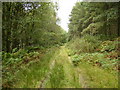
Natural PlacesSite Name: Ashberry windypit Alternative Name: Windy Pit, Windy Pits, Ryedale WindypitsCountry: England
NOTE: This site is 0.423 km away from the location you searched for.
County: Yorkshire (North) Type: Cave or Rock Shelter
Nearest Village: Helmsley
Map Ref: SE582829 Landranger Map Number: 100
Latitude: 54.238500N Longitude: 1.108525W
Condition:
| 5 | Perfect |
| 4 | Almost Perfect |
| 3 | Reasonable but with some damage |
| 2 | Ruined but still recognisable as an ancient site |
| 1 | Pretty much destroyed, possibly visible as crop marks |
| 0 | No data. |
| -1 | Completely destroyed |
| 5 | Superb |
| 4 | Good |
| 3 | Ordinary |
| 2 | Not Good |
| 1 | Awful |
| 0 | No data. |
| 5 | Can be driven to, probably with disabled access |
| 4 | Short walk on a footpath |
| 3 | Requiring a bit more of a walk |
| 2 | A long walk |
| 1 | In the middle of nowhere, a nightmare to find |
| 0 | No data. |
| 5 | co-ordinates taken by GPS or official recorded co-ordinates |
| 4 | co-ordinates scaled from a detailed map |
| 3 | co-ordinates scaled from a bad map |
| 2 | co-ordinates of the nearest village |
| 1 | co-ordinates of the nearest town |
| 0 | no data |
Internal Links:
External Links:
I have visited· I would like to visit
Andy B has visited here
")
Following the first recorded exploration of a Windypit by Rev. Buckland in 1832, these caves were explored and partially excavated during the mid 20th century. The human remains from the four Windypits were thought to be Late Neolithic or Early Bronze Age burials due to assumed association with the Beaker pottery and flint tools found in the chambers of these fissures. This research was therefore focused on the question: why cave burial? Why were these people excluded from the prehistoric burial monuments or barrows? Who were they and why were they placed in these seemingly liminal locations? Folklore narratives, historical accounts and ethnographic studies highlight the importance and diversity of use of these subterranean realms. They are fascinating features in the landscape. Today they capture our attention and imagination: in the past they were considered to be threshold locations, gateways to other worlds.
Map. refs. SE 576836, 582829, and 588828
Read more at the YAS Prehistory section
Note: History Cold Case: The Skeletons of Windy Pits, BBC2 Thursday at 9pm
You may be viewing yesterday's version of this page. To see the most up to date information please register for a free account.
Do not use the above information on other web sites or publications without permission of the contributor.
Nearby Images from Geograph Britain and Ireland:
©2013(licence)
©2020(licence)
©2019(licence)
©2007(licence)
©2007(licence)
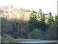
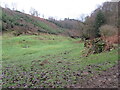
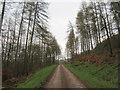
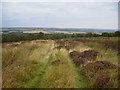
The above images may not be of the site on this page, they are loaded from Geograph.
Please Submit an Image of this site or go out and take one for us!
Click here to see more info for this site
Nearby sites
Key: Red: member's photo, Blue: 3rd party photo, Yellow: other image, Green: no photo - please go there and take one, Grey: site destroyed
Download sites to:
KML (Google Earth)
GPX (GPS waypoints)
CSV (Garmin/Navman)
CSV (Excel)
To unlock full downloads you need to sign up as a Contributory Member. Otherwise downloads are limited to 50 sites.
Turn off the page maps and other distractions
Nearby sites listing. In the following links * = Image available
nankm 0° Antofts windypit Cave or Rock Shelter (SE582829)
631m ESE 109° Buckland's Windypit Cave or Rock Shelter (SE588827)
859m NW 325° Slip Gill windypit Cave or Rock Shelter (SE577836)
3.0km S 182° Studfold Ring (Ampleforth)* Ancient Village or Settlement (SE5812279855)
3.1km ENE 73° All Saints (Helmsley)* Early Christian Sculptured Stone (SE61188387)
4.9km WSW 244° Cockerdale Wood Cairn Cairn (SE53838075)
4.9km NW 304° Kirby Ley* Round Barrow(s) (SE5408985584)
5.6km SE 136° St Oswald (Oswaldkirk)* Ancient Cross (SE62107892)
6.2km W 260° High Town round cairn Cairn (SE52138179)
6.6km W 272° Cooper Cross (Sutton Bank)* Ancient Cross (SE5157082994)
6.8km WSW 257° High Town Brow Round Barrow(s) (SE51598128)
6.8km WSW 258° Roulston Scar Barrow Round Barrow(s) (SE51538139)
6.9km W 260° Roulston Scar Camp Hillfort (SE514816)
6.9km WSW 257° Kilburn White Horse* Hill Figure or Geoglyph (SE51438129)
7.1km W 277° Sutton Bank Round Barrow* Round Barrow(s) (SE5108283684)
7.5km WNW 289° Hambleton Down North* Round Barrow(s) (SE5102885301)
8.0km W 259° Hood Hill Stone Natural Stone / Erratic / Other Natural Feature (SE50378125)
8.1km WNW 291° Boltby Scar Camp Hillfort (SE506857)
8.1km NNW 327° All Saints Church, Hawnby* Ancient Cross (SE53658967)
8.9km SE 125° Stonegrave Minster* Ancient Cross (SE6561077885)
8.9km SSE 168° Gilling Long Cairn* Chambered Cairn (SE6017074185)
9.2km ESE 115° All Saints and St James (Nunnington) Ancient Cross (SE6657079070)
9.3km N 6° Helmsley Moor RB1* Round Barrow(s) (SE5904992216)
9.7km N 4° Roppa Cross South* Ancient Cross (SE5872492614)
9.9km ENE 74° Kirkdale Sundial* Early Christian Sculptured Stone (SE6768885776)
View more nearby sites and additional images


 We would like to know more about this location. Please feel free to add a brief description and any relevant information in your own language.
 Wir möchten mehr über diese Stätte erfahren. Bitte zögern Sie nicht, eine kurze Beschreibung und relevante Informationen in Deutsch hinzuzufügen.
 Nous aimerions en savoir encore un peu sur les lieux. S'il vous plaît n'hesitez pas à ajouter une courte description et tous les renseignements pertinents dans votre propre langue.
 Quisieramos informarnos un poco más de las lugares. No dude en añadir una breve descripción y otros datos relevantes en su propio idioma.