


<< Our Photo Pages >> Menelaion - Ancient Temple in Greece in Peloponnese Peninsula
Submitted by Armand on Wednesday, 02 January 2019 Page Views: 1780
Neolithic and Bronze AgeSite Name: Menelaion Alternative Name: Sanctuary of Menelaos and HelenaCountry: Greece Region: Peloponnese Peninsula Type: Ancient Temple
Nearest Town: Sparta
Latitude: 37.065800N Longitude: 22.453400E
Condition:
| 5 | Perfect |
| 4 | Almost Perfect |
| 3 | Reasonable but with some damage |
| 2 | Ruined but still recognisable as an ancient site |
| 1 | Pretty much destroyed, possibly visible as crop marks |
| 0 | No data. |
| -1 | Completely destroyed |
| 5 | Superb |
| 4 | Good |
| 3 | Ordinary |
| 2 | Not Good |
| 1 | Awful |
| 0 | No data. |
| 5 | Can be driven to, probably with disabled access |
| 4 | Short walk on a footpath |
| 3 | Requiring a bit more of a walk |
| 2 | A long walk |
| 1 | In the middle of nowhere, a nightmare to find |
| 0 | No data. |
| 5 | co-ordinates taken by GPS or official recorded co-ordinates |
| 4 | co-ordinates scaled from a detailed map |
| 3 | co-ordinates scaled from a bad map |
| 2 | co-ordinates of the nearest village |
| 1 | co-ordinates of the nearest town |
| 0 | no data |
Be the first person to rate this site - see the 'Contribute!' box in the right hand menu.
Internal Links:
External Links:
")
On the hill of Menelaion during the 8th century BCE the eponymous heroes, Menelaus and Helen of Troy, were allegedly worshiped, with a possible altar and enclosure. At the end of the 7th and 6th centuries BCE, a temple built with limestone was erected in place. The Menelaeion heroon has been recognized as such at 1833 by Ludwig Ross. Ross excavated the area in the early 19th century, revealing lead votive figurines of the Laconic type.
For more information click here.
You may be viewing yesterday's version of this page. To see the most up to date information please register for a free account.
")
")
Do not use the above information on other web sites or publications without permission of the contributor.
Nearby Images from Flickr
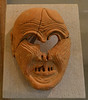
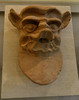

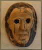
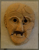
The above images may not be of the site on this page, but were taken nearby. They are loaded from Flickr so please click on them for image credits.
Click here to see more info for this site
Nearby sites
Click here to view sites on an interactive map of the areaKey: Red: member's photo, Blue: 3rd party photo, Yellow: other image, Green: no photo - please go there and take one, Grey: site destroyed
Download sites to:
KML (Google Earth)
GPX (GPS waypoints)
CSV (Garmin/Navman)
CSV (Excel)
To unlock full downloads you need to sign up as a Contributory Member. Otherwise downloads are limited to 50 sites.
Turn off the page maps and other distractions
Nearby sites listing. In the following links * = Image available
2.2km WNW 296° Sparta museum* Museum
2.8km WNW 296° Tomb of Leonidas* Ancient Temple
3.2km NW 305° Sparta (Greece)* Ancient Village or Settlement
3.3km S 185° Sanctuary of Apollo, Amycleos* Ancient Temple
5.2km SSE 166° Vafio* Chambered Tomb
9.9km SSE 167° Agios Vasileios Ancient Palace
32.8km ENE 63° Soha tombs Ancient Village or Settlement
40.3km NNW 342° Peraitheis Ancient Temple
43.3km N 356° Tegea Museum* Museum
43.4km N 356° Tegea Ancient Village or Settlement
43.5km NNW 336° Asea Ancient Temple
43.7km S 190° Kalamakia Cave* Cave or Rock Shelter
46.2km NW 321° Despoina Sanctuary.* Ancient Temple
47.4km WNW 285° Lakonian Gate* Hillfort
47.9km S 188° Alepotrypa Cave* Cave or Rock Shelter
48.0km NW 323° Ancient theater of Megalopolis* Ancient Village or Settlement
48.1km WNW 285° Artemis Limnatis* Ancient Temple
48.1km WSW 256° Petalidi* Ancient Temple
48.3km WNW 285° Eileithyia* Ancient Temple
48.4km NW 323° Ancient Megalopoli* Ancient Temple
48.5km W 262° Nichoria* Ancient Village or Settlement
48.7km WNW 286° Sanctuary of Zeus Ithomatas Ancient Temple
48.8km WNW 285° Ancient Messene* Ancient Village or Settlement
49.7km WNW 286° Arkadian Gate* Hillfort
51.9km NW 314° Lykosoura Despoina Sanctuary* Ancient Temple
View more nearby sites and additional images


 We would like to know more about this location. Please feel free to add a brief description and any relevant information in your own language.
 Wir möchten mehr über diese Stätte erfahren. Bitte zögern Sie nicht, eine kurze Beschreibung und relevante Informationen in Deutsch hinzuzufügen.
 Nous aimerions en savoir encore un peu sur les lieux. S'il vous plaît n'hesitez pas à ajouter une courte description et tous les renseignements pertinents dans votre propre langue.
 Quisieramos informarnos un poco más de las lugares. No dude en añadir una breve descripción y otros datos relevantes en su propio idioma.