


<< Our Photo Pages >> The Grey Stone (Moyarget) - Chambered Tomb in Ireland (Northern) in Co. Antrim
Submitted by Ptarmigan on Monday, 27 March 2017 Page Views: 2103
Neolithic and Bronze AgeSite Name: The Grey Stone (Moyarget) Alternative Name: The Grey StonesCountry: Ireland (Northern) County: Co. Antrim Type: Chambered Tomb
Nearest Town: Ballycastle Nearest Village: Moyarget
Map Ref: NW246974
Latitude: 55.193891N Longitude: 6.328977W
Condition:
| 5 | Perfect |
| 4 | Almost Perfect |
| 3 | Reasonable but with some damage |
| 2 | Ruined but still recognisable as an ancient site |
| 1 | Pretty much destroyed, possibly visible as crop marks |
| 0 | No data. |
| -1 | Completely destroyed |
| 5 | Superb |
| 4 | Good |
| 3 | Ordinary |
| 2 | Not Good |
| 1 | Awful |
| 0 | No data. |
| 5 | Can be driven to, probably with disabled access |
| 4 | Short walk on a footpath |
| 3 | Requiring a bit more of a walk |
| 2 | A long walk |
| 1 | In the middle of nowhere, a nightmare to find |
| 0 | No data. |
| 5 | co-ordinates taken by GPS or official recorded co-ordinates |
| 4 | co-ordinates scaled from a detailed map |
| 3 | co-ordinates scaled from a bad map |
| 2 | co-ordinates of the nearest village |
| 1 | co-ordinates of the nearest town |
| 0 | no data |
Internal Links:
External Links:
 (PID:163375)")
The Grey Stone ANT 008:024
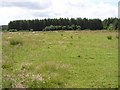
"On top of a small NW-facing slope, just below the top of a hill overlooking a stream. All that remains at this location is a massive basalt boulder badly damaged by attempts to blast it apart. It is orientated NW-SE & is 3.13m long. It is 1.54m wide at the SE end & 1.5m at NW, expanding to 2.07m in the centre. No visible trace remains of the 6 supporting stones or of the urn burial reported by Gray in 1883."
http://appsc.doeni.gov.uk/ambit/Details.aspx?MonID=626
You may be viewing yesterday's version of this page. To see the most up to date information please register for a free account.
 (PID:163374)")
 (PID:163373)")
 (PID:163372)")
Do not use the above information on other web sites or publications without permission of the contributor.
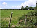
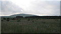
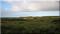
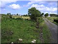
Nearby Images from Geograph Britain and Ireland:
©2008(licence)
©2008(licence)
©2008(licence)
©2008(licence)
©2008(licence)
The above images may not be of the site on this page, they are loaded from Geograph.
Please Submit an Image of this site or go out and take one for us!
Click here to see more info for this site
Nearby sites
Click here to view sites on an interactive map of the areaKey: Red: member's photo, Blue: 3rd party photo, Yellow: other image, Green: no photo - please go there and take one, Grey: site destroyed
Download sites to:
KML (Google Earth)
GPX (GPS waypoints)
CSV (Garmin/Navman)
CSV (Excel)
To unlock full downloads you need to sign up as a Contributory Member. Otherwise downloads are limited to 50 sites.
Turn off the page maps and other distractions
Nearby sites listing. In the following links * = Image available
2.7km SE 129° Kilcrue Cross* Ancient Cross (NW2658095587)
3.2km SE 127° Carneatley Standing Stone* Standing Stone (Menhir) (NW2700795317)
3.3km SE 144° Cloghanmurry Standing Stone* Standing Stone (Menhir) (NW2637094593)
3.5km WSW 253° Kilmahamogue Standing Stone* Standing Stone (Menhir) (NW212966)
3.7km WSW 241° Druid's Altar (Mosside)* Cairn (NW213958)
4.4km SSE 156° Monanclogh Standing Stone* Standing Stone (Menhir) (NW2612893283)
4.8km NNW 327° Magheraboy* Passage Grave
5.2km SSE 153° Knockans Rath / Souterrain* Souterrain (Fogou, Earth House) (NW267926)
5.5km NW 315° Clegnagh* Passage Grave
5.7km SSE 159° Knockans Standing Stone* Standing Stone (Menhir) (NW2632591923)
5.9km NW 317° Whitepark Bay* Cairn
6.1km SE 126° Knocklayd Cairn* Cairn
6.6km SSE 153° Tullaghore Cross* Ancient Cross (NW2721091351)
7.5km E 83° Broughanlea Carved Cross* Ancient Cross (NW3211397785)
7.9km SSW 205° Carnrig Fort* Artificial Mound (NW208904)
8.0km S 169° Alcrossagh Fort* Hillfort (NW256894)
8.1km SE 137° Breen Standing Stone* Standing Stone (Menhir) (NW2982791165)
8.3km E 85° Culfeightrin Stones* Standing Stones (D1477040765)
8.5km SE 128° Corvally Standing Stone* Standing Stone (Menhir) (NW3104391773)
8.8km WSW 236° Deffrick Castle* Souterrain (Fogou, Earth House) (NW170930)
8.9km SSW 210° Carnfeogue Standing Stone* Standing Stone (Menhir) (NW197900)
9.5km E 80° Ballyvoy Court Tomb* Court Tomb
9.5km E 80° Ballyvoy Passage Tomb* Passage Grave
9.6km ESE 123° Duncarbit Standing Stones* Standing Stones (D1473434814)
9.7km WSW 238° Drumlesk* Chambered Tomb (C983345)
View more nearby sites and additional images


 We would like to know more about this location. Please feel free to add a brief description and any relevant information in your own language.
 Wir möchten mehr über diese Stätte erfahren. Bitte zögern Sie nicht, eine kurze Beschreibung und relevante Informationen in Deutsch hinzuzufügen.
 Nous aimerions en savoir encore un peu sur les lieux. S'il vous plaît n'hesitez pas à ajouter une courte description et tous les renseignements pertinents dans votre propre langue.
 Quisieramos informarnos un poco más de las lugares. No dude en añadir una breve descripción y otros datos relevantes en su propio idioma.