


<< Our Photo Pages >> Menhir de Foshuel - Standing Stone (Menhir) in France in Bretagne:Finistère (29)
Submitted by holger_rix on Tuesday, 28 June 2016 Page Views: 881
Neolithic and Bronze AgeSite Name: Menhir de Foshuel Alternative Name: Menhir de St SamsonCountry: France Département: Bretagne:Finistère (29) Type: Standing Stone (Menhir)
Nearest Town: Brest Nearest Village: Landunvez
Latitude: 48.548460N Longitude: 4.73187W
Condition:
| 5 | Perfect |
| 4 | Almost Perfect |
| 3 | Reasonable but with some damage |
| 2 | Ruined but still recognisable as an ancient site |
| 1 | Pretty much destroyed, possibly visible as crop marks |
| 0 | No data. |
| -1 | Completely destroyed |
| 5 | Superb |
| 4 | Good |
| 3 | Ordinary |
| 2 | Not Good |
| 1 | Awful |
| 0 | No data. |
| 5 | Can be driven to, probably with disabled access |
| 4 | Short walk on a footpath |
| 3 | Requiring a bit more of a walk |
| 2 | A long walk |
| 1 | In the middle of nowhere, a nightmare to find |
| 0 | No data. |
| 5 | co-ordinates taken by GPS or official recorded co-ordinates |
| 4 | co-ordinates scaled from a detailed map |
| 3 | co-ordinates scaled from a bad map |
| 2 | co-ordinates of the nearest village |
| 1 | co-ordinates of the nearest town |
| 0 | no data |
Be the first person to rate this site - see the 'Contribute!' box in the right hand menu.
Internal Links:
External Links:
")
Foshuel, Landunvez, Brest, Finistère, Brittany
Information and Pictures:
t4t35.fr
You may be viewing yesterday's version of this page. To see the most up to date information please register for a free account.
Do not use the above information on other web sites or publications without permission of the contributor.
Nearby Images from Flickr
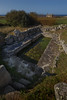
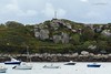

The above images may not be of the site on this page, but were taken nearby. They are loaded from Flickr so please click on them for image credits.
Click here to see more info for this site
Nearby sites
Click here to view sites on an interactive map of the areaKey: Red: member's photo, Blue: 3rd party photo, Yellow: other image, Green: no photo - please go there and take one, Grey: site destroyed
Download sites to:
KML (Google Earth)
GPX (GPS waypoints)
CSV (Garmin/Navman)
CSV (Excel)
To unlock full downloads you need to sign up as a Contributory Member. Otherwise downloads are limited to 50 sites.
Turn off the page maps and other distractions
Nearby sites listing. In the following links * = Image available
180m W 274° Menhirs du Lavoir de Saint-Samson Standing Stone (Menhir)
297m WNW 293° St Samson's Well (Landunvez)* Holy Well or Sacred Spring
600m WSW 252° Affleurement à cupules de Kerandraon Rock Art
642m WSW 252° Menhir de Kerandraon Standing Stone (Menhir)
1.4km SW 235° Tumulus de la pointe de Landunvez* Chambered Cairn
1.6km NE 43° Menhir de Beg-ar-Galeti* Standing Stone (Menhir)
1.7km SW 217° Menhirs de Kerlaguen* Standing Stones
2.1km SW 215° Menhir de Penquer* Standing Stone (Menhir)
2.1km SSW 212° Dolmen de Penn-al-Lann Burial Chamber or Dolmen
2.2km ENE 73° Pointe de Guilligui allée couverte* Passage Grave
2.3km SW 214° Menhir de Penfoul* Standing Stone (Menhir)
2.3km ENE 75° Menhir du Guilligui* Standing Stone (Menhir)
2.3km ENE 76° Menhir de la Pointe de Guilligui B* Standing Stone (Menhir)
2.8km E 88° Alignement de Kerhoanoc* Stone Row / Alignment
3.0km SW 223° Dolmen de Men-Milliget* Burial Chamber or Dolmen
3.4km S 173° Saint-Gonvarc'h menhir* Standing Stone (Menhir)
3.5km S 182° Menhir de Kerveleoc Standing Stone (Menhir)
3.6km SSW 192° Menhirs de Kerguiabo* Standing Stones
3.7km SE 142° Menhir De Kerougana* Standing Stone (Menhir)
3.8km SW 236° Dolmen Île-d'Yoc'h Burial Chamber or Dolmen
3.9km SW 234° Menhirs de l'Île-d'Yoc'h Standing Stones
4.1km NE 44° Ile Carn menhir* Standing Stone (Menhir)
4.1km NE 44° Île Carn cairn* Chambered Cairn
4.4km SSW 196° Menhir de Kerhouézel* Standing Stone (Menhir)
4.5km SSW 199° Menhir de Prat Bihan* Standing Stone (Menhir)
View more nearby sites and additional images


 We would like to know more about this location. Please feel free to add a brief description and any relevant information in your own language.
 Wir möchten mehr über diese Stätte erfahren. Bitte zögern Sie nicht, eine kurze Beschreibung und relevante Informationen in Deutsch hinzuzufügen.
 Nous aimerions en savoir encore un peu sur les lieux. S'il vous plaît n'hesitez pas à ajouter une courte description et tous les renseignements pertinents dans votre propre langue.
 Quisieramos informarnos un poco más de las lugares. No dude en añadir una breve descripción y otros datos relevantes en su propio idioma.