 with our Megalithic Portal iPhone app")


<< Text Pages >> Menhir de Bovelann - Standing Stone (Menhir) in France in Bretagne:Morbihan (56)
Submitted by holger_rix on Sunday, 05 June 2016 Page Views: 963
Neolithic and Bronze AgeSite Name: Menhir de BovelannCountry: France Département: Bretagne:Morbihan (56) Type: Standing Stone (Menhir)
Nearest Town: Lorient Nearest Village: Erdeven
Latitude: 47.626944N Longitude: 3.114778W
Condition:
| 5 | Perfect |
| 4 | Almost Perfect |
| 3 | Reasonable but with some damage |
| 2 | Ruined but still recognisable as an ancient site |
| 1 | Pretty much destroyed, possibly visible as crop marks |
| 0 | No data. |
| -1 | Completely destroyed |
| 5 | Superb |
| 4 | Good |
| 3 | Ordinary |
| 2 | Not Good |
| 1 | Awful |
| 0 | No data. |
| 5 | Can be driven to, probably with disabled access |
| 4 | Short walk on a footpath |
| 3 | Requiring a bit more of a walk |
| 2 | A long walk |
| 1 | In the middle of nowhere, a nightmare to find |
| 0 | No data. |
| 5 | co-ordinates taken by GPS or official recorded co-ordinates |
| 4 | co-ordinates scaled from a detailed map |
| 3 | co-ordinates scaled from a bad map |
| 2 | co-ordinates of the nearest village |
| 1 | co-ordinates of the nearest town |
| 0 | no data |
Be the first person to rate this site - see the 'Contribute!' box in the right hand menu.
Internal Links:
External Links:
Standing Stone (Menhir) in Bretagne:Morbihan (56)
Route de Saint-Sauveur, Erdeven, Lorient, Morbihan, Brittany
Source: T4T35
Information and Pictures:
www.t4t35.fr
You may be viewing yesterday's version of this page. To see the most up to date information please register for a free account.
Do not use the above information on other web sites or publications without permission of the contributor.
Nearby Images from Flickr

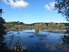

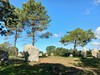


The above images may not be of the site on this page, but were taken nearby. They are loaded from Flickr so please click on them for image credits.
Click here to see more info for this site
Nearby sites
Click here to view sites on an interactive map of the areaKey: Red: member's photo, Blue: 3rd party photo, Yellow: other image, Green: no photo - please go there and take one, Grey: site destroyed
Download sites to:
KML (Google Earth)
GPX (GPS waypoints)
CSV (Garmin/Navman)
CSV (Excel)
To unlock full downloads you need to sign up as a Contributory Member. Otherwise downloads are limited to 50 sites.
Turn off the page maps and other distractions
Nearby sites listing. In the following links * = Image available
410m NNW 339° Menhir de Bovelan Standing Stone (Menhir)
422m NNW 342° Tertre de Bovelann Cist
433m WNW 290° Mané-Groh Dolmen* Burial Chamber or Dolmen
621m WSW 241° Crucuno Cromlech* Stone Circle
674m NW 319° Coet-ar-Bei* Multiple Stone Rows / Avenue
689m ENE 78° Coffre de Lannec Parqueu Hir er Neur Burial Chamber or Dolmen
707m NW 317° La Chaise de César* Standing Stone (Menhir)
923m WSW 251° Crucuno Dolmen* Burial Chamber or Dolmen
1.1km NE 56° Menhir de Kerdrain Standing Stone (Menhir)
1.1km ENE 65° Dolmen de Kerdrain Burial Chamber or Dolmen
1.2km SE 128° Dolmen de Cosquer Er Mané* Burial Chamber or Dolmen
1.3km SSW 211° Dolmen de Kernevé* Burial Chamber or Dolmen
1.4km ENE 79° Croix Julien* Standing Stone (Menhir)
1.4km WNW 301° Mané Braz menhirs* Standing Stones
1.4km SSW 192° Dolmens de Mane Rumor* Burial Chamber or Dolmen
1.5km SW 223° Tennad-er-Menguen Dolmen* Burial Chamber or Dolmen
1.5km WNW 302° Mané Braz tumulus* Chambered Tomb
1.5km SE 136° Dolmen de Cosquer Mané er Roh Burial Chamber or Dolmen
1.7km NNW 334° Er Run Dolmen* Burial Chamber or Dolmen
1.8km SE 126° Alignement de Crucuny Stone Row / Alignment
2.0km NE 48° Menhir de Mané-Pleurec* Standing Stone (Menhir)
2.0km NW 314° Menhirs de Keredo Standing Stone (Menhir)
2.0km WNW 293° Kerjean Menhirs* Multiple Stone Rows / Avenue
2.2km ENE 62° Allée Couverte d'er Grageu* Passage Grave
2.2km S 189° Menhirs le Vieux-Moulin (N)* Stone Row / Alignment
View more nearby sites and additional images


 We would like to know more about this location. Please feel free to add a brief description and any relevant information in your own language.
 Wir möchten mehr über diese Stätte erfahren. Bitte zögern Sie nicht, eine kurze Beschreibung und relevante Informationen in Deutsch hinzuzufügen.
 Nous aimerions en savoir encore un peu sur les lieux. S'il vous plaît n'hesitez pas à ajouter une courte description et tous les renseignements pertinents dans votre propre langue.
 Quisieramos informarnos un poco más de las lugares. No dude en añadir una breve descripción y otros datos relevantes en su propio idioma.