

<< Text Pages >> Alignement de Lann-Grand-Villarec 2 - Stone Row / Alignment in France in Bretagne:Morbihan (56)
Submitted by holger_rix on Monday, 16 May 2016 Page Views: 1612
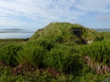
Neolithic and Bronze AgeSite Name: Alignement de Lann-Grand-Villarec 2Country: France Département: Bretagne:Morbihan (56) Type: Stone Row / Alignment
Nearest Town: Lorient Nearest Village: Ploemel
Latitude: 47.620503N Longitude: 3.082524W
Condition:
| 5 | Perfect |
| 4 | Almost Perfect |
| 3 | Reasonable but with some damage |
| 2 | Ruined but still recognisable as an ancient site |
| 1 | Pretty much destroyed, possibly visible as crop marks |
| 0 | No data. |
| -1 | Completely destroyed |
| 5 | Superb |
| 4 | Good |
| 3 | Ordinary |
| 2 | Not Good |
| 1 | Awful |
| 0 | No data. |
| 5 | Can be driven to, probably with disabled access |
| 4 | Short walk on a footpath |
| 3 | Requiring a bit more of a walk |
| 2 | A long walk |
| 1 | In the middle of nowhere, a nightmare to find |
| 0 | No data. |
| 5 | co-ordinates taken by GPS or official recorded co-ordinates |
| 4 | co-ordinates scaled from a detailed map |
| 3 | co-ordinates scaled from a bad map |
| 2 | co-ordinates of the nearest village |
| 1 | co-ordinates of the nearest town |
| 0 | no data |
Be the first person to rate this site - see the 'Contribute!' box in the right hand menu.
Internal Links:
External Links:
Stone Row / Alignment in Bretagne:Morbihan (56)
Ploemel, Lorient, Morbihan, Brittany
Source: T4T35
You may be viewing yesterday's version of this page. To see the most up to date information please register for a free account.
Do not use the above information on other web sites or publications without permission of the contributor.
Nearby Images from Flickr

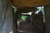
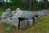
The above images may not be of the site on this page, but were taken nearby. They are loaded from Flickr so please click on them for image credits.
Click here to see more info for this site
Nearby sites
Click here to view sites on an interactive map of the areaKey: Red: member's photo, Blue: 3rd party photo, Yellow: other image, Green: no photo - please go there and take one, Grey: site destroyed
Download sites to:
KML (Google Earth)
GPX (GPS waypoints)
CSV (Garmin/Navman)
CSV (Excel)
To unlock full downloads you need to sign up as a Contributory Member. Otherwise downloads are limited to 50 sites.
Turn off the page maps and other distractions
Nearby sites listing. In the following links * = Image available
86m SSW 209° Alignement de Lann-Grand-Villarec 1 Stone Row / Alignment
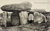
124m SSE 163° Alignement de Clud-Ur-Yar* Stone Row / Alignment
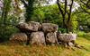
154m S 182° Dolmen de Klud-Ur-Yar* Burial Chamber or Dolmen
287m SE 141° Menhirs de Klud Er Yer Standing Stones
575m S 186° Mané Keriaval* Passage Grave
653m SSW 205° Mané-Kerioned Dolmen* Burial Chamber or Dolmen
658m ESE 107° Menhir de Crucuny 1* Standing Stone (Menhir)
664m ESE 106° Crucuny tumulus* Long Barrow
704m S 189° Menhirs de Keriaval* Standing Stone (Menhir)
817m SE 129° Crucuny Cromlech* Stone Circle
836m SE 127° Toul-er-Lann menhir Standing Stone (Menhir)
884m SW 215° Dolmen de Gognel Burial Chamber or Dolmen
920m NNE 18° Allée Couverte de Kergrim Passage Grave
944m S 170° Dolmen de Nauterio* Burial Chamber or Dolmen
998m WSW 250° Alignement de Crucuny Stone Row / Alignment
1.0km SE 133° Menhir de Crucuny 2 Standing Stone (Menhir)
1.1km E 80° Coët-A-Tous Not Known (by us)
1.2km N 8° Dolmen de Quelvezin Burial Chamber or Dolmen
1.2km SE 144° Len-Lochet menhirs* Standing Stones
1.2km SSW 211° Dolmens de Kerogel Burial Chamber or Dolmen
1.2km ENE 68° Dolmen de Mané-Grag* Burial Chamber or Dolmen
1.3km SE 134° Dolmen de Mané-Bras dit Roh-Vras Burial Chamber or Dolmen
1.3km SSE 164° Dolmen de Run Mori Burial Chamber or Dolmen
1.3km ESE 103° Mané-Brizil Dolmen* Burial Chamber or Dolmen
1.4km WSW 255° Dolmen de Cosquer Mané er Roh Burial Chamber or Dolmen
View more nearby sites and additional images


 We would like to know more about this location. Please feel free to add a brief description and any relevant information in your own language.
 Wir möchten mehr über diese Stätte erfahren. Bitte zögern Sie nicht, eine kurze Beschreibung und relevante Informationen in Deutsch hinzuzufügen.
 Nous aimerions en savoir encore un peu sur les lieux. S'il vous plaît n'hesitez pas à ajouter une courte description et tous les renseignements pertinents dans votre propre langue.
 Quisieramos informarnos un poco más de las lugares. No dude en añadir una breve descripción y otros datos relevantes en su propio idioma.