


<< Other Photo Pages >> Grotte du Roc de Marsal - Cave or Rock Shelter in France in Aquitaine:Dordogne (24)
Submitted by holger_rix on Friday, 06 May 2016 Page Views: 1581
Natural PlacesSite Name: Grotte du Roc de MarsalCountry: France Département: Aquitaine:Dordogne (24) Type: Cave or Rock Shelter
Nearest Town: Sarlat-la-Canéda Nearest Village: Le Bugue
Latitude: 44.909587N Longitude: 0.969840E
Condition:
| 5 | Perfect |
| 4 | Almost Perfect |
| 3 | Reasonable but with some damage |
| 2 | Ruined but still recognisable as an ancient site |
| 1 | Pretty much destroyed, possibly visible as crop marks |
| 0 | No data. |
| -1 | Completely destroyed |
| 5 | Superb |
| 4 | Good |
| 3 | Ordinary |
| 2 | Not Good |
| 1 | Awful |
| 0 | No data. |
| 5 | Can be driven to, probably with disabled access |
| 4 | Short walk on a footpath |
| 3 | Requiring a bit more of a walk |
| 2 | A long walk |
| 1 | In the middle of nowhere, a nightmare to find |
| 0 | No data. |
| 5 | co-ordinates taken by GPS or official recorded co-ordinates |
| 4 | co-ordinates scaled from a detailed map |
| 3 | co-ordinates scaled from a bad map |
| 2 | co-ordinates of the nearest village |
| 1 | co-ordinates of the nearest town |
| 0 | no data |
Be the first person to rate this site - see the 'Contribute!' box in the right hand menu.
Internal Links:
External Links:
")
Le Bugue, Sarlat-la-Canéda, Dordogne, Aquitaine-Limousin-Poitou-Charentes
Source: T4T35.fr
Information:
fr.wikipedia.org
You may be viewing yesterday's version of this page. To see the most up to date information please register for a free account.
")
")
Do not use the above information on other web sites or publications without permission of the contributor.
Nearby Images from Flickr
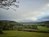
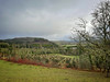
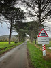
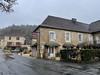
The above images may not be of the site on this page, but were taken nearby. They are loaded from Flickr so please click on them for image credits.
Click here to see more info for this site
Nearby sites
Click here to view sites on an interactive map of the areaKey: Red: member's photo, Blue: 3rd party photo, Yellow: other image, Green: no photo - please go there and take one, Grey: site destroyed
Download sites to:
KML (Google Earth)
GPX (GPS waypoints)
CSV (Garmin/Navman)
CSV (Excel)
To unlock full downloads you need to sign up as a Contributory Member. Otherwise downloads are limited to 50 sites.
Turn off the page maps and other distractions
Nearby sites listing. In the following links * = Image available
438m SE 141° Campagne menhir* Standing Stone (Menhir)
1.8km N 353° Grotte du Sorcier* Cave or Rock Shelter
3.2km ENE 79° La Combe cave* Cave or Rock Shelter
4.1km WNW 293° Grotte de Bara-Bahau* Cave or Rock Shelter
4.3km ENE 67° Grotte de la Mouthe* Cave or Rock Shelter
4.4km NNE 33° Grotte de l'Oreille d'Enfer* Cave or Rock Shelter
4.4km NNE 30° Abri de Lartet* Cave or Rock Shelter
4.4km NNE 30° Abri du Poisson* Cave or Rock Shelter
4.6km NE 49° Musée National de Préhistoire* Museum
4.6km SE 133° Polissoirs du Bousquet* Polissoir
4.6km NE 46° Gisement du Pataud* Cave or Rock Shelter
4.6km NE 54° Grotte de la Croze* Cave or Rock Shelter
4.6km NE 54° Grotte d'Abzac Cave or Rock Shelter
4.7km NE 42° Abri de Cro-Magnon* Cave or Rock Shelter
4.9km NW 305° Menhir de Ladouch* Natural Stone / Erratic / Other Natural Feature
4.9km NNE 27° Grotte de Grand Roc* Cave or Rock Shelter
5.0km NNE 27° Abri de Laugerie-Basse* Cave or Rock Shelter
5.3km NNW 332° Abri de la Ferrassie* Cave or Rock Shelter
5.4km ENE 58° Font-de-Gaume* Cave or Rock Shelter
5.5km NNE 28° Abri de Laugerie-Haute* Cave or Rock Shelter
5.8km W 268° Dolmen Queyre-Levat* Burial Chamber or Dolmen
6.1km NNE 28° Gisement de la Micoque* Cave or Rock Shelter
6.4km W 264° Limeuil Jardin Musée Cave or Rock Shelter
6.7km SW 216° Saint-Chamassy Dolmen* Burial Chamber or Dolmen
6.8km ENE 56° Grotte des Combarelles 1* Cave or Rock Shelter
View more nearby sites and additional images


 We would like to know more about this location. Please feel free to add a brief description and any relevant information in your own language.
 Wir möchten mehr über diese Stätte erfahren. Bitte zögern Sie nicht, eine kurze Beschreibung und relevante Informationen in Deutsch hinzuzufügen.
 Nous aimerions en savoir encore un peu sur les lieux. S'il vous plaît n'hesitez pas à ajouter une courte description et tous les renseignements pertinents dans votre propre langue.
 Quisieramos informarnos un poco más de las lugares. No dude en añadir una breve descripción y otros datos relevantes en su propio idioma.