


<< Text Pages >> Oppidum de la Culasse - Ancient Village or Settlement in France in Languedoc:Gard (30)
Submitted by holger_rix on Monday, 25 April 2016 Page Views: 880
Multi-periodSite Name: Oppidum de la CulasseCountry: France Département: Languedoc:Gard (30) Type: Ancient Village or Settlement
Nearest Town: Le Vigan Nearest Village: Rogues
Latitude: 43.862140N Longitude: 3.570100E
Condition:
| 5 | Perfect |
| 4 | Almost Perfect |
| 3 | Reasonable but with some damage |
| 2 | Ruined but still recognisable as an ancient site |
| 1 | Pretty much destroyed, possibly visible as crop marks |
| 0 | No data. |
| -1 | Completely destroyed |
| 5 | Superb |
| 4 | Good |
| 3 | Ordinary |
| 2 | Not Good |
| 1 | Awful |
| 0 | No data. |
| 5 | Can be driven to, probably with disabled access |
| 4 | Short walk on a footpath |
| 3 | Requiring a bit more of a walk |
| 2 | A long walk |
| 1 | In the middle of nowhere, a nightmare to find |
| 0 | No data. |
| 5 | co-ordinates taken by GPS or official recorded co-ordinates |
| 4 | co-ordinates scaled from a detailed map |
| 3 | co-ordinates scaled from a bad map |
| 2 | co-ordinates of the nearest village |
| 1 | co-ordinates of the nearest town |
| 0 | no data |
Be the first person to rate this site - see the 'Contribute!' box in the right hand menu.
Internal Links:
External Links:
Ancient Village or Settlement in Languedoc:Gard (30)
Camasso, Rogues, Le Vigan, Gard, Languedoc-Roussillon-Midi-Pyrénées
Source: T4T35.fr
You may be viewing yesterday's version of this page. To see the most up to date information please register for a free account.
Do not use the above information on other web sites or publications without permission of the contributor.
Nearby Images from Flickr
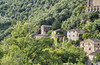
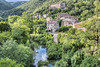
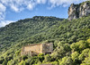
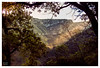

The above images may not be of the site on this page, but were taken nearby. They are loaded from Flickr so please click on them for image credits.
Click here to see more info for this site
Nearby sites
Click here to view sites on an interactive map of the areaKey: Red: member's photo, Blue: 3rd party photo, Yellow: other image, Green: no photo - please go there and take one, Grey: site destroyed
Download sites to:
KML (Google Earth)
GPX (GPS waypoints)
CSV (Garmin/Navman)
CSV (Excel)
To unlock full downloads you need to sign up as a Contributory Member. Otherwise downloads are limited to 50 sites.
Turn off the page maps and other distractions
Nearby sites listing. In the following links * = Image available
867m SSW 199° Menhir de la Descente de Madières* Standing Stone (Menhir)
1.7km NW 313° Cromlech La Castre Stone Circle
2.4km NW 318° Dolmen du Sotch de Gardie* Burial Chamber or Dolmen
2.7km N 350° Trivalle menhir* Standing Stone (Menhir)
2.8km NNW 333° Gouarens Tumulus* Round Barrow(s)
2.8km SSW 211° Dolmen du Rancas 1* Burial Chamber or Dolmen
3.0km SSW 211° Dolmen du Rancas 2* Burial Chamber or Dolmen
3.1km N 353° Ciste de Lacalm 2* Cist
3.2km NNW 344° Menhir de Gagnat* Standing Stone (Menhir)
3.2km N 353° Lacam de Rogues 1* Stone Circle
3.2km N 10° Oppidum de la Blacarède* Ancient Village or Settlement
3.2km WNW 284° Menhir de Jurade 1* Standing Stone (Menhir)
3.2km WNW 287° Menhir de Jurade 2* Standing Stone (Menhir)
3.2km N 353° Ciste de Lacam* Burial Chamber or Dolmen
3.2km N 353° Lacam Tumulus 2* Round Barrow(s)
3.3km N 351° Menhir Camp de Bouissière* Standing Stone (Menhir)
3.5km WNW 289° Menhir d'Éouze* Standing Stone (Menhir)
3.5km N 349° Lacam menhir* Standing Stone (Menhir)
3.6km N 352° Lacam de Rogues 2* Stone Circle
3.7km WSW 247° Tumulus de San Peyle* Round Barrow(s)
3.7km N 7° Ciste de Rogues* Cist
4.0km ESE 101° Menhir de la Coupette Standing Stone (Menhir)
4.2km E 95° Dolmen de la Maline Burial Chamber or Dolmen
4.3km NW 326° Dolmen Borie d'Arre 3* Burial Chamber or Dolmen
4.3km WSW 255° Dolmen du Dévezas* Burial Chamber or Dolmen
View more nearby sites and additional images


 We would like to know more about this location. Please feel free to add a brief description and any relevant information in your own language.
 Wir möchten mehr über diese Stätte erfahren. Bitte zögern Sie nicht, eine kurze Beschreibung und relevante Informationen in Deutsch hinzuzufügen.
 Nous aimerions en savoir encore un peu sur les lieux. S'il vous plaît n'hesitez pas à ajouter une courte description et tous les renseignements pertinents dans votre propre langue.
 Quisieramos informarnos un poco más de las lugares. No dude en añadir una breve descripción y otros datos relevantes en su propio idioma.