


<< Text Pages >> Tumulus des Lacs 4 - Cairn in France in Languedoc:Lozère (48)
Submitted by holger_rix on Friday, 22 April 2016 Page Views: 702
Neolithic and Bronze AgeSite Name: Tumulus des Lacs 4Country: France Département: Languedoc:Lozère (48) Type: Cairn
Nearest Town: Florac Nearest Village: Les Lacs
Latitude: 44.371937N Longitude: 3.470392E
Condition:
| 5 | Perfect |
| 4 | Almost Perfect |
| 3 | Reasonable but with some damage |
| 2 | Ruined but still recognisable as an ancient site |
| 1 | Pretty much destroyed, possibly visible as crop marks |
| 0 | No data. |
| -1 | Completely destroyed |
| 5 | Superb |
| 4 | Good |
| 3 | Ordinary |
| 2 | Not Good |
| 1 | Awful |
| 0 | No data. |
| 5 | Can be driven to, probably with disabled access |
| 4 | Short walk on a footpath |
| 3 | Requiring a bit more of a walk |
| 2 | A long walk |
| 1 | In the middle of nowhere, a nightmare to find |
| 0 | No data. |
| 5 | co-ordinates taken by GPS or official recorded co-ordinates |
| 4 | co-ordinates scaled from a detailed map |
| 3 | co-ordinates scaled from a bad map |
| 2 | co-ordinates of the nearest village |
| 1 | co-ordinates of the nearest town |
| 0 | no data |
Be the first person to rate this site - see the 'Contribute!' box in the right hand menu.
Internal Links:
External Links:
Cairn in Languedoc:Lozère (48)
Les Lacs, Florac, Lozère, Languedoc-Roussillon-Midi-Pyrénées
Source: T4T35.fr
You may be viewing yesterday's version of this page. To see the most up to date information please register for a free account.
Do not use the above information on other web sites or publications without permission of the contributor.
Nearby Images from Flickr

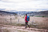
The above images may not be of the site on this page, but were taken nearby. They are loaded from Flickr so please click on them for image credits.
Click here to see more info for this site
Nearby sites
Click here to view sites on an interactive map of the areaKey: Red: member's photo, Blue: 3rd party photo, Yellow: other image, Green: no photo - please go there and take one, Grey: site destroyed
Download sites to:
KML (Google Earth)
GPX (GPS waypoints)
CSV (Garmin/Navman)
CSV (Excel)
To unlock full downloads you need to sign up as a Contributory Member. Otherwise downloads are limited to 50 sites.
Turn off the page maps and other distractions
Nearby sites listing. In the following links * = Image available
113m NNE 24° Tumulus des Lacs 2 Cairn
268m N 9° Tumulus des Lacs 1 Cairn
405m E 80° Tumulus des Lacs 3 Cairn
1.2km W 271° Tumulus de Jouanas Cairn
2.7km NW 322° Tumulus du Mont Roubio Cairn
3.2km E 80° Menhir des Coustos Standing Stone (Menhir)
3.3km NW 325° Dolmen de Peyrelevade (Sauveterre)* Burial Chamber or Dolmen
3.6km NW 323° Tumulus de Chardounio Cairn
4.8km WNW 285° Dolmen de Dignas* Burial Chamber or Dolmen
4.8km W 263° Fountain of Burle (Sainte Enimie) Holy Well or Sacred Spring
4.8km W 263° Dolmen de Téoulets Burial Chamber or Dolmen
4.8km NW 320° Dolmen de Champerboux Burial Chamber or Dolmen
5.1km N 351° Tumulus du Devez Viel Ring Cairn
5.2km NNW 348° Dolmen du Devez Viel Burial Chamber or Dolmen
5.2km WNW 301° Menhir du Bac* Standing Stone (Menhir)
5.7km NE 36° La Baraque de l'Estrade * Burial Chamber or Dolmen
5.8km SW 217° Dolmen du Buisson* Burial Chamber or Dolmen
6.3km SE 134° Dolmen de Condamine Burial Chamber or Dolmen
6.5km SSW 211° Menhir des Espougnes* Standing Stone (Menhir)
6.6km SW 219° Dolmen de Petit Batailles Burial Chamber or Dolmen
6.6km SSW 199° Dolmen de Vallongue* Burial Chamber or Dolmen
7.3km SE 131° Dolmen de Combe-Lébrouse* Burial Chamber or Dolmen
7.3km WNW 282° Dolmen de la Baume (Sainte-Enimie)* Burial Chamber or Dolmen
7.5km NW 317° Ayguières Dolmen* Burial Chamber or Dolmen
7.5km NW 317° Ayguieres Menhir* Standing Stone (Menhir)
View more nearby sites and additional images


 We would like to know more about this location. Please feel free to add a brief description and any relevant information in your own language.
 Wir möchten mehr über diese Stätte erfahren. Bitte zögern Sie nicht, eine kurze Beschreibung und relevante Informationen in Deutsch hinzuzufügen.
 Nous aimerions en savoir encore un peu sur les lieux. S'il vous plaît n'hesitez pas à ajouter une courte description et tous les renseignements pertinents dans votre propre langue.
 Quisieramos informarnos un poco más de las lugares. No dude en añadir una breve descripción y otros datos relevantes en su propio idioma.