


<< Text Pages >> Stèle dite Ar Villien - Sculptured Stone in France in Bretagne:Côtes-D'Armor (22)
Submitted by holger_rix on Tuesday, 05 April 2016 Page Views: 875
Multi-periodSite Name: Stèle dite Ar Villien Alternative Name: Chapelle de PénityCountry: France Département: Bretagne:Côtes-D'Armor (22) Type: Sculptured Stone
Nearest Town: Guingamp Nearest Village: Bourbriac
Latitude: 48.462528N Longitude: 3.142761W
Condition:
| 5 | Perfect |
| 4 | Almost Perfect |
| 3 | Reasonable but with some damage |
| 2 | Ruined but still recognisable as an ancient site |
| 1 | Pretty much destroyed, possibly visible as crop marks |
| 0 | No data. |
| -1 | Completely destroyed |
| 5 | Superb |
| 4 | Good |
| 3 | Ordinary |
| 2 | Not Good |
| 1 | Awful |
| 0 | No data. |
| 5 | Can be driven to, probably with disabled access |
| 4 | Short walk on a footpath |
| 3 | Requiring a bit more of a walk |
| 2 | A long walk |
| 1 | In the middle of nowhere, a nightmare to find |
| 0 | No data. |
| 5 | co-ordinates taken by GPS or official recorded co-ordinates |
| 4 | co-ordinates scaled from a detailed map |
| 3 | co-ordinates scaled from a bad map |
| 2 | co-ordinates of the nearest village |
| 1 | co-ordinates of the nearest town |
| 0 | no data |
Be the first person to rate this site - see the 'Contribute!' box in the right hand menu.
Internal Links:
External Links:
Sculptured Stone in Bretagne:Côtes-D'Armor (22)
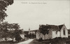
Chapelle de Pénity, D 22, Bourbriac, Guingamp, Côtes-d'Armor, Brittany
Source: T4T35.fr
"This spherical stone is placed on the gable of the apse of the chapel. Legend has it that Saint-Briac would be launched to determine the place of his hermitage. It gives rise, from time immemorial, in games of strength on the day of forgiveness."
Picture:
fr.topic-topos.com
You may be viewing yesterday's version of this page. To see the most up to date information please register for a free account.
Do not use the above information on other web sites or publications without permission of the contributor.
Nearby Images from Flickr
The above images may not be of the site on this page, but were taken nearby. They are loaded from Flickr so please click on them for image credits.
Click here to see more info for this site
Nearby sites
Click here to view sites on an interactive map of the areaKey: Red: member's photo, Blue: 3rd party photo, Yellow: other image, Green: no photo - please go there and take one, Grey: site destroyed
Download sites to:
KML (Google Earth)
GPX (GPS waypoints)
CSV (Garmin/Navman)
CSV (Excel)
To unlock full downloads you need to sign up as a Contributory Member. Otherwise downloads are limited to 50 sites.
Turn off the page maps and other distractions
Nearby sites listing. In the following links * = Image available
794m SW 217° Tanouëdou tumulus* Round Barrow(s)
1.1km SW 222° Restes (Bourbriac) allée couverte Passage Grave
4.3km SSW 204° Menhir de Toul-du* Standing Stone (Menhir)
4.3km S 188° Caillouan Menhir* Standing Stone (Menhir)
5.0km NW 326° Dolmen de Kervoaic Burial Chamber or Dolmen
5.6km S 180° Dolmen de Keranquéré* Burial Chamber or Dolmen
5.9km ENE 71° Allée Couverte de Bois-Meur Passage Grave
6.2km SE 133° Menhir de Kerprat Standing Stone (Menhir)
7.0km WSW 247° Le Caveau de Kerivoa* Burial Chamber or Dolmen
7.4km WSW 243° Menhir de Creac'h-an-Archant* Standing Stone (Menhir)
7.4km WSW 244° Coffre de Creac'h an Archant* Cist
7.9km SSW 206° St Gildas Well (Magoar)* Holy Well or Sacred Spring
8.0km SSE 164° Lesquiolec Standing Stone (Menhir)
8.0km SW 231° Menhir de Magourou Standing Stone (Menhir)
8.4km SE 139° Coat Ar Belleques* Standing Stone (Menhir)
8.4km SW 235° Menhir de Kerligan 3 Standing Stone (Menhir)
8.5km WSW 243° Menhir de Cosquer Jehan* Standing Stone (Menhir)
8.9km SW 215° Menhir de Kerohou Vraz Standing Stone (Menhir)
9.1km WSW 237° Menhir de Kerligan 1* Standing Stone (Menhir)
9.1km SW 220° Menhir de Crech Quenez Bras* Standing Stone (Menhir)
9.2km SE 126° Menhir de Coldabry Standing Stone (Menhir)
9.2km SE 133° Menhir de La Villeneuve* Standing Stone (Menhir)
9.2km WSW 244° Alignement de Kersaliou Stone Row / Alignment
9.3km ESE 122° Allée couverte du Parc-Kerdic* Passage Grave
9.4km SW 214° Menhir de Kerien Standing Stone (Menhir)
View more nearby sites and additional images

")
 We would like to know more about this location. Please feel free to add a brief description and any relevant information in your own language.
 Wir möchten mehr über diese Stätte erfahren. Bitte zögern Sie nicht, eine kurze Beschreibung und relevante Informationen in Deutsch hinzuzufügen.
 Nous aimerions en savoir encore un peu sur les lieux. S'il vous plaît n'hesitez pas à ajouter une courte description et tous les renseignements pertinents dans votre propre langue.
 Quisieramos informarnos un poco más de las lugares. No dude en añadir una breve descripción y otros datos relevantes en su propio idioma.