


<< Text Pages >> Dolmen du Verdier 3 - Burial Chamber or Dolmen in France in Midi:Lot (46)
Submitted by holger_rix on Monday, 04 April 2016 Page Views: 841
Neolithic and Bronze AgeSite Name: Dolmen du Verdier 3 Alternative Name: Dolmen du Verdier (C)Country: France Département: Midi:Lot (46) Type: Burial Chamber or Dolmen
Nearest Town: Cajarc Nearest Village: Cajarc
Latitude: 44.511075N Longitude: 1.848792E
Condition:
| 5 | Perfect |
| 4 | Almost Perfect |
| 3 | Reasonable but with some damage |
| 2 | Ruined but still recognisable as an ancient site |
| 1 | Pretty much destroyed, possibly visible as crop marks |
| 0 | No data. |
| -1 | Completely destroyed |
| 5 | Superb |
| 4 | Good |
| 3 | Ordinary |
| 2 | Not Good |
| 1 | Awful |
| 0 | No data. |
| 5 | Can be driven to, probably with disabled access |
| 4 | Short walk on a footpath |
| 3 | Requiring a bit more of a walk |
| 2 | A long walk |
| 1 | In the middle of nowhere, a nightmare to find |
| 0 | No data. |
| 5 | co-ordinates taken by GPS or official recorded co-ordinates |
| 4 | co-ordinates scaled from a detailed map |
| 3 | co-ordinates scaled from a bad map |
| 2 | co-ordinates of the nearest village |
| 1 | co-ordinates of the nearest town |
| 0 | no data |
Be the first person to rate this site - see the 'Contribute!' box in the right hand menu.
Internal Links:
External Links:
Burial Chamber (Dolmen) in Midi:Lot (46)
La Rive, Saujac, Villefranche-de-Rouergue, Aveyron, Languedoc-Roussillon-Midi-Pyrénées
Source: T4T35.fr
Coordinates from Panoramio
You may be viewing yesterday's version of this page. To see the most up to date information please register for a free account.
Do not use the above information on other web sites or publications without permission of the contributor.
Nearby Images from Flickr
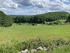
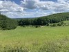
The above images may not be of the site on this page, but were taken nearby. They are loaded from Flickr so please click on them for image credits.
Click here to see more info for this site
Nearby sites
Click here to view sites on an interactive map of the areaKey: Red: member's photo, Blue: 3rd party photo, Yellow: other image, Green: no photo - please go there and take one, Grey: site destroyed
Download sites to:
KML (Google Earth)
GPX (GPS waypoints)
CSV (Garmin/Navman)
CSV (Excel)
To unlock full downloads you need to sign up as a Contributory Member. Otherwise downloads are limited to 50 sites.
Turn off the page maps and other distractions
Nearby sites listing. In the following links * = Image available
296m NE 42° Dolmen du Verdier 2 Burial Chamber or Dolmen
871m NNE 16° Verdier Menhir* Standing Stone (Menhir)
1.4km ENE 64° Dolmen du Verdier 1* Burial Chamber or Dolmen
1.5km SE 133° Dolmen du Camp d'Inou Tou 1 Burial Chamber or Dolmen
1.6km SE 133° Dolmen du Camp d'Inou Tou 3 Burial Chamber or Dolmen
1.7km SE 131° Dolmen du Camp d'Inou Tou 2 Burial Chamber or Dolmen
1.9km NNE 13° Mas Mondieu Dolmen* Burial Chamber or Dolmen
2.1km NNE 14° Chenil Dolmen* Burial Chamber or Dolmen
2.5km NNE 20° Dolmen du Pech Laglayre 0* Burial Chamber or Dolmen
2.7km NNE 32° Dolmen du Pech Laglayre 4* Burial Chamber or Dolmen
2.8km NNE 30° Dolmen du Pech Laglayre 3* Burial Chamber or Dolmen
2.8km NNE 23° Dolmen du Pech Laglayre 1* Burial Chamber or Dolmen
2.9km ENE 77° Dolmen de Pech Roubert Burial Chamber or Dolmen
2.9km NNE 27° Dolmen du Pech Laglayre 2* Burial Chamber or Dolmen
3.2km SE 132° Dolmen des Pradines (Cadrieu) Burial Chamber or Dolmen
3.3km E 84° Dolmen du Mas de Gabat Burial Chamber or Dolmen
3.7km ESE 114° Dolmens des Bouygues Burial Chamber or Dolmen
3.7km W 266° Mas de Pezet Dolmen* Burial Chamber or Dolmen
3.8km ESE 113° Dolmen d'Igues Burial Chamber or Dolmen
4.0km NW 316° Majoural Dolmen* Burial Chamber or Dolmen
4.1km NW 319° Combe de Sole Dolmen 1* Burial Chamber or Dolmen
4.1km ENE 61° Dolmen des Aguals* Burial Chamber or Dolmen
4.2km NW 320° Combe de Sole Dolmen 2* Burial Chamber or Dolmen
4.3km E 80° Dolmen de Pech Joly* Burial Chamber or Dolmen
4.4km ENE 67° Dolmen de la Combe de l’Ours 2 Burial Chamber or Dolmen
View more nearby sites and additional images


 We would like to know more about this location. Please feel free to add a brief description and any relevant information in your own language.
 Wir möchten mehr über diese Stätte erfahren. Bitte zögern Sie nicht, eine kurze Beschreibung und relevante Informationen in Deutsch hinzuzufügen.
 Nous aimerions en savoir encore un peu sur les lieux. S'il vous plaît n'hesitez pas à ajouter une courte description et tous les renseignements pertinents dans votre propre langue.
 Quisieramos informarnos un poco más de las lugares. No dude en añadir una breve descripción y otros datos relevantes en su propio idioma.