

<< Text Pages >> Dolmen du Seg 2 - Burial Chamber or Dolmen in France in Midi:Aveyron (12)
Submitted by holger_rix on Sunday, 27 March 2016 Page Views: 744
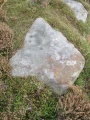
Neolithic and Bronze AgeSite Name: Dolmen du Seg 2Country: France Département: Midi:Aveyron (12) Type: Burial Chamber or Dolmen
Nearest Town: Millau Nearest Village: Montredon
Latitude: 44.059197N Longitude: 3.216511E
Condition:
| 5 | Perfect |
| 4 | Almost Perfect |
| 3 | Reasonable but with some damage |
| 2 | Ruined but still recognisable as an ancient site |
| 1 | Pretty much destroyed, possibly visible as crop marks |
| 0 | No data. |
| -1 | Completely destroyed |
| 5 | Superb |
| 4 | Good |
| 3 | Ordinary |
| 2 | Not Good |
| 1 | Awful |
| 0 | No data. |
| 5 | Can be driven to, probably with disabled access |
| 4 | Short walk on a footpath |
| 3 | Requiring a bit more of a walk |
| 2 | A long walk |
| 1 | In the middle of nowhere, a nightmare to find |
| 0 | No data. |
| 5 | co-ordinates taken by GPS or official recorded co-ordinates |
| 4 | co-ordinates scaled from a detailed map |
| 3 | co-ordinates scaled from a bad map |
| 2 | co-ordinates of the nearest village |
| 1 | co-ordinates of the nearest town |
| 0 | no data |
Be the first person to rate this site - see the 'Contribute!' box in the right hand menu.
Internal Links:
External Links:
Burial Chamber (Dolmen) in Midi:Aveyron (12)
Montredon, Millau, Aveyron, Midi-Pyrénées
Source: T4T35.fr
You may be viewing yesterday's version of this page. To see the most up to date information please register for a free account.
Do not use the above information on other web sites or publications without permission of the contributor.
Nearby Images from Flickr
The above images may not be of the site on this page, but were taken nearby. They are loaded from Flickr so please click on them for image credits.
Click here to see more info for this site
Nearby sites
Click here to view sites on an interactive map of the areaKey: Red: member's photo, Blue: 3rd party photo, Yellow: other image, Green: no photo - please go there and take one, Grey: site destroyed
Download sites to:
KML (Google Earth)
GPX (GPS waypoints)
CSV (Garmin/Navman)
CSV (Excel)
To unlock full downloads you need to sign up as a Contributory Member. Otherwise downloads are limited to 50 sites.
Turn off the page maps and other distractions
Nearby sites listing. In the following links * = Image available
70m WNW 285° Dolmen du Seg 1 Burial Chamber or Dolmen
145m WSW 258° Dolmen du Seg 3 Burial Chamber or Dolmen
2.9km SE 127° Dolmen de Féneyret des Liquisses Burial Chamber or Dolmen
3.1km SSE 167° Combe-de-Lestournel menhir Standing Stone (Menhir)
3.2km NNE 13° Dolmen du Sot (Aveyron)* Burial Chamber or Dolmen
3.3km S 175° Puech-Bertrand menhir Standing Stone (Menhir)
4.1km S 171° Montrepos menhir* Standing Stone (Menhir)
4.2km S 169° Dolmen des Places Nord* Burial Chamber or Dolmen
4.3km WNW 297° Dolmen de Saint-Martin-du-Larzac 2* Burial Chamber or Dolmen
4.3km S 169° Dolmen des Places Sud Burial Chamber or Dolmen
4.3km WNW 297° Dolmen de Saint-Martin-du-Larzac 3* Burial Chamber or Dolmen
4.4km SW 223° Menhir de la Couvertoirade Standing Stone (Menhir)
4.4km WNW 285° Dolmen de Saint-Martin-du-Larzac 5* Burial Chamber or Dolmen
4.4km WNW 296° Dolmen de Saint-Martin-du-Larzac 4* Burial Chamber or Dolmen
4.5km N 3° Menhir de Pierrefiche du Larzac* Standing Stone (Menhir)
4.8km W 278° Roc Traucat* Rock Outcrop
5.0km W 264° Rochers de La Blaquière* Rock Outcrop
5.1km WNW 295° Dolmen de Brusque* Burial Chamber or Dolmen
5.3km ESE 103° Dolmen du Baylet Burial Chamber or Dolmen
5.5km WNW 292° Dolmens du Mas de Bru Burial Chamber or Dolmen
5.5km ESE 102° Dolmen des Cuns Burial Chamber or Dolmen
6.5km ENE 66° Dolmen de Revens Burial Chamber or Dolmen
6.6km SW 226° Dolmen de la Fabière* Burial Chamber or Dolmen
7.0km SW 234° Jonquet Dolmen* Burial Chamber or Dolmen
7.3km W 280° Dolmen de Potensac* Burial Chamber or Dolmen
View more nearby sites and additional images


 We would like to know more about this location. Please feel free to add a brief description and any relevant information in your own language.
 Wir möchten mehr über diese Stätte erfahren. Bitte zögern Sie nicht, eine kurze Beschreibung und relevante Informationen in Deutsch hinzuzufügen.
 Nous aimerions en savoir encore un peu sur les lieux. S'il vous plaît n'hesitez pas à ajouter une courte description et tous les renseignements pertinents dans votre propre langue.
 Quisieramos informarnos un poco más de las lugares. No dude en añadir una breve descripción y otros datos relevantes en su propio idioma.