


<< Our Photo Pages >> Dolmen de Lanester - Burial Chamber or Dolmen in France in Bretagne:Morbihan (56)
Submitted by holger_rix on Saturday, 27 February 2016 Page Views: 1198
Neolithic and Bronze AgeSite Name: Dolmen de Lanester Alternative Name: Baie de KerdréanCountry: France Département: Bretagne:Morbihan (56) Type: Burial Chamber or Dolmen
Nearest Town: Baden Nearest Village: Mane Er Groz
Latitude: 47.625358N Longitude: 2.937284W
Condition:
| 5 | Perfect |
| 4 | Almost Perfect |
| 3 | Reasonable but with some damage |
| 2 | Ruined but still recognisable as an ancient site |
| 1 | Pretty much destroyed, possibly visible as crop marks |
| 0 | No data. |
| -1 | Completely destroyed |
| 5 | Superb |
| 4 | Good |
| 3 | Ordinary |
| 2 | Not Good |
| 1 | Awful |
| 0 | No data. |
| 5 | Can be driven to, probably with disabled access |
| 4 | Short walk on a footpath |
| 3 | Requiring a bit more of a walk |
| 2 | A long walk |
| 1 | In the middle of nowhere, a nightmare to find |
| 0 | No data. |
| 5 | co-ordinates taken by GPS or official recorded co-ordinates |
| 4 | co-ordinates scaled from a detailed map |
| 3 | co-ordinates scaled from a bad map |
| 2 | co-ordinates of the nearest village |
| 1 | co-ordinates of the nearest town |
| 0 | no data |
Be the first person to rate this site - see the 'Contribute!' box in the right hand menu.
Internal Links:
External Links:
")
Mane Er Groz, Baden, Morbihan, Brittany
Source: T4T35.fr
You may be viewing yesterday's version of this page. To see the most up to date information please register for a free account.
")
")
")
Do not use the above information on other web sites or publications without permission of the contributor.
Nearby Images from Flickr
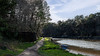
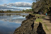
The above images may not be of the site on this page, but were taken nearby. They are loaded from Flickr so please click on them for image credits.
Click here to see more info for this site
Nearby sites
Click here to view sites on an interactive map of the areaKey: Red: member's photo, Blue: 3rd party photo, Yellow: other image, Green: no photo - please go there and take one, Grey: site destroyed
Download sites to:
KML (Google Earth)
GPX (GPS waypoints)
CSV (Garmin/Navman)
CSV (Excel)
To unlock full downloads you need to sign up as a Contributory Member. Otherwise downloads are limited to 50 sites.
Turn off the page maps and other distractions
Nearby sites listing. In the following links * = Image available
1.1km SW 226° Dolmen de Rohello* Burial Chamber or Dolmen
1.2km WNW 300° Dolmen de Kerdrec'h Burial Chamber or Dolmen
1.8km WNW 301° Pierre à Sacrifice du Rocher* Natural Stone / Erratic / Other Natural Feature
1.8km NW 305° Tumulus du Rocher* Chambered Tomb
1.8km NW 307° Tombelles de Kernourz * Burial Chamber or Dolmen
1.8km NNW 335° Menhir du Bono Standing Stone (Menhir)
2.2km WNW 296° Dolmen du Vide Bouteilles* Burial Chamber or Dolmen
2.3km WSW 237° Dolmen de Kercado Burial Chamber or Dolmen
2.3km WNW 282° Kerentreh tumulus Chambered Tomb
2.4km SSE 154° Menhir de Mériadec* Standing Stone (Menhir)
2.4km WNW 288° Dolmen Vide Bouteilles II* Burial Chamber or Dolmen
2.8km WNW 297° Dolmen du Château de Rosnarho Burial Chamber or Dolmen
3.1km SSE 161° Pointe de Toulvern Dolmen* Burial Chamber or Dolmen
3.3km SSE 164° Dolmens de Mané-Ven-Guen* Burial Chamber or Dolmen
3.8km N 351° Dolmen de Mané-Bransquel Burial Chamber or Dolmen
3.8km SSW 205° Dolmen de Kerlévarec Burial Chamber or Dolmen
4.0km SW 231° Dolmen de Pont-er-Lenn* Burial Chamber or Dolmen
4.1km SW 227° Kerdaniel Dolmen* Burial Chamber or Dolmen
4.4km SSE 166° Dolmens de la Presqu'île de Couédic Burial Chamber or Dolmen
4.5km N 10° Dolmens de Kerroyal Burial Chamber or Dolmen
4.7km SW 214° Dolmen du Coët-Courzo* Burial Chamber or Dolmen
4.7km NNE 16° Menhir de Keroyal* Standing Stone (Menhir)
4.8km SW 232° Kerran Dolmens* Chambered Tomb
5.0km SW 218° Kercadoret Dolmen* Burial Chamber or Dolmen
5.2km WSW 257° Er Mar Dolmen* Burial Chamber or Dolmen
View more nearby sites and additional images


 We would like to know more about this location. Please feel free to add a brief description and any relevant information in your own language.
 Wir möchten mehr über diese Stätte erfahren. Bitte zögern Sie nicht, eine kurze Beschreibung und relevante Informationen in Deutsch hinzuzufügen.
 Nous aimerions en savoir encore un peu sur les lieux. S'il vous plaît n'hesitez pas à ajouter une courte description et tous les renseignements pertinents dans votre propre langue.
 Quisieramos informarnos un poco más de las lugares. No dude en añadir una breve descripción y otros datos relevantes en su propio idioma.