


<< Text Pages >> Table du Jars - Rock Art in France in Pays de la Loire:Vendée (85)
Submitted by holger_rix on Tuesday, 19 January 2016 Page Views: 736
Rock ArtSite Name: Table du JarsCountry: France Département: Pays de la Loire:Vendée (85) Type: Rock Art
Nearest Town: Les Sables-d'Olonne Nearest Village: Brétinière
Latitude: 46.705833N Longitude: 2.368056W
Condition:
| 5 | Perfect |
| 4 | Almost Perfect |
| 3 | Reasonable but with some damage |
| 2 | Ruined but still recognisable as an ancient site |
| 1 | Pretty much destroyed, possibly visible as crop marks |
| 0 | No data. |
| -1 | Completely destroyed |
| 5 | Superb |
| 4 | Good |
| 3 | Ordinary |
| 2 | Not Good |
| 1 | Awful |
| 0 | No data. |
| 5 | Can be driven to, probably with disabled access |
| 4 | Short walk on a footpath |
| 3 | Requiring a bit more of a walk |
| 2 | A long walk |
| 1 | In the middle of nowhere, a nightmare to find |
| 0 | No data. |
| 5 | co-ordinates taken by GPS or official recorded co-ordinates |
| 4 | co-ordinates scaled from a detailed map |
| 3 | co-ordinates scaled from a bad map |
| 2 | co-ordinates of the nearest village |
| 1 | co-ordinates of the nearest town |
| 0 | no data |
Be the first person to rate this site - see the 'Contribute!' box in the right hand menu.
Internal Links:
External Links:
Rock Art in Pays de la Loire:Vendée (85)
Brétinière, L'Île-d'Yeu, Les Sables-d'Olonne, Vendée, Pays de la Loire
Source: T4T35.fr
You may be viewing yesterday's version of this page. To see the most up to date information please register for a free account.
Do not use the above information on other web sites or publications without permission of the contributor.
Nearby Images from Flickr

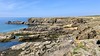
The above images may not be of the site on this page, but were taken nearby. They are loaded from Flickr so please click on them for image credits.
Click here to see more info for this site
Nearby sites
Click here to view sites on an interactive map of the areaKey: Red: member's photo, Blue: 3rd party photo, Yellow: other image, Green: no photo - please go there and take one, Grey: site destroyed
Download sites to:
KML (Google Earth)
GPX (GPS waypoints)
CSV (Garmin/Navman)
CSV (Excel)
To unlock full downloads you need to sign up as a Contributory Member. Otherwise downloads are limited to 50 sites.
Turn off the page maps and other distractions
Nearby sites listing. In the following links * = Image available
309m WNW 288° Menhir de Chiron Lazare Standing Stone (Menhir)
423m SW 217° Cromlech de Barbe* Stone Circle
806m NNW 331° Les Cinq Pierres du Chatonnet Rock Art
1.3km E 94° Pierres à cupules du Chien-à-l'Affût Rock Art
1.4km SSE 154° Gouffre d'Enfer Cave or Rock Shelter
1.5km ENE 67° Menhir de Ker Doucet* Standing Stone (Menhir)
1.6km ESE 102° Roche aux Fras Rock Art
1.8km NE 53° Dolmen de Ker Chalon Burial Chamber or Dolmen
2.4km ESE 123° Menhir du Pissot Standing Stone (Menhir)
2.5km ESE 117° Dolmen des Landes (Ile d'Yeu) Burial Chamber or Dolmen
2.5km NNW 333° Dolmen des Tabernaudes* Burial Chamber or Dolmen
2.6km NNW 346° La Table de Ker Difouaine* Sculptured Stone
2.7km WNW 303° Pierre des Amporelles Rock Art
2.7km SE 129° Pierre Tremblante Burial Chamber or Dolmen
2.9km NW 326° Dolmen dit la Planche à Puare* Burial Chamber or Dolmen
3.0km NNW 343° Dolmen des Petits Fradets* Burial Chamber or Dolmen
3.2km ESE 107° Dolmen dit La Guette Burial Chamber or Dolmen
3.6km ESE 108° Menhir de Vrimonière Standing Stone (Menhir)
3.6km ESE 115° Pierres du Pain et du Beurre* Standing Stones
3.8km ESE 114° Menhir de Soux* Standing Stone (Menhir)
30.7km NNE 15° megalithe de la Croix Rouge* Not Known (by us)
32.8km E 91° Tonnelle menhir* Standing Stone (Menhir)
35.3km NNE 25° La Table Submergée* Burial Chamber or Dolmen
35.7km E 81° Pré Doux menhir Standing Stone (Menhir)
35.7km E 82° La Pierre-au-Trésor-de-la-Triée* Standing Stone (Menhir)
View more nearby sites and additional images


 We would like to know more about this location. Please feel free to add a brief description and any relevant information in your own language.
 Wir möchten mehr über diese Stätte erfahren. Bitte zögern Sie nicht, eine kurze Beschreibung und relevante Informationen in Deutsch hinzuzufügen.
 Nous aimerions en savoir encore un peu sur les lieux. S'il vous plaît n'hesitez pas à ajouter une courte description et tous les renseignements pertinents dans votre propre langue.
 Quisieramos informarnos un poco más de las lugares. No dude en añadir una breve descripción y otros datos relevantes en su propio idioma.