


<< Our Photo Pages >> Warburg-Daseburg Henge - Henge in Germany in North Rhine-Westphalia
Submitted by Harald_Platta on Sunday, 08 February 2015 Page Views: 3276
Neolithic and Bronze AgeSite Name: Warburg-Daseburg Henge Alternative Name: Kreisgrabenanlage Warburg-Daseburg, Daseburger KreisgrabenCountry: Germany Land: North Rhine-Westphalia Type: Henge
Nearest Town: Warburg
Latitude: 51.493889N Longitude: 9.216944E
Condition:
| 5 | Perfect |
| 4 | Almost Perfect |
| 3 | Reasonable but with some damage |
| 2 | Ruined but still recognisable as an ancient site |
| 1 | Pretty much destroyed, possibly visible as crop marks |
| 0 | No data. |
| -1 | Completely destroyed |
| 5 | Superb |
| 4 | Good |
| 3 | Ordinary |
| 2 | Not Good |
| 1 | Awful |
| 0 | No data. |
| 5 | Can be driven to, probably with disabled access |
| 4 | Short walk on a footpath |
| 3 | Requiring a bit more of a walk |
| 2 | A long walk |
| 1 | In the middle of nowhere, a nightmare to find |
| 0 | No data. |
| 5 | co-ordinates taken by GPS or official recorded co-ordinates |
| 4 | co-ordinates scaled from a detailed map |
| 3 | co-ordinates scaled from a bad map |
| 2 | co-ordinates of the nearest village |
| 1 | co-ordinates of the nearest town |
| 0 | no data |
Internal Links:
External Links:
I have visited· I would like to visit
Harald_Platta has visited here
")
A few items have been found during the excavation. These comprise cremated bones of animals and a human canine tooth as well as pottery, which includes a decorated baggy pot. Based on the analysis of the findings, the enclosure has been dated in the time between 4600 and 4400 BC. Therefore, it is most likely that it was build by the Rössen Culture.
As with all known henge enclosures, the original function of the Warburg-Daseburg henge is not known. It may have been used as a secular assembly point, but possibly also for religious rituals or as an astronomical calendar. Given that the people of the Rössen Culture belonged to the first farmers in history, it may as well have been a mixture of all three elements.
There are indications that the Warburg-Daseburg henge was suitable to be used for astronomical observations. The four entrances can roughly be aligned with the cardinal points. The west entrance allowed the sighting of the stars Altair and Spica, while the star Deneb could be seen through the north entrance and the star Aldebaran as well as the Pleiades could be detected via the east entrance. Moreover, it was possible to sight summer solstice, because then the sun would set right behind the nearby volcano Desenberg when observed from the center of the henge.
The archaeologists did put the henge back into the ground. Today, it is again hardly visible and not accessible as it lies on private property. However, a part of the discovered objects is displayed in the museum LWL-Museum für Archäologie in Herne. Figure 1 is a photo taken from the corresponding vitrine in Herne. The display cabinet is embedded in the floor of the museum. The displayed picture is a photo taken during the excavations. The ecliptic of the sun, which it would have had in 4500 BC, has been added to this picture. This demonstrates, that a viewer who was standing in the middle of the henge, would have seen the sun disappear right behind the volcano Desenberg during summer solstice. The decorated baggy pot was found in the ditch of the henge. Figure 2 shows the visitors`information. The draft marks the ditch and the position of the gates, which are aligned to the cardinal points.
The Warburg-Daseburg henge can be marked as a rather small, but well analysed enclosure.
Text References:
[01] H. Kröger & H.J. Betzer: Die mittelneolithische Grabenanlage von Warburg-Daseburg, Kr. Höxter. In: Archäologische Beiträge zur Geschichte Westfalens (1997).
[02] H. Kröger: Die Kreisgrabenanlage von Warburg-Daseburg, Kr. Höxter. In: Archäologie in Ostwestfalen 3 (1998).
[03] W. Schlosser: Archäoastronomische Objekte der Hellweg-Region (2). In: Andromeda – Zeitschrift der Sternfreunde Münster e.V. Nr.2 (2000).
[04] M. Meyer & D. Raetzel-Fabian: Neolithische Grabenwerke in Mitteleuropa - Ein Überblick (2006).
[05] T. Plath: Zur Problematik der Nutzungsinterpretation mittelneolithischer Kreisgrabenanlagen. Dissertation Universität Hamburg (2011).
[06] M. Baales & H.-O. Pollmann: Kreisrunde Grabenwerke des Mittelneolithikums in Westfalen. In: Revolution Jungsteinzeit (2015).
You may be viewing yesterday's version of this page. To see the most up to date information please register for a free account.
")
Do not use the above information on other web sites or publications without permission of the contributor.
Nearby Images from Flickr
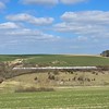
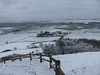

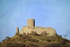


The above images may not be of the site on this page, but were taken nearby. They are loaded from Flickr so please click on them for image credits.
Click here to see more info for this site
Nearby sites
Click here to view sites on an interactive map of the areaKey: Red: member's photo, Blue: 3rd party photo, Yellow: other image, Green: no photo - please go there and take one, Grey: site destroyed
Download sites to:
KML (Google Earth)
GPX (GPS waypoints)
CSV (Garmin/Navman)
CSV (Excel)
To unlock full downloads you need to sign up as a Contributory Member. Otherwise downloads are limited to 50 sites.
Turn off the page maps and other distractions
Nearby sites listing. In the following links * = Image available
4.8km W 262° Museum im Stern* Museum
5.9km W 272° Warburg Galeriegrab (4)* Chambered Tomb
6.0km W 273° Warburg Galeriegrab (5) Chambered Tomb
6.0km W 274° Warburg Galeriegrab (2) Chambered Tomb
6.1km W 272° Warburg Galeriegrab (3)* Chambered Tomb
6.1km W 275° Warburg Galeriegrab (1)* Chambered Tomb
7.3km NW 308° Hohenwepel Galeriegrab Chambered Tomb
8.8km NW 314° Linienbandkeramisches Gräberfeld von Warburg-Hohenwepel Barrow Cemetery
11.6km WNW 294° Erdwerk von Rimbeck* Misc. Earthwork
11.6km WNW 293° Rimbeck* Passage Grave
11.7km WNW 294° Weisses Holz Huegelgrab (1)* Cairn
12.1km NNE 26° Erdwerk Borgentreich-Bühne* Misc. Earthwork
13.1km WNW 291° Kellberg Huegelgraeber (1)* Cairn
15.7km SE 133° Calden (2)* Chambered Tomb
16.5km SE 130° Calden (1)* Passage Grave
17.2km SSE 151° Wichtelkirche* Natural Stone / Erratic / Other Natural Feature
17.2km SSE 148° Helfensteine* Hillfort
17.5km WNW 298° Opferstein Hardehausen Natural Stone / Erratic / Other Natural Feature
18.0km SSE 150° Hoher Dörnberg* Hillfort
18.6km NW 312° Teufelssteine (Willebadessen)* Natural Stone / Erratic / Other Natural Feature
18.7km NW 310° Opferstein Fauler Jäger* Natural Stone / Erratic / Other Natural Feature
18.7km NW 310° Opferstein am Hexenberg* Natural Stone / Erratic / Other Natural Feature
18.7km NW 310° Drudenhöhle* Cave or Rock Shelter
19.1km NW 310° Behmburg* Hillfort
19.2km NW 308° Kleiner Herrgott* Ancient Cross
View more nearby sites and additional images


 We would like to know more about this location. Please feel free to add a brief description and any relevant information in your own language.
 Wir möchten mehr über diese Stätte erfahren. Bitte zögern Sie nicht, eine kurze Beschreibung und relevante Informationen in Deutsch hinzuzufügen.
 Nous aimerions en savoir encore un peu sur les lieux. S'il vous plaît n'hesitez pas à ajouter une courte description et tous les renseignements pertinents dans votre propre langue.
 Quisieramos informarnos un poco más de las lugares. No dude en añadir una breve descripción y otros datos relevantes en su propio idioma.