

, Aubrey Burl")
<< Image Pages >> Yucca House - Ancient Village or Settlement in United States in The Southwest
Submitted by bat400 on Wednesday, 30 May 2012 Page Views: 2780
Multi-periodSite Name: Yucca House Alternative Name: Aztec SpringsCountry: United States Region: The Southwest Type: Ancient Village or Settlement
Nearest Town: Cortez, CO
Latitude: 37.250300N Longitude: 108.6864W
Condition:
| 5 | Perfect |
| 4 | Almost Perfect |
| 3 | Reasonable but with some damage |
| 2 | Ruined but still recognisable as an ancient site |
| 1 | Pretty much destroyed, possibly visible as crop marks |
| 0 | No data. |
| -1 | Completely destroyed |
| 5 | Superb |
| 4 | Good |
| 3 | Ordinary |
| 2 | Not Good |
| 1 | Awful |
| 0 | No data. |
| 5 | Can be driven to, probably with disabled access |
| 4 | Short walk on a footpath |
| 3 | Requiring a bit more of a walk |
| 2 | A long walk |
| 1 | In the middle of nowhere, a nightmare to find |
| 0 | No data. |
| 5 | co-ordinates taken by GPS or official recorded co-ordinates |
| 4 | co-ordinates scaled from a detailed map |
| 3 | co-ordinates scaled from a bad map |
| 2 | co-ordinates of the nearest village |
| 1 | co-ordinates of the nearest town |
| 0 | no data |
Internal Links:
External Links:
")
An unexcavated site (visible structure, dated generally as Pueblo III, 1150AD - 1300AD.) Yucca House was mapped in 1878 as two distinct housing blocks around a central plaza with a multi-story compund. East of this complex of buildings was an isolated L-shaped single story roomblock and a low wall, that together surrounded a Great Kiva.
Modern (2000) non-invasive methods were used to re-map the site and confirmed the same general layout and identified isolated features as roomblocks, towers, and kivas.
Several smaller unexcavated structures are in the immediate area and the sites were served by several natural springs.
Although the land was donated to the federal government in 1919, the site was never excavated. Instead landowners surrounding the site protected it from intrusion and later donated additional surrounding land to provide access. No excavation is planned, but non-invasive techniques and survays are likely.
The site is open to the public, but there are no facilities or interpretation. Only some stonework is exposed. See the National Park website and Visitor's Guide.
The Mesa Verde Institute has conducted guided tours to this site in the past.
You may be viewing yesterday's version of this page. To see the most up to date information please register for a free account.
Do not use the above information on other web sites or publications without permission of the contributor.
Nearby Images from Flickr
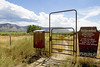
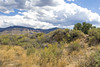
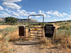
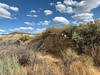

The above images may not be of the site on this page, but were taken nearby. They are loaded from Flickr so please click on them for image credits.
Click here to see more info for this site
Nearby sites
Click here to view sites on an interactive map of the areaKey: Red: member's photo, Blue: 3rd party photo, Yellow: other image, Green: no photo - please go there and take one, Grey: site destroyed
Download sites to:
KML (Google Earth)
GPX (GPS waypoints)
CSV (Garmin/Navman)
CSV (Excel)
To unlock full downloads you need to sign up as a Contributory Member. Otherwise downloads are limited to 50 sites.
Turn off the page maps and other distractions
Nearby sites listing. In the following links * = Image available
11.5km NNE 16° Dillard Ancient Village or Settlement
13.3km NW 318° McElmo Creek Kiva Ancient Village or Settlement
14.6km ESE 114° Mesa Verde - Step House Ancient Village or Settlement
14.7km ESE 118° Nordenskjoeld Site No 16* Ancient Village or Settlement
15.1km ESE 118° Mesa Verde - Long House Ancient Village or Settlement
15.1km ESE 117° Badger House Community Ancient Village or Settlement
15.5km NW 312° Castle Rock Pueblo Ancient Village or Settlement
15.7km NW 317° Saddlehorn Pueblo Ancient Village or Settlement
16.0km ESE 120° Kodak House Ancient Village or Settlement
16.0km E 95° Mesa Verde - Coyote Village* Ancient Village or Settlement
16.1km E 94° Mesa Verde - Mummy Lake* Misc. Earthwork
16.2km E 93° Mesa Verde - Megalithic House* Ancient Village or Settlement
16.2km E 94° Mesa Verde - Far View Tower* Ancient Temple
16.2km E 95° Mesa Verde - Far View House* Ancient Village or Settlement
16.3km E 95° Mesa Verde - Pipe Shrine House* Ancient Village or Settlement
16.4km E 87° Mesa Verde Ancient Village or Settlement
18.3km NNW 334° Sand Canyon Pueblo Ancient Village or Settlement
18.4km ESE 117° Navajo Watchtower Promontory Fort / Cliff Castle
18.6km ESE 113° Thomas House Ancient Village or Settlement
19.1km ESE 113° Mesa Verde - Spruce Tree House* Ancient Village or Settlement
19.2km ESE 116° Mesa Verde - Petroglyph Pt. Trail Cliff Dwelling * Ancient Village or Settlement
19.2km ESE 116° Mesa Verde - Petroglyph Point* Rock Art
19.6km ESE 115° Mesa Verde - Pithouses and Pueblos* Ancient Village or Settlement
19.6km ESE 118° Mesa Verde - Square Tower House* Ancient Village or Settlement
20.7km ESE 117° Mesa Verde - Fire Temple* Ancient Village or Settlement
View more nearby sites and additional images


 We would like to know more about this location. Please feel free to add a brief description and any relevant information in your own language.
 Wir möchten mehr über diese Stätte erfahren. Bitte zögern Sie nicht, eine kurze Beschreibung und relevante Informationen in Deutsch hinzuzufügen.
 Nous aimerions en savoir encore un peu sur les lieux. S'il vous plaît n'hesitez pas à ajouter une courte description et tous les renseignements pertinents dans votre propre langue.
 Quisieramos informarnos un poco más de las lugares. No dude en añadir una breve descripción y otros datos relevantes en su propio idioma.