

<< Text Pages >> Schmerlecke Galeriegrab (3) - Passage Grave in Germany in North Rhine-Westphalia
Submitted by Martin_L on Sunday, 15 April 2012 Page Views: 1960
Neolithic and Bronze AgeSite Name: Schmerlecke Galeriegrab (3)Country: Germany Land: North Rhine-Westphalia Type: Passage Grave
Nearest Town: Soest Nearest Village: Schmerlecke
Latitude: 51.595971N Longitude: 8.237313E
Condition:
| 5 | Perfect |
| 4 | Almost Perfect |
| 3 | Reasonable but with some damage |
| 2 | Ruined but still recognisable as an ancient site |
| 1 | Pretty much destroyed, possibly visible as crop marks |
| 0 | No data. |
| -1 | Completely destroyed |
| 5 | Superb |
| 4 | Good |
| 3 | Ordinary |
| 2 | Not Good |
| 1 | Awful |
| 0 | No data. |
| 5 | Can be driven to, probably with disabled access |
| 4 | Short walk on a footpath |
| 3 | Requiring a bit more of a walk |
| 2 | A long walk |
| 1 | In the middle of nowhere, a nightmare to find |
| 0 | No data. |
| 5 | co-ordinates taken by GPS or official recorded co-ordinates |
| 4 | co-ordinates scaled from a detailed map |
| 3 | co-ordinates scaled from a bad map |
| 2 | co-ordinates of the nearest village |
| 1 | co-ordinates of the nearest town |
| 0 | no data |
Internal Links:
External Links:
Remains of a gallery grave near Soest. Discovered in 2007. Part of a neolithic cemetery consisting of at least 3 gallery graves. Measuring 20-25m.
Sites recently examined by Dr. K. Schierhold et al.
More information about the recent excavations
References:
[1] K. Schierhold, Gräber für die Ewigkeit: die spätjungsteinzeitliche Kollektivgrabnekropole von Erwitte-Schmerlecke, Kr. Soest. Jahrbuch Westfalen 2011, 33–38.
[2] K. Schierhold / M. Baales / E. Cichy, Spätneolithischen Großsteingräbern auf der Spur - Geomagnetik in Erwitte-Schmerlecke. In: Th. Otten / H. Hellenkemper / J. Kunow u. a. (Hrsg.), Fundgeschichten. Archäologie in Nordrhein-Westfalen (Mainz 2010) 74–77.
You may be viewing yesterday's version of this page. To see the most up to date information please register for a free account.
Do not use the above information on other web sites or publications without permission of the contributor.
Nearby Images from Flickr
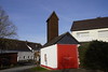
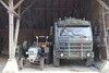
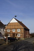
The above images may not be of the site on this page, but were taken nearby. They are loaded from Flickr so please click on them for image credits.
Click here to see more info for this site
Nearby sites
Click here to view sites on an interactive map of the areaKey: Red: member's photo, Blue: 3rd party photo, Yellow: other image, Green: no photo - please go there and take one, Grey: site destroyed
Download sites to:
KML (Google Earth)
GPX (GPS waypoints)
CSV (Garmin/Navman)
CSV (Excel)
To unlock full downloads you need to sign up as a Contributory Member. Otherwise downloads are limited to 50 sites.
Turn off the page maps and other distractions
Nearby sites listing. In the following links * = Image available
17m NNE 24° Schmerlecke (2) Chambered Tomb
275m S 184° Schmerlecke (1) Chambered Tomb
645m SW 227° Nasenstein* Standing Stone (Menhir)
3.1km E 88° Völlinghausen Chambered Tomb
3.4km SW 231° Erdwerk Bad Sassendorf Misc. Earthwork
4.2km E 91° Völlinghausen Galeriegrab Chambered Tomb
9.7km WSW 254° Erdwerk von Soest Misc. Earthwork
10.3km SSE 149° Uelde Galeriegrab Chambered Tomb
11.0km WSW 257° Soest-Ardey Opferteich Holy Well or Sacred Spring
11.1km SW 231° Hiddingsen Galeriegrab* Chambered Tomb
13.9km SSE 150° Summstein Belecke Modern Stone Circle etc
14.9km WNW 300° Lippborg Galeriegrab Chambered Tomb
16.9km WSW 252° Ostönnen Galeriegrab Chambered Tomb
18.7km SW 236° Grabhügel in den Bilmer Büschen Barrow Cemetery
19.9km NW 315° Beckum 2* Chambered Tomb
20.3km ENE 77° Tudorfer Weg Barrow Cemetery
20.5km SSE 148° Hoher Stein (bei Suttrop)* Cave or Rock Shelter
20.7km SE 137° Wallburg Schaftsköppen* Hillfort
21.1km SSE 147° Hohler Stein bei Kallenhardt* Cave or Rock Shelter
21.3km WSW 243° Ruhner Weg* Ancient Village or Settlement
21.6km SW 229° Grabhügel Große Aupke* Round Barrow(s)
21.8km SW 227° Grabhügelgruppe am Alten Holzweg* Barrow Cemetery
22.0km WSW 243° Gräberfeld von Ense-Bremen* Barrow Cemetery
22.3km NE 56° Hügelgräberfeld Mantinghausen Barrow Cemetery
22.3km SW 226° Grabhügelgruppe am Rehbocksweg* Barrow Cemetery
View more nearby sites and additional images


 We would like to know more about this location. Please feel free to add a brief description and any relevant information in your own language.
 Wir möchten mehr über diese Stätte erfahren. Bitte zögern Sie nicht, eine kurze Beschreibung und relevante Informationen in Deutsch hinzuzufügen.
 Nous aimerions en savoir encore un peu sur les lieux. S'il vous plaît n'hesitez pas à ajouter une courte description et tous les renseignements pertinents dans votre propre langue.
 Quisieramos informarnos un poco más de las lugares. No dude en añadir una breve descripción y otros datos relevantes en su propio idioma.