


<< Text Pages >> Truthwall Commom - Ancient Village or Settlement in England in Cornwall
Submitted by coldrum on Saturday, 16 July 2011 Page Views: 2879
Multi-periodSite Name: Truthwall CommomCountry: England County: Cornwall Type: Ancient Village or Settlement
Map Ref: SW38483267
Latitude: 50.136316N Longitude: 5.661134W
Condition:
| 5 | Perfect |
| 4 | Almost Perfect |
| 3 | Reasonable but with some damage |
| 2 | Ruined but still recognisable as an ancient site |
| 1 | Pretty much destroyed, possibly visible as crop marks |
| 0 | No data. |
| -1 | Completely destroyed |
| 5 | Superb |
| 4 | Good |
| 3 | Ordinary |
| 2 | Not Good |
| 1 | Awful |
| 0 | No data. |
| 5 | Can be driven to, probably with disabled access |
| 4 | Short walk on a footpath |
| 3 | Requiring a bit more of a walk |
| 2 | A long walk |
| 1 | In the middle of nowhere, a nightmare to find |
| 0 | No data. |
| 5 | co-ordinates taken by GPS or official recorded co-ordinates |
| 4 | co-ordinates scaled from a detailed map |
| 3 | co-ordinates scaled from a bad map |
| 2 | co-ordinates of the nearest village |
| 1 | co-ordinates of the nearest town |
| 0 | no data |
Be the first person to rate this site - see the 'Contribute!' box in the right hand menu.
Internal Links:
External Links:
I have visited· I would like to visit
lucasn visited on 23rd Jul 2018 - their rating: Cond: 3 Amb: 4 Access: 2
The remains of a field system with two hut circles integrated into the boundary pattern. The field systemis defined by stoney banks and lynchets up to 0.5 metres high.
Source: Pastscape
You may be viewing yesterday's version of this page. To see the most up to date information please register for a free account.
")
")
")
Do not use the above information on other web sites or publications without permission of the contributor.
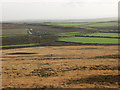
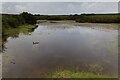
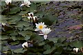
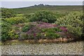
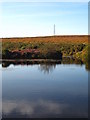
Nearby Images from Geograph Britain and Ireland:
©2005(licence)
©2023(licence)
©2023(licence)
©2023(licence)
©2009(licence)
The above images may not be of the site on this page, they are loaded from Geograph.
Please Submit an Image of this site or go out and take one for us!
Click here to see more info for this site
Nearby sites
Key: Red: member's photo, Blue: 3rd party photo, Yellow: other image, Green: no photo - please go there and take one, Grey: site destroyed
Download sites to:
KML (Google Earth)
GPX (GPS waypoints)
CSV (Garmin/Navman)
CSV (Excel)
To unlock full downloads you need to sign up as a Contributory Member. Otherwise downloads are limited to 50 sites.
Turn off the page maps and other distractions
Nearby sites listing. In the following links * = Image available
288m SSE 163° Tregeseal W Stone Circle (SW38553239)
315m WSW 249° Truthwall Barrow* Round Barrow(s) (SW38183257)
317m SSE 153° Tregeseal C* Stone Circle (SW38613238)
349m SSE 146° Tregeseal East* Stone Circle (SW38663237)
399m W 264° No Go By Hill Field System* Misc. Earthwork (SW38083265)
423m ESE 102° Truthwall Common barrows* Round Barrow(s) (SW38893256)
431m NE 43° Carn Kenidjack propped stone* Natural Stone / Erratic / Other Natural Feature (SW38793297)
459m NE 41° Carn Kenidjack* Rock Outcrop (SW388330)
471m W 281° Camyorth Field System Misc. Earthwork (SW38023278)
514m NNW 333° Carnbean Barrows* Round Barrow(s) (SW38273314)
530m E 93° Kenidjack Common holed stones* Stone Row / Alignment (SW39013262)
581m S 173° Carn Vres* Round Barrow(s) (SW38523209)
619m E 84° Carn Kenidjack Hut Circle and Enclosure Ancient Village or Settlement (SW391327)
656m ENE 68° Carnyorth Circles Ancient Village or Settlement (SW39103289)
660m S 178° Lower Bostraze Misc. Earthwork (SW38473201)
688m SW 217° Tregeseal Barrow* Chambered Tomb (SW38043214)
778m W 269° Higher Botallack Enclosure* Ancient Village or Settlement (SW377327)
852m ENE 61° Boslow Cross* Ancient Cross (SW39253304)
883m NE 45° Portheras Barrow* Round Barrow(s) (SW39143326)
1.1km N 351° Carn Eanes Standing stone* Modern Stone Circle etc (SW38373375)
1.1km NE 49° Woon Gumpus Barrows Round Barrow(s) (SW39343335)
1.2km ENE 67° Woon Gumpus Menhirs* Natural Stone / Erratic / Other Natural Feature (SW3960033079)
1.3km ENE 68° Woon Gumpas Common Tumuli* Barrow Cemetery (SW397331)
1.3km N 352° Carn Eanes Cairn* Cairn (SW38373397)
1.3km ESE 112° Wheal Buller Settlement* Ancient Village or Settlement (SW397321)
View more nearby sites and additional images


 We would like to know more about this location. Please feel free to add a brief description and any relevant information in your own language.
 Wir möchten mehr über diese Stätte erfahren. Bitte zögern Sie nicht, eine kurze Beschreibung und relevante Informationen in Deutsch hinzuzufügen.
 Nous aimerions en savoir encore un peu sur les lieux. S'il vous plaît n'hesitez pas à ajouter une courte description et tous les renseignements pertinents dans votre propre langue.
 Quisieramos informarnos un poco más de las lugares. No dude en añadir una breve descripción y otros datos relevantes en su propio idioma.