


<< Text Pages >> Saveock Water Archaeology - Modern Stone Circle etc in England in Cornwall
Submitted by Andy B on Thursday, 17 February 2011 Page Views: 9008
Modern SitesSite Name: Saveock Water Archaeology Alternative Name: Saveock Mill, Cornwall's Celtic Village, Cornwall Celtic VillageCountry: England County: Cornwall Type: Modern Stone Circle etc
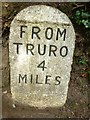
Nearest Town: Truro Nearest Village: Chacewater
Map Ref: SW76324476
Latitude: 50.260365N Longitude: 5.139622W
Condition:
| 5 | Perfect |
| 4 | Almost Perfect |
| 3 | Reasonable but with some damage |
| 2 | Ruined but still recognisable as an ancient site |
| 1 | Pretty much destroyed, possibly visible as crop marks |
| 0 | No data. |
| -1 | Completely destroyed |
| 5 | Superb |
| 4 | Good |
| 3 | Ordinary |
| 2 | Not Good |
| 1 | Awful |
| 0 | No data. |
| 5 | Can be driven to, probably with disabled access |
| 4 | Short walk on a footpath |
| 3 | Requiring a bit more of a walk |
| 2 | A long walk |
| 1 | In the middle of nowhere, a nightmare to find |
| 0 | No data. |
| 5 | co-ordinates taken by GPS or official recorded co-ordinates |
| 4 | co-ordinates scaled from a detailed map |
| 3 | co-ordinates scaled from a bad map |
| 2 | co-ordinates of the nearest village |
| 1 | co-ordinates of the nearest town |
| 0 | no data |
Be the first person to rate this site - see the 'Contribute!' box in the right hand menu.
Internal Links:
External Links:
The location of Cornwall Celtic Village, a reconstructed Bronze-Iron Age settlement run by Jacqui Wood. The purpose of the project is to educate the public in the daily life of the Bronze/Iron-Age inhabitants of Cornwall and to enable them to participate in activities which help to reconstruct that way of life.
Jacqui Wood is best known as the author of the book 'Prehistoric Cooking', as well as the founder and director of Saveock Water Archaeology, which is also run from this site. They have run training excavations since 2000 - the multi-phase nature of the site means there is something for everyone, with finds ranging from the Mesolithic to Early Modern periods.
Listed as 'Modern Site' as there is not an actual prehistoric site, nor is it a museum as such as I cannot find details of its opening times.
Cornwall Celtic Village
Saveock Mill
Greenbottom
Chacewater
Cornwall TR4 8QQ
Tel: 01872 56035
You may be viewing yesterday's version of this page. To see the most up to date information please register for a free account.
")
Do not use the above information on other web sites or publications without permission of the contributor.
Nearby Images from Geograph Britain and Ireland:
©2016(licence)
©2016(licence)
©2024(licence)
©2017(licence)
©2020(licence)
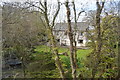
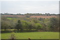
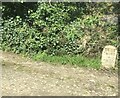
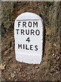
The above images may not be of the site on this page, they are loaded from Geograph.
Please Submit an Image of this site or go out and take one for us!
Click here to see more info for this site
Nearby sites
Key: Red: member's photo, Blue: 3rd party photo, Yellow: other image, Green: no photo - please go there and take one, Grey: site destroyed
Download sites to:
KML (Google Earth)
GPX (GPS waypoints)
CSV (Garmin/Navman)
CSV (Excel)
To unlock full downloads you need to sign up as a Contributory Member. Otherwise downloads are limited to 50 sites.
Turn off the page maps and other distractions
Nearby sites listing. In the following links * = Image available
2.4km NE 50° Bosvisack Round* Hillfort (SW78254624)
3.3km ENE 65° Penventinnie Round* Ancient Village or Settlement (SW79374603)
3.4km N 356° Kenwyn Four Burrows* Barrow Cemetery (SW762482)
3.5km NW 305° Two Burrows Round Barrow* Round Barrow(s) (SW735469)
4.9km WNW 292° Coosewartha round Ancient Village or Settlement (SW719468)
5.0km SSW 204° St Gwennap's Well Holy Well or Sacred Spring (SW741403)
5.6km SE 140° Carnon Downs Barrow* Round Barrow(s) (SW79754036)
5.7km ENE 77° Kenwyn* Holy Well or Sacred Spring (SW819458)
5.7km E 85° St Domnu's Well* Holy Well or Sacred Spring (SW820450)
6.0km WNW 299° Park Shady Spring* Holy Well or Sacred Spring (SW71154790)
6.1km E 87° Royal Cornwall Museum* Museum (SW824448)
6.2km SSE 163° St Piran's Well* Holy Well or Sacred Spring (SW779388)
6.2km E 86° Truro Cathedral Celtic Cross* Early Christian Sculptured Stone (SW825449)
6.4km SW 227° Figgy Dowdy's Well* Holy Well or Sacred Spring (SW7146740637)
6.9km NW 312° Bolster Bank* Misc. Earthwork (SW714496)
6.9km SSW 207° Trebowland Round* Ancient Village or Settlement (SW72923874)
7.0km WNW 295° Trevissick round* Ancient Village or Settlement (SW701480)
7.1km WSW 244° St Rumon's Cross* Ancient Cross (SW69804195)
7.4km S 188° Lady Holy Well* Holy Well or Sacred Spring (SW7492937503)
7.4km NW 322° St Agnes Cornish Cross* Ancient Cross (SW720508)
7.5km SSW 198° Seaureaugh standing Stone* Standing Stone (Menhir) (SW73723776)
7.5km E 79° Truro Eastern District Centre Neolithic Enclosure* Causewayed Enclosure (SW838459)
7.6km N 8° Caer Dane* Ancient Village or Settlement (SW777522)
7.6km SSW 205° Trewithen Round Ancient Village or Settlement (SW72833802)
7.7km NW 314° St Agnes Beacon* Barrow Cemetery (SW710503)
View more nearby sites and additional images


 We would like to know more about this location. Please feel free to add a brief description and any relevant information in your own language.
 Wir möchten mehr über diese Stätte erfahren. Bitte zögern Sie nicht, eine kurze Beschreibung und relevante Informationen in Deutsch hinzuzufügen.
 Nous aimerions en savoir encore un peu sur les lieux. S'il vous plaît n'hesitez pas à ajouter une courte description et tous les renseignements pertinents dans votre propre langue.
 Quisieramos informarnos un poco más de las lugares. No dude en añadir una breve descripción y otros datos relevantes en su propio idioma.