


<< Text Pages >> Fontaine Ste-Onenn - Holy Well or Sacred Spring in France in Bretagne:Morbihan (56)
Submitted by Sunny100 on Tuesday, 18 January 2011 Page Views: 4469
Springs and Holy WellsSite Name: Fontaine Ste-Onenn Alternative Name: St Onenna's Well, St Nenna's Well, St Hwenna's WellCountry: France Département: Bretagne:Morbihan (56) Type: Holy Well or Sacred Spring
Nearest Town: Ploermel Nearest Village: Trehorenteuc
Latitude: 48.008300N Longitude: 2.2876W
Condition:
| 5 | Perfect |
| 4 | Almost Perfect |
| 3 | Reasonable but with some damage |
| 2 | Ruined but still recognisable as an ancient site |
| 1 | Pretty much destroyed, possibly visible as crop marks |
| 0 | No data. |
| -1 | Completely destroyed |
| 5 | Superb |
| 4 | Good |
| 3 | Ordinary |
| 2 | Not Good |
| 1 | Awful |
| 0 | No data. |
| 5 | Can be driven to, probably with disabled access |
| 4 | Short walk on a footpath |
| 3 | Requiring a bit more of a walk |
| 2 | A long walk |
| 1 | In the middle of nowhere, a nightmare to find |
| 0 | No data. |
| 5 | co-ordinates taken by GPS or official recorded co-ordinates |
| 4 | co-ordinates scaled from a detailed map |
| 3 | co-ordinates scaled from a bad map |
| 2 | co-ordinates of the nearest village |
| 1 | co-ordinates of the nearest town |
| 0 | no data |
Internal Links:
External Links:
Fontaine Ste-Onenn (St Onenna's Well) is an interesting little holy well that has been hidden away and remains something of a secretive place. It is said to be located just north of the village of Trehorenteuc in the Canton of Mauron in a corner of a farmer's field on what is private land. The forest of Broceliande lies just east of the village. [Please go to the Tourist information office in the village - they will put you in touch with a guide]. It is a pilgrimage site that is dedicated to the 7th century St Onenna. Please note the above latitude/longitude is for the village church.
Legend tells us that St Onenna was the sister of King Judicael of Brittany, but at the age of 10 she ran away from the luxury of her father's palace in Paimpont. She came to what is now Trehorenteuc where she lived with a poor family and began to care for local people who were living in very bad conditions and suffering ill health. Every day she placed flowers at the altar in the church, and she apparently tended a flock of geese. Legend also says she managed to thwart a gang of ruffians who were attempting to ransack the village.
The well with its narrow entrance is of pre-Christian origins, and is situated under a small raised mound. Steps go down into a pool of water which is some 10 foot below ground level. The well chamber is quadrilateral is shape and the sides are supported by stonework; there is a niche in the wall that may have held a statue. The water once cured lung problems, menstral problems and was also good for poor eyesight. Two pilgrimages to the well occur every year, generally on or around the saint's feastday 30th April.
The church back in the village used to be dedicated to St Onenna, but in the early 1900s it was re-dedicated to The Holy Grael. A window inside depicts the legend of the saint who died at the young age of 28 in 650 CE. The nearby Forest of Broceliande is associated with King Arthur and Merlin. Legend has it that the Holy Grael itself was buried somewhere in the area. But just where ?
You may be viewing yesterday's version of this page. To see the most up to date information please register for a free account.
Do not use the above information on other web sites or publications without permission of the contributor.
Nearby Images from Flickr
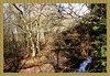
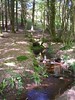
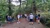
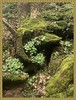
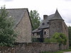
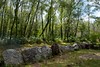
The above images may not be of the site on this page, but were taken nearby. They are loaded from Flickr so please click on them for image credits.
Click here to see more info for this site
Nearby sites
Click here to view sites on an interactive map of the areaKey: Red: member's photo, Blue: 3rd party photo, Yellow: other image, Green: no photo - please go there and take one, Grey: site destroyed
Download sites to:
KML (Google Earth)
GPX (GPS waypoints)
CSV (Garmin/Navman)
CSV (Excel)
To unlock full downloads you need to sign up as a Contributory Member. Otherwise downloads are limited to 50 sites.
Turn off the page maps and other distractions
Nearby sites listing. In the following links * = Image available
870m NNW 339° Butte-Ronde Chambered Tomb
1.3km N 354° Jardin-aux-Moines tumulus* Chambered Tomb
1.6km ESE 120° Sépulture mégalithique de Rauco Cist
1.7km ESE 123° L'Hotié de Viviane* Chambered Tomb
2.3km SE 143° Tombeau des Géants* Passage Grave
2.3km ESE 105° Coffre de la Guette Burial Chamber or Dolmen
3.3km SE 137° Le Tombeau du Géant* Chambered Tomb
4.5km NE 42° Fontaine de Barenton* Holy Well or Sacred Spring
5.6km ESE 103° Allée Couverte de l'Orgeril Passage Grave
7.3km SSE 164° Allée Couverte de Brambelay Passage Grave
8.1km N 1° Dolmen dit Pierre des Champs-Morgan Burial Chamber or Dolmen
8.2km SW 226° Hino allée couverte* Passage Grave
8.9km NNE 31° Allée Couverte dite Le Rocher Passage Grave
9.3km SSE 160° Allée couverte dite de Roherman* Passage Grave
13.2km S 177° Allée couverte dite la Roche des Fées* Passage Grave
13.6km SE 146° Allée Couverte dite le Tombeau des Rochettes Passage Grave
14.1km NE 54° Tombeau des Anglais (Paimpont)* Passage Grave
14.1km NE 52° Menhir de Coisbois* Standing Stone (Menhir)
14.2km SSW 198° Maison Neuve menhir* Standing Stone (Menhir)
14.2km NE 46° Menhirs de la Lande de Saint-Jean Standing Stone (Menhir)
14.4km SSW 199° Piprais menhir* Standing Stone (Menhir)
14.5km ENE 63° Tombeau de la Duchesse d'Angoulème Burial Chamber or Dolmen
14.6km SW 224° Haut Bézon allée couverte* Passage Grave
14.6km SSE 147° La Verrie menhir* Standing Stone (Menhir)
14.7km SW 227° Ville Bouquet allée couverte* Passage Grave
View more nearby sites and additional images


 We would like to know more about this location. Please feel free to add a brief description and any relevant information in your own language.
 Wir möchten mehr über diese Stätte erfahren. Bitte zögern Sie nicht, eine kurze Beschreibung und relevante Informationen in Deutsch hinzuzufügen.
 Nous aimerions en savoir encore un peu sur les lieux. S'il vous plaît n'hesitez pas à ajouter une courte description et tous les renseignements pertinents dans votre propre langue.
 Quisieramos informarnos un poco más de las lugares. No dude en añadir una breve descripción y otros datos relevantes en su propio idioma.