Featured: Ark of Secrets - Neolithic spirit alive in the Middle Ages

Ark of Secrets - Neolithic spirit alive in the Middle Ages

Great Stone Circles, Aubrey Burl

Great Stone Circles, Aubrey Burl

Who's Online

There are currently, 266 guests and 7 members online.

You are a guest. To join in, please register for free by clicking here

Sponsors

<< Our Photo Pages >> Ness of Woodwick - Broch or Nuraghe in Scotland in Orkney

Submitted by howar on Saturday, 20 November 2010  Page Views: 4285

Iron Age and Later PrehistorySite Name: Ness of Woodwick
Country: Scotland County: Orkney Type: Broch or Nuraghe
 Nearest Village: Redland
Map Ref: HY40072487
Latitude: 59.106463N  Longitude: 3.048097W
Condition:
5Perfect
4Almost Perfect
3Reasonable but with some damage
2Ruined but still recognisable as an ancient site
1Pretty much destroyed, possibly visible as crop marks
0No data.
-1Completely destroyed
2 Ambience:
5Superb
4Good
3Ordinary
2Not Good
1Awful
0No data.
5 Access:
5Can be driven to, probably with disabled access
4Short walk on a footpath
3Requiring a bit more of a walk
2A long walk
1In the middle of nowhere, a nightmare to find
0No data.
no data Accuracy:
5co-ordinates taken by GPS or official recorded co-ordinates
4co-ordinates scaled from a detailed map
3co-ordinates scaled from a bad map
2co-ordinates of the nearest village
1co-ordinates of the nearest town
0no data
5

Internal Links:
External Links:

Ness of Woodwick
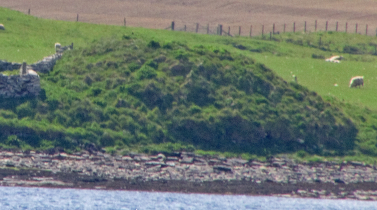
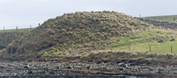
Ness of Woodwick submitted by howar : Craig of Ritten broch is 50~60' diameter. Outer wall is at shore level to the right (Vote or comment on this photo)
Broch in Orkney

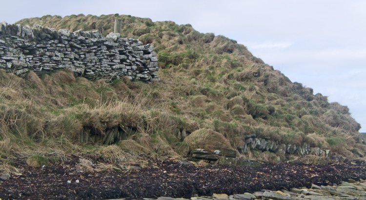
From the ferry looking north of the Woodwick woods I could make out the looming remains of the Ness of Woodwick broch in Evie (NMRS record no. HY42SW 9 at HY40072487). Hedges notes that the rocky outcrops and sand below would be a good place to haul up a boat. This site is between the Loch of Vastray, a freshwater lochan, and the Rendall-Evie parish boundary at Woodwick's sea inlet. Though the site is called the Ness of Woodwick, after the headland, this is very obviously the Craig of Ritten/Rittin. The 'crag' is an impressive mound with dimensions estimated as 50-60 feet across with an inner diameter about half that - in 1946 at the seaward side to the NE about 20' of outer wall (thought to be the outer wall-face) could be observed. No midden was seen. Twenty years later most of this outer wall was overgrown like the rest of the mound. On a wider view there are two stone-walled enclosures running south of the mound that feel old, though post-broch they are in the right situation to replace outbuildings if this were a broch settlement like Gurness. I wonder if ritten could possibly be an error for pitten to give us a name Pict's Crag ?? Alternatively a ret is an enclosure used during sheep-shearing.
You may be viewing yesterday's version of this page. To see the most up to date information please register for a free account.

Ness of Woodwick
Ness of Woodwick submitted by howar : Low wall by broch (Vote or comment on this photo)

Ness of Woodwick
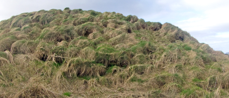
Ness of Woodwick submitted by howar : Southern view of broch mound showing single course turf-covered wall, chiefly made of made of vertical slabs, running to it. Intriguing but date ? (Vote or comment on this photo)

Ness of Woodwick
Ness of Woodwick submitted by howar : View along broch mound to bank behind the later enclosure (Vote or comment on this photo)

Ness of Woodwick
Ness of Woodwick submitted by howar : Southern side of mound with exposed wall. Also visible near top right edge of image is stone from another bit (Vote or comment on this photo)

Ness of Woodwick
Ness of Woodwick submitted by howar : Southern side of broch with wall course partly exposed (Vote or comment on this photo)

Ness of Woodwick
Ness of Woodwick submitted by howar : View from broch across lumps and bumps inside enclosure and out

Ness of Woodwick
Ness of Woodwick submitted by howar : Wall exposure at top of northern side

Ness of Woodwick
Ness of Woodwick submitted by howar : Top of northern side of mound with part of wall exposed

Ness of Woodwick
Ness of Woodwick submitted by howar : Sideways look across basal wall

Ness of Woodwick
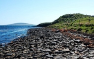
Ness of Woodwick submitted by howar : Exposed basal wall is only just above shoreline!

Ness of Woodwick
Ness of Woodwick submitted by howar : Looking from shore in front of mound with basal wall showing

Ness of Woodwick
Ness of Woodwick submitted by howar : Coming from northwards along shore

Ness of Woodwick
Ness of Woodwick submitted by howar : Looking down from track onto broch mound

Ness of Woodwick
Ness of Woodwick submitted by howar : Broch and later enclosure seen from side of Vishall Hill

Ness of Woodwick
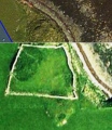
Ness of Woodwick submitted by howar : Composite satellite image of site

Ness of Woodwick
Ness of Woodwick submitted by howar : Craig of Ritten broch mound and one of possible enclosures with trackway down to the beach

Ness of Woodwick
Ness of Woodwick submitted by howar : Craig of Ritten from Rousay ferry - look to the north of the wood at Woodwick

Ness of Woodwick
Ness of Woodwick submitted by Creative Commons : Broch at the Craig of Ritten This one, as is often the case, has a beautiful situation. It is one of several nearby, the largest by far being that at Gurness, 3 km to the NE. They are of course, a Pictish construction. Copyright Ian Balcombe and licensed for reuse under the Creative Commons Licence

Do not use the above information on other web sites or publications without permission of the contributor.
Click here to see more info for this site

Nearby sites

Click here to view sites on an interactive OS map

Key: Red: member's photo, Blue: 3rd party photo, Yellow: other image, Green: no photo - please go there and take one, Grey: site destroyed

Download sites to:
KML (Google Earth)
GPX (GPS waypoints)
CSV (Garmin/Navman)
CSV (Excel)

To unlock full downloads you need to sign up as a Contributory Member. Otherwise downloads are limited to 50 sites.


Turn off the page maps and other distractions

Nearby sites listing. In the following links * = Image available
 1.3km S 191° Knowe of Midgarth* Ancient Village or Settlement (HY39812361)
 2.1km W 268° Redland South* Chambered Cairn (HY38002484)
 2.1km S 178° Tingwall Broch* Broch or Nuraghe (HY401228)
 2.3km W 274° Quoys Chambered Cairn Chambered Cairn (HY37822507)
 2.6km N 359° Knowe of Burrian (Frotoft)* Broch or Nuraghe (HY40062745)
 2.6km N 6° Langstane (Orkney)* Standing Stone (Menhir) (HY404275)
 2.7km NNE 29° Knowe of Hunclett* Broch or Nuraghe (HY41442722)
 2.7km NW 316° Gurness* Broch or Nuraghe (HY3818926842)
 2.7km NW 315° Aikerness Class I Pictish Symbol Stone (HY38182685)
 3.0km NNE 25° Blackhammer* Chambered Tomb (HY41422761)
 3.1km N 356° Knowe of Lairo* Chambered Cairn (HY39922796)
 3.1km N 7° Knowe of Yarso* Chambered Cairn (HY40482795)
 3.1km N 359° Knowe of Ramsay* Chambered Cairn (HY40042800)
 3.3km NNW 344° Viera Lodge Broch or Nuraghe (HY392281)
 3.7km NE 41° Taversoe Tuick* Chambered Cairn (HY42572761)
 4.1km WNW 296° Knowe of Stenso* Broch or Nuraghe (HY3639426747)
 4.2km S 190° Seven Knowes* Barrow Cemetery (HY39282072)
 4.4km NNW 337° Westness Chambererd Tomb* Chambered Tomb (HY38402898)
 4.6km ENE 72° Braes of Ha’Breck, Wyre. Ancient Village or Settlement (HY445262)
 4.8km NNE 29° Tammaskirk* Ancient Village or Settlement (HY42502907)
 5.0km NE 50° Cubbie Roo's Burden* Chambered Cairn (HY43932800)
 5.0km SE 145° Holm of Rendall* Cairn (HY4283220735)
 5.0km WNW 298° Knowe of Grugar* Broch or Nuraghe (HY35642730)
 5.2km WNW 293° Grugar* Carving (HY353270)
 5.4km NNW 331° Knowe of Swandro* Chambered Cairn (HY37532966)
View more nearby sites and additional images

<< Great Gaddesden church puddingstones

Ty Aderyn cairn 2 >>

Please add your thoughts on this site

The Imagined Sound of Sun on Stone - Sally Beamish

The Imagined Sound of Sun on Stone - Sally Beamish

Sponsors

Auto-Translation (Google)

Translate from English into:

"Ness of Woodwick" | Login/Create an Account | 3 News and Comments
  
Go back to top of page    Comments are owned by the poster. We aren't responsible for their content.
Re: Ness of Woodwick by howar on Sunday, 12 April 2015
(User Info | Send a Message)
Even taking photos along the way it took me under 50 minutes to reach the broch mound from the Evie Road, but you can get by car much of the way. Just north of Woodwick is the Ardwick Road, go up this to the top where there are several farms clustered together. Behind Arwick there is a half-snapped-off sign for the beach (wonderful how markers self-destruct in Orkney) and you continue down past Lower Bisgarth to where there is a parting of the ways. From Vishall Hill you can make out the broch because of the brightness of the later drywall enclosure stuck behind it. On the left a farmtrack goes to the sands by the northern side of the lochan (with its almost vestigial ayre) while on the right you take what is almost a farm road down to the shore and turn to your right for the Ness of Woodwick. I went at low tide but it seemed to me that you could walk the outside of the field with care if the tide were too high. Even though on the map the Craig of Ritten juts out it felt to me more as if the broch mound was tucked into the land. Though the 20' internal wall arc mentioned in the report is indeed hidden now there is another exposed at the bottom of the tower, not much above the shore so easily masked if you visit on an incoming tide. It struck me that the tower must survive under the mound almost complete. All over the mound you can find the odd stone. However the nature of a broch is that these being isolated I could not tell if these were simply part of the massively wide broch tower wall or parts of other structures. Clambering up to the top I could see several lumps and bumps inside the medaeval/'modern' enclosure and just beyond it. What with the surviving height of the broch tower and the topography I would deem it likely that the rest of the broch settlement survives under the turf. I wish I could find my Photoshopped version of the 'original' Google Earth image I found, as it clearly showed the tower outworks as a surviving plan despite the ground cover. On the composite image from two satellites you can still make out a figure-of-eight with one side a dark line of inner and outer broch tower arcs and connection (?entrance side). Also away from the main broch you can see the bumps I saw. Most obvious is a beetle shaped oval directly adjoining, almost entirely contained by one side of the 'modern' enclosure. Which makes the site extend inland like the other Evie brochs.
[ Reply to This ]

Re: Ness of Woodwick by howar on Tuesday, 19 February 2013
(User Info | Send a Message)
A Google satellite image shows the western half of the broch tower walls as plain as a pikestaff. Attached to and surrounding this, and occupying much of the eastern half of the modern enlosure close to, is a large oval patch in a deeper green that looks likely to be an area of broch settlement. The pic is so full of potential detail that I wish I could post it here
[ Reply to This ]

Re: Ness of Woodwick by howar on Sunday, 27 January 2013
(User Info | Send a Message)
From the ferry looking north of the Woodwick woods I could make out the looming remains of the Ness of Woodwick broch in Evie (NMRS record no. HY42SW 9 at HY40072487). Hedges notes that the rocky outcrops and sand below would be a good place to haul up a boat. This site is between the Loch of Vastray, a freshwater lochan, and the Rendall-Evie parish boundary at Woodwick's sea inlet. Though the site is called the Ness of Woodwick, after the headland, this is very obviously the Craig of Ritten/Rittin. The 'crag' is an impressive mound with dimensions estimated as 50-60 feet across with an inner diameter about half that - in 1946 at the seaward side to the NE about 20' of outer wall (thought to be the outer wall-face) could be observed. No midden was seen. Twenty years later most of this outer wall was overgrown like the rest of the mound. On a wider view there are two stone-walled enclosures running south of the mound that feel old, though post-broch they are in the right situation to replace outbuildings if this were a broch settlement like Gurness. I wonder if ritten could possibly be an error for pitten to give us a name Pict's Crag ?? Alternatively a ret is an enclosure used during sheep-shearing.
[ Reply to This ]

Your Name: Anonymous [ Register Now ]
Subject:


Add your comment or contribution to this page. Spam or offensive posts are deleted immediately, don't even bother

<<< What is five plus one as a number? (Please type the answer to this question in the little box on the left)
You can also embed videos and other things. For Youtube please copy and paste the 'embed code'.
For Google Street View please include Street View in the text.
Create a web link like this: <a href="https://www.megalithic.co.uk">This is a link</a>  

Allowed HTML is:
<p> <b> <i> <a> <img> <em> <br> <strong> <blockquote> <tt> <li> <ol> <ul> <object> <param> <embed> <iframe>

We would like to know more about this location. Please feel free to add a brief description and any relevant information in your own language.
Wir möchten mehr über diese Stätte erfahren. Bitte zögern Sie nicht, eine kurze Beschreibung und relevante Informationen in Deutsch hinzuzufügen.
Nous aimerions en savoir encore un peu sur les lieux. S'il vous plaît n'hesitez pas à ajouter une courte description et tous les renseignements pertinents dans votre propre langue.
Quisieramos informarnos un poco más de las lugares. No dude en añadir una breve descripción y otros datos relevantes en su propio idioma.