

<< Our Photo Pages >> Carrieres menhir - Standing Stone (Menhir) in France in Midi:Tarn (81)
Submitted by TheCaptain on Saturday, 23 October 2010 Page Views: 2174
Neolithic and Bronze AgeSite Name: Carrieres menhirCountry: France Département: Midi:Tarn (81) Type: Standing Stone (Menhir)
Nearest Town: Nages Nearest Village: Nages
Latitude: 43.668200N Longitude: 2.780000E
Condition:
| 5 | Perfect |
| 4 | Almost Perfect |
| 3 | Reasonable but with some damage |
| 2 | Ruined but still recognisable as an ancient site |
| 1 | Pretty much destroyed, possibly visible as crop marks |
| 0 | No data. |
| -1 | Completely destroyed |
| 5 | Superb |
| 4 | Good |
| 3 | Ordinary |
| 2 | Not Good |
| 1 | Awful |
| 0 | No data. |
| 5 | Can be driven to, probably with disabled access |
| 4 | Short walk on a footpath |
| 3 | Requiring a bit more of a walk |
| 2 | A long walk |
| 1 | In the middle of nowhere, a nightmare to find |
| 0 | No data. |
| 5 | co-ordinates taken by GPS or official recorded co-ordinates |
| 4 | co-ordinates scaled from a detailed map |
| 3 | co-ordinates scaled from a bad map |
| 2 | co-ordinates of the nearest village |
| 1 | co-ordinates of the nearest town |
| 0 | no data |
Internal Links:
External Links:
I have visited· I would like to visit
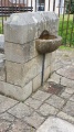
TheCaptain visited on 16th Sep 2005 - their rating: Cond: 3 Amb: 3 Access: 5 While driving through Carriers towards Nages from the southeast, I saw a little menhir shining in the low sun beside the road near to a cross. Its not much more than a metre tall, and possibly once had markings on it, and is a very pale coloured stone. It is nicely presented in its little garden like setting.
")
It is nicely presented in its little garden like setting.
You may be viewing yesterday's version of this page. To see the most up to date information please register for a free account.
")
Do not use the above information on other web sites or publications without permission of the contributor.
Nearby Images from Flickr

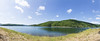

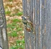
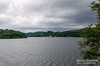
The above images may not be of the site on this page, but were taken nearby. They are loaded from Flickr so please click on them for image credits.
Click here to see more info for this site
Nearby sites
Click here to view sites on an interactive map of the areaKey: Red: member's photo, Blue: 3rd party photo, Yellow: other image, Green: no photo - please go there and take one, Grey: site destroyed
Download sites to:
KML (Google Earth)
GPX (GPS waypoints)
CSV (Garmin/Navman)
CSV (Excel)
To unlock full downloads you need to sign up as a Contributory Member. Otherwise downloads are limited to 50 sites.
Turn off the page maps and other distractions
Nearby sites listing. In the following links * = Image available
665m NNW 346° Lou Prat statue menhir* Sculptured Stone
780m N 356° Nages menhir* Standing Stone (Menhir)
2.1km SSW 193° Rouvière statue-menhir Sculptured Stone
2.1km S 185° Griffoulou menhir Standing Stone (Menhir)
2.1km S 186° Menhir de la Serre de Nages* Standing Stone (Menhir)
2.1km S 186° Trédos menhir* Standing Stone (Menhir)
2.1km S 186° Rieu-Montagné museum* Museum
2.2km S 185° Barraque-des-Fourniols statue-menhir* Sculptured Stone
2.6km E 92° Croix-de-Condomines menhir* Standing Stone (Menhir)
2.8km SW 224° Rouiregros statue menhir* Sculptured Stone
3.2km S 179° Naujac statue menhir* Sculptured Stone
3.2km NE 49° Lubio-Ferrières statue-menhir* Sculptured Stone
3.4km WNW 298° statue-menhir du Pic du Montalet Sculptured Stone
3.5km ENE 72° Paumérou menhir* Standing Stone (Menhir)
4.2km SSE 167° Triby-Fabié statue-menhir* Sculptured Stone
4.4km ENE 74° Pré-de-Roi Menhir* Standing Stone (Menhir)
4.7km E 80° Menhir de Candoubre 2* Standing Stone (Menhir)
4.8km E 80° Candoubre menhir* Standing Stone (Menhir)
5.0km E 85° Dolmen de Castelsec* Burial Chamber or Dolmen
5.1km SE 125° La Landette statue menhir* Sculptured Stone
5.1km S 183° Dolmen de la Frajure* Burial Chamber or Dolmen
5.4km ENE 71° Dolmen de Lagarde* Burial Chamber or Dolmen
5.7km NE 51° Plos statue menhir 1 Sculptured Stone
5.7km NNE 25° Moulin-de-Louat 1 statue-menhir* Sculptured Stone
5.7km NNE 25° Moulin-de-Louat 2 statue-menhir* Sculptured Stone
View more nearby sites and additional images


 We would like to know more about this location. Please feel free to add a brief description and any relevant information in your own language.
 Wir möchten mehr über diese Stätte erfahren. Bitte zögern Sie nicht, eine kurze Beschreibung und relevante Informationen in Deutsch hinzuzufügen.
 Nous aimerions en savoir encore un peu sur les lieux. S'il vous plaît n'hesitez pas à ajouter une courte description et tous les renseignements pertinents dans votre propre langue.
 Quisieramos informarnos un poco más de las lugares. No dude en añadir una breve descripción y otros datos relevantes en su propio idioma.