 with our Megalithic Portal iPhone app")


<< Our Photo Pages >> Sagne Marty 2 statue menhir - Sculptured Stone in France in Midi:Tarn (81)
Submitted by Aska on Saturday, 23 October 2010 Page Views: 2862
Multi-periodSite Name: Sagne Marty 2 statue menhir Alternative Name: Sagnes Marty 2 statue menhirCountry: France Département: Midi:Tarn (81) Type: Sculptured Stone
Nearest Town: Mazamet Nearest Village: Sagne Marty
Latitude: 43.546320N Longitude: 2.426200E
Condition:
| 5 | Perfect |
| 4 | Almost Perfect |
| 3 | Reasonable but with some damage |
| 2 | Ruined but still recognisable as an ancient site |
| 1 | Pretty much destroyed, possibly visible as crop marks |
| 0 | No data. |
| -1 | Completely destroyed |
| 5 | Superb |
| 4 | Good |
| 3 | Ordinary |
| 2 | Not Good |
| 1 | Awful |
| 0 | No data. |
| 5 | Can be driven to, probably with disabled access |
| 4 | Short walk on a footpath |
| 3 | Requiring a bit more of a walk |
| 2 | A long walk |
| 1 | In the middle of nowhere, a nightmare to find |
| 0 | No data. |
| 5 | co-ordinates taken by GPS or official recorded co-ordinates |
| 4 | co-ordinates scaled from a detailed map |
| 3 | co-ordinates scaled from a bad map |
| 2 | co-ordinates of the nearest village |
| 1 | co-ordinates of the nearest town |
| 0 | no data |
Internal Links:
External Links:
I have visited· I would like to visit
johnstone visited on 15th Sep 2018 - their rating: Cond: 5 Amb: 4 Access: 5
")
Note: One of several new sites and pictures sent in from Aska, who has been searching for these southern French statue-menhirs.
You may be viewing yesterday's version of this page. To see the most up to date information please register for a free account.
")
")
Do not use the above information on other web sites or publications without permission of the contributor.
Nearby Images from Flickr
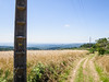
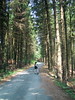
The above images may not be of the site on this page, but were taken nearby. They are loaded from Flickr so please click on them for image credits.
Click here to see more info for this site
Nearby sites
Click here to view sites on an interactive map of the areaKey: Red: member's photo, Blue: 3rd party photo, Yellow: other image, Green: no photo - please go there and take one, Grey: site destroyed
Download sites to:
KML (Google Earth)
GPX (GPS waypoints)
CSV (Garmin/Navman)
CSV (Excel)
To unlock full downloads you need to sign up as a Contributory Member. Otherwise downloads are limited to 50 sites.
Turn off the page maps and other distractions
Nearby sites listing. In the following links * = Image available
51m W 273° Sagne Marty 1 statue menhir* Sculptured Stone
3.9km S 172° Dolmen de la Carelle* Burial Chamber or Dolmen
5.3km NNW 331° Statue-menhir du Vergnas* Sculptured Stone
5.6km N 1° Fontbelle statue-menhir* Sculptured Stone
5.9km E 86° Statue-menhir du Bouscadié* Sculptured Stone
5.9km S 184° Prats menhir* Standing Stone (Menhir)
7.1km NNW 340° Chaos de la Balme* Rock Outcrop
7.3km NNW 339° Le Châpeau de Napoleon (Sidobre)* Rock Outcrop
7.4km NNW 338° Rocher l’Hamburger* Rock Outcrop
7.7km SSE 156° Peyre-Pause* Standing Stone (Menhir)
8.0km NNE 13° Pèira-Florida menhir Standing Stone (Menhir)
8.2km N 351° Le Roc de l'Enclume* Rock Outcrop
8.9km SE 130° Roucan menhir* Standing Stone (Menhir)
8.9km NW 315° Roc de Ruscayrolles Rock Outcrop
9.0km N 3° Montjarié menhir 1* Standing Stone (Menhir)
9.1km N 3° Croix-de-Guior menhir* Sculptured Stone
9.1km SSW 201° Pierre Plantée d'Hautpoul* Standing Stone (Menhir)
9.2km NNW 327° Rocher Tremblant de Lascombes* Rock Outcrop
9.4km WSW 237° Grotte de Lacalm* Cave or Rock Shelter
9.5km N 3° Guior-Haut statue-menhir* Sculptured Stone
9.9km N 351° Menhir de la Maison du Sidobre* Modern Stone Circle etc
10.1km NNW 344° Rocher Tremblant de Sept Faux* Rock Outcrop
10.4km NNE 19° La Vergne menhir Standing Stone (Menhir)
10.6km SE 146° Amalrics Menhir* Standing Stone (Menhir)
10.8km NNE 31° Crouzigues statue-menhir Sculptured Stone
View more nearby sites and additional images


 We would like to know more about this location. Please feel free to add a brief description and any relevant information in your own language.
 Wir möchten mehr über diese Stätte erfahren. Bitte zögern Sie nicht, eine kurze Beschreibung und relevante Informationen in Deutsch hinzuzufügen.
 Nous aimerions en savoir encore un peu sur les lieux. S'il vous plaît n'hesitez pas à ajouter une courte description et tous les renseignements pertinents dans votre propre langue.
 Quisieramos informarnos un poco más de las lugares. No dude en añadir una breve descripción y otros datos relevantes en su propio idioma.