


<< Our Photo Pages >> St. Thomas' Well - Holy Well or Sacred Spring in England in Herefordshire
Submitted by HOLYWELL on Thursday, 03 April 2008 Page Views: 5571
Springs and Holy WellsSite Name: St. Thomas' WellCountry: England County: Herefordshire Type: Holy Well or Sacred Spring
Nearest Village: Llanveynoe
Map Ref: SO28433201
Latitude: 51.981921N Longitude: 3.0435W
Condition:
| 5 | Perfect |
| 4 | Almost Perfect |
| 3 | Reasonable but with some damage |
| 2 | Ruined but still recognisable as an ancient site |
| 1 | Pretty much destroyed, possibly visible as crop marks |
| 0 | No data. |
| -1 | Completely destroyed |
| 5 | Superb |
| 4 | Good |
| 3 | Ordinary |
| 2 | Not Good |
| 1 | Awful |
| 0 | No data. |
| 5 | Can be driven to, probably with disabled access |
| 4 | Short walk on a footpath |
| 3 | Requiring a bit more of a walk |
| 2 | A long walk |
| 1 | In the middle of nowhere, a nightmare to find |
| 0 | No data. |
| 5 | co-ordinates taken by GPS or official recorded co-ordinates |
| 4 | co-ordinates scaled from a detailed map |
| 3 | co-ordinates scaled from a bad map |
| 2 | co-ordinates of the nearest village |
| 1 | co-ordinates of the nearest town |
| 0 | no data |
Internal Links:
External Links:
I have visited· I would like to visit
AJHL visited on 16th Feb 2023 - their rating: Cond: 5 Amb: 5 Access: 4 A beautiful spring with a nice atmosphere. The water was cold and sweet.
geoffstickland have visited here
")
The spring was resorted to for those suffering from rheumatism and weak eyes and was even thought to be a suitable site to bottle. Fortunately this did not happen as the spring head is quite pleasant and is a much visited site. It emerges from under a rock and into small pool.
You may be viewing yesterday's version of this page. To see the most up to date information please register for a free account.
")
Do not use the above information on other web sites or publications without permission of the contributor.
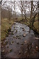
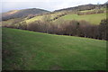
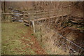
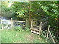
Nearby Images from Geograph Britain and Ireland:
©2009(licence)
©2011(licence)
©2009(licence)
©2012(licence)
©2011(licence)
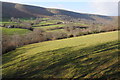
The above images may not be of the site on this page, they are loaded from Geograph.
Please Submit an Image of this site or go out and take one for us!
Click here to see more info for this site
Nearby sites
Key: Red: member's photo, Blue: 3rd party photo, Yellow: other image, Green: no photo - please go there and take one, Grey: site destroyed
Download sites to:
KML (Google Earth)
GPX (GPS waypoints)
CSV (Garmin/Navman)
CSV (Excel)
To unlock full downloads you need to sign up as a Contributory Member. Otherwise downloads are limited to 50 sites.
Turn off the page maps and other distractions
Nearby sites listing. In the following links * = Image available
2.0km ESE 108° Llanveyno Crosses* Ancient Cross (SO3031131361)
2.3km SSE 165° Crucorney Fawr 1 Round Cairn (SO290298)
2.7km SSE 161° Crucorney Fawr 2 Round Cairn (SO293294)
3.6km SSE 156° Wiral Cairn* Cairn (SO2985028710)
4.2km W 262° Darren Esgob* Stone Circle (SO242315)
4.8km W 277° Blaenbwch* Standing Stone (Menhir) (SO23633271)
5.6km NNE 19° Wern Derys* Standing Stone (Menhir) (SO30363726)
6.2km SE 136° Clodock Inscribed Stone* Carving (SO32642751)
6.3km SE 137° St. Clodock's Well* Holy Well or Sacred Spring (SO32692738)
6.6km S 182° Garn Wen (Monmouthshire)* Stone Circle (SO28072545)
7.0km NW 319° Pen Y Beacon* Stone Circle (SO23933735)
7.0km S 183° Llanthony Barrow Cemetery (SO2825)
7.3km SW 232° Maen Llwyd (Powys)* Standing Stone (Menhir) (SO22602762)
7.3km NW 321° Maes-Coch Chambered Cairn (SO239378)
7.5km SSW 208° Nant Yr Ychen Round Cairn* Cairn (SO2476025470)
7.9km NNW 326° Twyn-Y-Beddau* Round Barrow(s) (SO2414838610)
8.7km S 170° St Martin's Church (Cwmyoy)* Ancient Cross (SO29902340)
8.9km SSW 195° Disgwylfa, Cairn I* Cairn (SO2597023440)
9.1km W 277° Wern Frank Wood Cairn Cairn (SO194332)
9.2km WSW 251° Pen Trumau Ring Cairn (SO196292)
9.4km NE 52° Poston Camp Hillfort (SO3598937647)
9.6km S 182° Partrishow Churchyard Cross* Ancient Cross (SO2788822434)
9.6km S 183° Ffynnon Ishow* Holy Well or Sacred Spring (SO2784322428)
9.7km NE 45° Peterchurch St Peter's Well* Holy Well or Sacred Spring (SO35333880)
9.7km SSE 157° Pen-Twyn Hillfort (SO321230)
View more nearby sites and additional images


 We would like to know more about this location. Please feel free to add a brief description and any relevant information in your own language.
 Wir möchten mehr über diese Stätte erfahren. Bitte zögern Sie nicht, eine kurze Beschreibung und relevante Informationen in Deutsch hinzuzufügen.
 Nous aimerions en savoir encore un peu sur les lieux. S'il vous plaît n'hesitez pas à ajouter une courte description et tous les renseignements pertinents dans votre propre langue.
 Quisieramos informarnos un poco más de las lugares. No dude en añadir una breve descripción y otros datos relevantes en su propio idioma.