


<< Our Photo Pages >> Bodysgallen - Hillfort in Wales in Conwy
Submitted by C_Michael_Hogan on Sunday, 16 December 2007 Page Views: 11198
Iron Age and Later PrehistorySite Name: Bodysgallen Alternative Name: Bod CaswallonCountry: Wales County: Conwy Type: Hillfort
Nearest Town: Llandudno Nearest Village: Llanrhos
Map Ref: SH798791
Latitude: 53.295180N Longitude: 3.804895W
Condition:
| 5 | Perfect |
| 4 | Almost Perfect |
| 3 | Reasonable but with some damage |
| 2 | Ruined but still recognisable as an ancient site |
| 1 | Pretty much destroyed, possibly visible as crop marks |
| 0 | No data. |
| -1 | Completely destroyed |
| 5 | Superb |
| 4 | Good |
| 3 | Ordinary |
| 2 | Not Good |
| 1 | Awful |
| 0 | No data. |
| 5 | Can be driven to, probably with disabled access |
| 4 | Short walk on a footpath |
| 3 | Requiring a bit more of a walk |
| 2 | A long walk |
| 1 | In the middle of nowhere, a nightmare to find |
| 0 | No data. |
| 5 | co-ordinates taken by GPS or official recorded co-ordinates |
| 4 | co-ordinates scaled from a detailed map |
| 3 | co-ordinates scaled from a bad map |
| 2 | co-ordinates of the nearest village |
| 1 | co-ordinates of the nearest town |
| 0 | no data |
Internal Links:
External Links:
I have visited· I would like to visit
C_Michael_Hogan has visited here
")
CUNEDDA/CASWALLON DYNASTY. Caswallon-Law-Hir (Brythonic for Caswallon Long Hand) was one of the first Welsh nobles to consolidate local authority after the vacuum of Roman withdrawal from Brittania. Caswallon is credited with defeating the Irish leader Sirigi at Cerrig-y-Gwyddel on Holyhead Island (Archaeological, 1849) after the Irish pirates invaded Anglesey following the absence of Rome's defencive mantle. The Welsh king Cunedda first began campaigns against the Irish two generations earlier.
Caswallon-Law-Hir erected a second palace on Anglesey after his victory over Sirigi. (Nicolas, 1872) Thus ultimately the kingdom of Caswallon encompassed Gwynedd including Anglesey, but Caswallon died at the home he built on Pydew Mountain. The modern name of the site, Bodysgallen, derives from the Gaelic Bod Caswallon, meaning the dwelling place of Caswallon. (Rhys, 1883) (Ward, 1884)
Caswallon-Law-Hir was the grandson of Cunedda, who along with his son fled from sentinel stations on Hadrian's Wall, upon Pictish invasion following the departure of Maximus from Brittania. It was common for auxiliaries or native tribes loyal to the Romans to man the Hadrian's Wall milecastles, watchtowers and even major forts. (Hogan, 2007) Cunedda in turn drove the "Gwyddyl Ffischti'‘ (who had seized power after Roman withdrawal) from northern Wales (Haigh, 1861) and founded the Kingdom of Gwynedd. (Merivale, 1865)
Maelgwn Gwynedd succeeded his father Caswallon-Law-Hir and fortified the nearby valley city of Deganwy into a castle; where he held his court. In earlier times the Welsh preferred combat in open fields, but with more frequent incursions by Saxons, a trend developed to prefer stone to timber for their fortifications. After Maelgwn Gwynedd completed his new palace, he consolidated power and was deemed one of five most powerful kings in Wales in the early and middle sixth century. According to Williams, Maelgwn Gwynedd was chosen as the king of the Britons in 546, succeeding the legendary King Arthur. (Williams, 1835) (The latter assertion is, of course, unclear, since Arthur's true identity and era are under ongoing debate.) In some records Maelgwn Gwynedd is called the King of Deganwy. (Edwards, 1720)
Rhun, grandson of Caswallon-Law-Hir, engaged in a long bloody war with Northumberland Saxons; after successive waves of victories in that distant land, Rhun was eventually driven back to his Gwynedd homeland and slain there. (Hughes, 1832)
TOWER HOUSE. In the 13th century a five storey tower house was constructed nearby to serve as a watchtower and adjunct to the expansive Conwy Castle, which is a World Heritage Site. The complete spiral staircase within the tower is completely in tact and masonry analysis dates that feature to the late 13th century. I found it surprising that the spiral is anti-clockwise (non-defencive), but that underscores the structure's use for sentinel purposes rather than repelling attackers from the tower. A substantial early 17th century manor house has been added to surround the tower house.
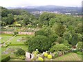
ENVIRONMENT AND SETTING. Caswallon's ruined castle is heavily overgrown since at least 1835 with a thorny understory, so that exploration is difficult and not encouraged. The site was clearly chosen by the fifth century king due to its strategic aspect having commanding views in all directions; the value was further enhanced by luxuriant broadleaf forests that are present even today. Soils on site are fertile and support growth of produce and rich grazing for sheep. The limestone quarry on site had abundant stone to construct the fifth century royal home, the tower house, manor house extension and even Conwy Castle. The site is presently under private ownership, but is fully accessible to guests of the luxury hotel operating from the manor house. Other amenities on site include a 17th century parterre garden, hiking trails, tower views of Conwy Castle and the coast as well as a working flower and vegetable garden with medieval walls.
REFERENCES
* ''The Archaeological Journal'' (1849) by Council, British Archaeological Association, Central Committee
* Thomas Nicholas (1872) ''Annals and Antiquities of the Counties and County Families of Wales'', Longmans, Green, Reader
* "Pennant's Tour in Wales" (1883) ed. Professor Rhys, vol. III
* ''Ward and Lock's (late Shaw's) illustrated guide to and popular history of North Wales''(1884)
By Ward, Lock and co., ltd
* Robert Williams (1835) ''The History and Antiquities of the Town of Aberconwy and it Neighbourhood'', T. Gee, 200 pages
* Edward Edwards (1720) ''Survey of the Cathedral Church of Saint Asaph'‘, vol II. 6.
* C. Michael Hogan (2007) ''Hadrian's Wall'', The Megalithic Portal, ed. Andy Burnham
* Daniel Henry Haigh (1861) ‘'The Conquest of Britain by the Saxons''
* Charles Merivale (1865) ‘' History of the Romans'‘, appended Cambridge Genealogist's Notes
* H. Hughes (1832) ''The Cambrian Quarterly Magazine and Celtic Repertory'‘.
The above content is original work of C. Michael Hogan prepared for the Megalithic Portal.
You may be viewing yesterday's version of this page. To see the most up to date information please register for a free account.
")
")
")
Do not use the above information on other web sites or publications without permission of the contributor.
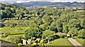
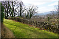
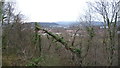
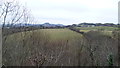
Nearby Images from Geograph Britain and Ireland:
©2014(licence)
©2017(licence)
©2015(licence)
©2015(licence)
©2007(licence)
The above images may not be of the site on this page, they are loaded from Geograph.
Please Submit an Image of this site or go out and take one for us!
Click here to see more info for this site
Nearby sites
Key: Red: member's photo, Blue: 3rd party photo, Yellow: other image, Green: no photo - please go there and take one, Grey: site destroyed
Download sites to:
KML (Google Earth)
GPX (GPS waypoints)
CSV (Garmin/Navman)
CSV (Excel)
To unlock full downloads you need to sign up as a Contributory Member. Otherwise downloads are limited to 50 sites.
Turn off the page maps and other distractions
Nearby sites listing. In the following links * = Image available
1.3km NNW 338° Llanrhos church Inscribed Stone Early Christian Sculptured Stone (SH79338032)
1.3km NNW 332° Ffynnon Santes Fair Holy Well or Sacred Spring (SH792803)
1.6km WNW 281° Deganwy Castle* Ancient Village or Settlement (SH7822579455)
1.8km N 5° Coed Gaer Hut Circle* Ancient Village or Settlement (SH80028092)
2.5km N 2° Ogof Tan-Y-Bryn Cave or Rock Shelter (SH79948160)
2.7km NNE 20° Ogof Pant-Y-Wennol Cave Cave or Rock Shelter (SH80818161)
3.5km ENE 77° Bryn Euryn* Hillfort (SH832798)
3.8km NNW 330° Llandudno Museum* Museum (SH78008240)
4.0km NNE 24° Ogof Rhiwleden Cave or Rock Shelter (SH81538269)
4.0km WSW 250° Conway Mountain* Hillfort (SH760778)
4.1km NNW 333° Lower Kendrick's Cave Cave or Rock Shelter (SH780828)
4.1km NNW 333° Upper Kendrick's Cave* Cave or Rock Shelter (SH7798182821)
4.2km NNW 332° St Tudno's Cradle* Natural Stone / Erratic / Other Natural Feature (SH779829)
4.3km NNW 336° Llandudno Eisteddfod Circle* Modern Stone Circle etc (SH7816883048)
4.3km NNW 333° Pen-y-Dinas (Conwy)* Hillfort (SH779830)
4.4km S 185° Hendre Waelod* Burial Chamber or Dolmen (SH79297474)
4.6km NW 325° Lletty'r Filiast* Burial Chamber or Dolmen (SH7721382950)
4.6km NNW 333° Great Orme Lost Chamber* Burial Chamber or Dolmen (SH778833)
4.7km NW 323° Great Orme barrow* Round Barrow(s) (SH771829)
4.8km ENE 63° St Trillo's Holy Well & Chapel* Holy Well or Sacred Spring (SH84138113)
4.8km NW 324° Great Orme Mine* Ancient Mine, Quarry or other Industry (SH7707683100)
5.2km NW 326° Brynia Poethion Ancient Village or Settlement (SH76998343)
5.2km NW 319° Bishop's Quarries Hut Circle Ancient Village or Settlement (SH76498311)
5.4km NNW 328° St Tudno's Well* Holy Well or Sacred Spring (SH77068378)
5.6km WSW 250° Alltwen Hillfort* Hillfort (SH745773)
View more nearby sites and additional images


 We would like to know more about this location. Please feel free to add a brief description and any relevant information in your own language.
 Wir möchten mehr über diese Stätte erfahren. Bitte zögern Sie nicht, eine kurze Beschreibung und relevante Informationen in Deutsch hinzuzufügen.
 Nous aimerions en savoir encore un peu sur les lieux. S'il vous plaît n'hesitez pas à ajouter une courte description et tous les renseignements pertinents dans votre propre langue.
 Quisieramos informarnos un poco más de las lugares. No dude en añadir una breve descripción y otros datos relevantes en su propio idioma.