

<< Our Photo Pages >> Saint-Chamassy Dolmen - Burial Chamber or Dolmen in France in Aquitaine:Dordogne (24)
Submitted by ocdolmen on Thursday, 27 August 2009 Page Views: 7033
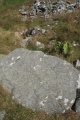
Neolithic and Bronze AgeSite Name: Saint-Chamassy Dolmen Alternative Name: Dolmen de Cantegrel, Roc del CayreCountry: France Département: Aquitaine:Dordogne (24) Type: Burial Chamber or Dolmen
Nearest Town: Buisson-de-Cadouin Nearest Village: Saint-Chamassy
Latitude: 44.860700N Longitude: 0.919320E
Condition:
| 5 | Perfect |
| 4 | Almost Perfect |
| 3 | Reasonable but with some damage |
| 2 | Ruined but still recognisable as an ancient site |
| 1 | Pretty much destroyed, possibly visible as crop marks |
| 0 | No data. |
| -1 | Completely destroyed |
| 5 | Superb |
| 4 | Good |
| 3 | Ordinary |
| 2 | Not Good |
| 1 | Awful |
| 0 | No data. |
| 5 | Can be driven to, probably with disabled access |
| 4 | Short walk on a footpath |
| 3 | Requiring a bit more of a walk |
| 2 | A long walk |
| 1 | In the middle of nowhere, a nightmare to find |
| 0 | No data. |
| 5 | co-ordinates taken by GPS or official recorded co-ordinates |
| 4 | co-ordinates scaled from a detailed map |
| 3 | co-ordinates scaled from a bad map |
| 2 | co-ordinates of the nearest village |
| 1 | co-ordinates of the nearest town |
| 0 | no data |
Internal Links:
External Links:
I have visited· I would like to visit
johnstone visited on 22nd Jun 2015 - their rating: Cond: 4 Amb: 4 Access: 4
alchemille have visited here
")
Megalith situated in a wood along a dead end foothpath at the south of Saint-Chamassy village.
Marked on french IGN map.
Base Mérimée (Historic Monument)
You may be viewing yesterday's version of this page. To see the most up to date information please register for a free account.
")
")
")
")
")
")
")
Do not use the above information on other web sites or publications without permission of the contributor.
Click here to see more info for this site
Nearby sites
Click here to view sites on an interactive map of the areaKey: Red: member's photo, Blue: 3rd party photo, Yellow: other image, Green: no photo - please go there and take one, Grey: site destroyed
Download sites to:
KML (Google Earth)
GPX (GPS waypoints)
CSV (Garmin/Navman)
CSV (Excel)
To unlock full downloads you need to sign up as a Contributory Member. Otherwise downloads are limited to 50 sites.
Turn off the page maps and other distractions
Nearby sites listing. In the following links * = Image available
3.4km NW 317° Gisement de Limeuil Cave or Rock Shelter
3.7km S 182° Dolmen Le Cayre* Burial Chamber or Dolmen
5.4km NNW 334° Limeuil Jardin Musée Cave or Rock Shelter
5.5km WSW 241° Grotte de Cussac* Cave or Rock Shelter
5.5km NNW 341° Dolmen Queyre-Levat* Burial Chamber or Dolmen
5.9km NW 321° Dolmen des Fontenelles* Burial Chamber or Dolmen
6.6km NE 40° Campagne menhir* Standing Stone (Menhir)
6.7km NE 36° Grotte du Roc de Marsal* Cave or Rock Shelter
7.0km N 2° Grotte de Bara-Bahau* Cave or Rock Shelter
7.7km ENE 72° Polissoirs du Bousquet* Polissoir
7.7km SE 145° Cayra Levada* Burial Chamber or Dolmen
8.2km NNE 27° Grotte du Sorcier* Cave or Rock Shelter
8.3km N 360° Menhir de Ladouch* Natural Stone / Erratic / Other Natural Feature
8.4km SSE 150° Bonarme Dolmen* Burial Chamber or Dolmen
8.7km SSE 153° Bonarme polissoirs* Polissoir
9.3km NE 49° La Combe cave* Cave or Rock Shelter
9.9km WSW 244° Sigoniac Ancient Village or Settlement
10.3km N 8° Abri de la Ferrassie* Cave or Rock Shelter
10.7km NE 48° Grotte de la Mouthe* Cave or Rock Shelter
11.1km NE 35° Grotte de l'Oreille d'Enfer* Cave or Rock Shelter
11.1km NE 34° Abri de Lartet* Cave or Rock Shelter
11.1km NE 34° Abri du Poisson* Cave or Rock Shelter
11.2km NE 43° Grotte de la Croze* Cave or Rock Shelter
11.2km NE 43° Grotte d'Abzac Cave or Rock Shelter
11.2km NE 42° Musée National de Préhistoire* Museum
View more nearby sites and additional images


 We would like to know more about this location. Please feel free to add a brief description and any relevant information in your own language.
 Wir möchten mehr über diese Stätte erfahren. Bitte zögern Sie nicht, eine kurze Beschreibung und relevante Informationen in Deutsch hinzuzufügen.
 Nous aimerions en savoir encore un peu sur les lieux. S'il vous plaît n'hesitez pas à ajouter une courte description et tous les renseignements pertinents dans votre propre langue.
 Quisieramos informarnos un poco más de las lugares. No dude en añadir una breve descripción y otros datos relevantes en su propio idioma.