


<< Our Photo Pages >> Allée couverte de la Bellée - Passage Grave in France in Picardie:Oise (60)
Submitted by binardino on Thursday, 10 February 2005 Page Views: 5393
Neolithic and Bronze AgeSite Name: Allée couverte de la Bellée Alternative Name: Bois de la BelléeCountry: France Département: Picardie:Oise (60) Type: Passage Grave
Nearest Town: Gisors Nearest Village: Boury-en-Vexin
Latitude: 49.248300N Longitude: 1.761600E
Condition:
| 5 | Perfect |
| 4 | Almost Perfect |
| 3 | Reasonable but with some damage |
| 2 | Ruined but still recognisable as an ancient site |
| 1 | Pretty much destroyed, possibly visible as crop marks |
| 0 | No data. |
| -1 | Completely destroyed |
| 5 | Superb |
| 4 | Good |
| 3 | Ordinary |
| 2 | Not Good |
| 1 | Awful |
| 0 | No data. |
| 5 | Can be driven to, probably with disabled access |
| 4 | Short walk on a footpath |
| 3 | Requiring a bit more of a walk |
| 2 | A long walk |
| 1 | In the middle of nowhere, a nightmare to find |
| 0 | No data. |
| 5 | co-ordinates taken by GPS or official recorded co-ordinates |
| 4 | co-ordinates scaled from a detailed map |
| 3 | co-ordinates scaled from a bad map |
| 2 | co-ordinates of the nearest village |
| 1 | co-ordinates of the nearest town |
| 0 | no data |
Internal Links:
External Links:
I have visited· I would like to visit
SolarMegalith rrmoser would like to visit
")
Located in a private hunting wood, this passage grave is wonderful, especially the death divinity on the right stone of the entrance. Wonderful, you have an entrance hole and a capstone over the entrance the rest of capstones have disapeared. around 10 meters long and 1,5 wide.
Note: Positional co-ordinates scaled from a detailed map source.
You may be viewing yesterday's version of this page. To see the most up to date information please register for a free account.
")
")
")
")
Do not use the above information on other web sites or publications without permission of the contributor.
Nearby Images from Flickr
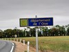
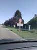
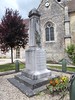
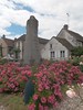
The above images may not be of the site on this page, but were taken nearby. They are loaded from Flickr so please click on them for image credits.
Click here to see more info for this site
Nearby sites
Click here to view sites on an interactive map of the areaKey: Red: member's photo, Blue: 3rd party photo, Yellow: other image, Green: no photo - please go there and take one, Grey: site destroyed
Download sites to:
KML (Google Earth)
GPX (GPS waypoints)
CSV (Garmin/Navman)
CSV (Excel)
To unlock full downloads you need to sign up as a Contributory Member. Otherwise downloads are limited to 50 sites.
Turn off the page maps and other distractions
Nearby sites listing. In the following links * = Image available
241m SSW 194° Menhir de la Bellée Standing Stone (Menhir)
3.0km S 182° Allée Couverte de Vaudancourt Passage Grave
3.3km NNW 337° Croix Percée* Ancient Cross
3.7km WSW 243° Pierres Tournantes Standing Stones
4.1km ENE 64° Chambors Menhir* Standing Stone (Menhir)
6.0km ENE 63° Trie-Chateau dolmen* Passage Grave
6.2km ENE 64° Trie-Château Menhir* Standing Stone (Menhir)
6.8km E 81° Menhir dit la Pierre Droite (Delincourt)* Standing Stone (Menhir)
8.0km SW 227° Allée Couverte du Fayel Passage Grave
8.1km SE 126° Menhir du Fayel* Standing Stone (Menhir)
11.0km SSW 211° Vielle Cote Dolmen* Passage Grave
11.5km SW 225° Allée Couverte de Dampsmesnil* Passage Grave
11.9km SE 146° Les Luats Passage Grave
13.2km NNE 17° Menhir dit la Borne du Bois Madame* Standing Stone (Menhir)
14.1km NNE 19° Allée couverte du Bois de Champignolle* Passage Grave
15.7km ESE 115° Pierre Frite de Lavilletertre* Standing Stone (Menhir)
15.7km SSE 158° Bois Couturier Allée couverte* Passage Grave
15.8km SW 224° Bus-St-Remy burial chamber Burial Chamber or Dolmen
15.9km SSE 154° Menhir dit la Croisette* Standing Stone (Menhir)
16.8km SSE 157° La Ferme Duport Passage Grave
16.8km SSE 158° Musée Archéologique Du Val-D'Oise* Museum
17.2km WNW 289° La Londe Tumulus Chambered Tomb
18.0km SSE 160° Menhir dit la Pierre Droite (Gadancourt)* Standing Stone (Menhir)
18.2km SSW 203° Allée couverte de Bézu Passage Grave
18.7km SSE 157° Polissoir de St Martin* Polissoir
View more nearby sites and additional images


 We would like to know more about this location. Please feel free to add a brief description and any relevant information in your own language.
 Wir möchten mehr über diese Stätte erfahren. Bitte zögern Sie nicht, eine kurze Beschreibung und relevante Informationen in Deutsch hinzuzufügen.
 Nous aimerions en savoir encore un peu sur les lieux. S'il vous plaît n'hesitez pas à ajouter une courte description et tous les renseignements pertinents dans votre propre langue.
 Quisieramos informarnos un poco más de las lugares. No dude en añadir una breve descripción y otros datos relevantes en su propio idioma.