


<< Our Photo Pages >> King Charles's Well - Holy Well or Sacred Spring in England in Leicestershire and Rutland
Submitted by enkidu41 on Tuesday, 31 August 2004 Page Views: 7587
Springs and Holy WellsSite Name: King Charles's Well Alternative Name: Carles TroughCountry: England County: Leicestershire and Rutland Type: Holy Well or Sacred Spring
Nearest Town: Market Harborough Nearest Village: Tur Langton
Map Ref: SP722949
Latitude: 52.547172N Longitude: 0.936713W
Condition:
| 5 | Perfect |
| 4 | Almost Perfect |
| 3 | Reasonable but with some damage |
| 2 | Ruined but still recognisable as an ancient site |
| 1 | Pretty much destroyed, possibly visible as crop marks |
| 0 | No data. |
| -1 | Completely destroyed |
| 5 | Superb |
| 4 | Good |
| 3 | Ordinary |
| 2 | Not Good |
| 1 | Awful |
| 0 | No data. |
| 5 | Can be driven to, probably with disabled access |
| 4 | Short walk on a footpath |
| 3 | Requiring a bit more of a walk |
| 2 | A long walk |
| 1 | In the middle of nowhere, a nightmare to find |
| 0 | No data. |
| 5 | co-ordinates taken by GPS or official recorded co-ordinates |
| 4 | co-ordinates scaled from a detailed map |
| 3 | co-ordinates scaled from a bad map |
| 2 | co-ordinates of the nearest village |
| 1 | co-ordinates of the nearest town |
| 0 | no data |
Be the first person to rate this site - see the 'Contribute!' box in the right hand menu.
Internal Links:
External Links:
I have visited· I would like to visit
ChristopherJones visited on 15th Dec 2019 - their rating: Cond: 4 Amb: 4 Access: 3
")
King Charles's Well at Tur Langton was named after Charles I who reputedly stopped there to drink on his campaigns.
The well was the only source of water in the area and did not dry in the 1976 drought. The present structure dates to 1813.
Based on the description by, and used by kind permission of, Bob Trubshaw, from his Interactive Little-known Leicestershire and Rutland CD-ROM.
You may be viewing yesterday's version of this page. To see the most up to date information please register for a free account.
")
")
")
")
Do not use the above information on other web sites or publications without permission of the contributor.
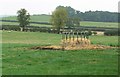
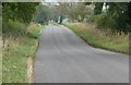
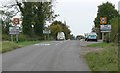
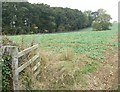
Nearby Images from Geograph Britain and Ireland:
©2007(licence)
©2007(licence)

©2006(licence)
©2007(licence)
©2007(licence)
The above images may not be of the site on this page, they are loaded from Geograph.
Please Submit an Image of this site or go out and take one for us!
Click here to see more info for this site
Nearby sites
Key: Red: member's photo, Blue: 3rd party photo, Yellow: other image, Green: no photo - please go there and take one, Grey: site destroyed
Download sites to:
KML (Google Earth)
GPX (GPS waypoints)
CSV (Garmin/Navman)
CSV (Excel)
To unlock full downloads you need to sign up as a Contributory Member. Otherwise downloads are limited to 50 sites.
Turn off the page maps and other distractions
Nearby sites listing. In the following links * = Image available
1.2km SSW 205° St. Ann's Well* Holy Well or Sacred Spring (SP717938)
4.1km W 265° The Munt* Artificial Mound (SP6807294487)
4.6km NNW 342° St Michael's Church (Illston On The Hill)* Ancient Cross (SP7066899287)
5.6km NNE 12° St John The Baptist (Rolleston)* Ancient Cross (SK7326200402)
6.5km NNW 330° King's Norton* Holy Well or Sacred Spring (SK6890100495)
7.7km S 172° Harborough Museum* Museum (SP7342087285)
7.7km SSE 167° Peter's Pence Stone* Standing Stone (Menhir) (SP740874)
7.9km N 359° Billesdon Cross* Ancient Cross (SK7191302822)
9.0km S 187° Judith's Stone.* Marker Stone (SP7120786000)
9.7km SW 223° Mowsley Stone* Standing Stone (Menhir) (SP657877)
11.1km NNW 342° Ingarsby* Standing Stone (Menhir) (SK6857805373)
12.9km E 98° Great Easton Roman Well* Holy Well or Sacred Spring (SP850933)
14.6km NNW 337° Beeby Holy Well* Holy Well or Sacred Spring (SK664083)
14.6km ENE 59° Ridlington settlement Misc. Earthwork (SK846027)
14.8km NNW 336° Beeby Henge (SK660083)
15.0km SW 214° Husbands Bosworth Causewayed Enclosure* Causewayed Enclosure (SP64018235)
15.6km NW 322° The Humber Stone* Standing Stone (Menhir) (SK6241607095)
16.1km NE 44° The Braunston Goddess* Sculptured Stone (SK8324606581)
16.7km WNW 288° The Wethers* Standing Stones (SP56149972)
16.9km NW 305° Jewry Wall Museum Museum (SK582045)
17.2km NW 308° St. Margaret's Church* Holy Well or Sacred Spring (SK584052)
17.3km ESE 108° Parliament Stone* Natural Stone / Erratic / Other Natural Feature (SP888898)
17.4km NNE 14° Burrough-on-the-hill* Hillfort (SK761119)
17.7km NNW 337° Mowde Bush Stone* Standing Stone (Menhir) (SK649110)
17.7km SW 236° Misterton and Walcote Cursus Cursus (SP576848)
View more nearby sites and additional images


 We would like to know more about this location. Please feel free to add a brief description and any relevant information in your own language.
 Wir möchten mehr über diese Stätte erfahren. Bitte zögern Sie nicht, eine kurze Beschreibung und relevante Informationen in Deutsch hinzuzufügen.
 Nous aimerions en savoir encore un peu sur les lieux. S'il vous plaît n'hesitez pas à ajouter une courte description et tous les renseignements pertinents dans votre propre langue.
 Quisieramos informarnos un poco más de las lugares. No dude en añadir una breve descripción y otros datos relevantes en su propio idioma.