


<< Other Photo Pages >> Liechtensteinisches Landesmuseum - Museum in Liechtenstein
Submitted by Harald_Platta on Sunday, 24 November 2019 Page Views: 1201
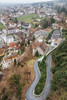
MuseumsSite Name: Liechtensteinisches Landesmuseum Alternative Name: Liechtenstein National MuseumCountry: Liechtenstein
NOTE: This site is 0.14 km away from the location you searched for.
Type: Museum
Nearest Town: Vaduz
Latitude: 47.138670N Longitude: 9.522690E
Condition:
| 5 | Perfect |
| 4 | Almost Perfect |
| 3 | Reasonable but with some damage |
| 2 | Ruined but still recognisable as an ancient site |
| 1 | Pretty much destroyed, possibly visible as crop marks |
| 0 | No data. |
| -1 | Completely destroyed |
| 5 | Superb |
| 4 | Good |
| 3 | Ordinary |
| 2 | Not Good |
| 1 | Awful |
| 0 | No data. |
| 5 | Can be driven to, probably with disabled access |
| 4 | Short walk on a footpath |
| 3 | Requiring a bit more of a walk |
| 2 | A long walk |
| 1 | In the middle of nowhere, a nightmare to find |
| 0 | No data. |
| 5 | co-ordinates taken by GPS or official recorded co-ordinates |
| 4 | co-ordinates scaled from a detailed map |
| 3 | co-ordinates scaled from a bad map |
| 2 | co-ordinates of the nearest village |
| 1 | co-ordinates of the nearest town |
| 0 | no data |
Be the first person to rate this site - see the 'Contribute!' box in the right hand menu.
Internal Links:
External Links:
")
Museum Homepage: Liechtensteinisches Landesmuseum.
You may be viewing yesterday's version of this page. To see the most up to date information please register for a free account.
Do not use the above information on other web sites or publications without permission of the contributor.
Nearby Images from Flickr
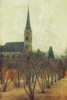
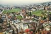
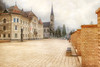
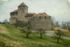

The above images may not be of the site on this page, but were taken nearby. They are loaded from Flickr so please click on them for image credits.
Click here to see more info for this site
Nearby sites
Click here to view sites on an interactive map of the areaKey: Red: member's photo, Blue: 3rd party photo, Yellow: other image, Green: no photo - please go there and take one, Grey: site destroyed
Download sites to:
KML (Google Earth)
GPX (GPS waypoints)
CSV (Garmin/Navman)
CSV (Excel)
To unlock full downloads you need to sign up as a Contributory Member. Otherwise downloads are limited to 50 sites.
Turn off the page maps and other distractions
Nearby sites listing. In the following links * = Image available
1.6km N 0° Summstein Vaduz Modern Stone Circle etc
3.5km S 169° Triesen Prehistoric Settlements Ancient Village or Settlement
8.3km SSW 192° Gutenberg Prehistoric Settlements* Ancient Village or Settlement
8.5km N 9° Opferplatz von Mauren Holy Well or Sacred Spring
11.1km NNE 14° Borscht Prehistoric Settlements* Ancient Village or Settlement
11.3km SW 217° Oberprod Schalenstein Rock Art
17.5km E 83° Tschengla* Modern Stone Circle etc
21.7km WSW 253° Seebenalp Hinkelstein * Standing Stone (Menhir)
21.9km S 177° Untervaz Druidenstein Rock Art
22.7km NNE 24° Kultstein Kirche St. Arbogast* Holed Stone
32.3km S 179° Präz Lepontische Stele Sculptured Stone
32.3km S 179° Urmein Schalensteine* Rock Art
32.3km S 179° Rätisches Museum Museum
32.3km S 179° Mesocco-Benabbia Lepontische Stele* Sculptured Stone
32.3km S 179° Sietschen Lepontische Stele* Sculptured Stone
32.3km S 179° Stabio Lepontische Stelen Sculptured Stone
32.3km S 179° Davesco-Soragno Lepontische Stelen* Sculptured Stone
32.7km N 4° Rasplen Chindlistein* Rock Art
33.1km N 4° Holed Stone / Schalenstein Unter-Altenstein* Holed Stone
33.3km N 5° Holed Stone / Schalenstein Strich* Holed Stone
33.7km WNW 294° Summstein Eich Modern Stone Circle etc
41.3km WNW 285° Ernetschwil Schalenstein Rock Art
42.3km N 351° Fussstein* Rock Art
43.5km SSW 210° Falera Menhirfeld* Stone Row / Alignment
43.6km SSW 210° Falera Vorgeschichtliche Siedlung* Ancient Village or Settlement
View more nearby sites and additional images


 We would like to know more about this location. Please feel free to add a brief description and any relevant information in your own language.
 Wir möchten mehr über diese Stätte erfahren. Bitte zögern Sie nicht, eine kurze Beschreibung und relevante Informationen in Deutsch hinzuzufügen.
 Nous aimerions en savoir encore un peu sur les lieux. S'il vous plaît n'hesitez pas à ajouter une courte description et tous les renseignements pertinents dans votre propre langue.
 Quisieramos informarnos un poco más de las lugares. No dude en añadir una breve descripción y otros datos relevantes en su propio idioma.