


<< Text Pages >> Gelbhart Grabhügelgruppe - Barrow Cemetery in Germany in Baden-Wuerttemberg
Submitted by AlexHunger on Tuesday, 13 September 2005 Page Views: 2138
Neolithic and Bronze AgeSite Name: Gelbhart GrabhügelgruppeCountry: Germany
NOTE: This site is 2.737 km away from the location you searched for.
Land: Baden-Wuerttemberg Type: Barrow Cemetery
Nearest Village: Wilhelmsdorf - Esenhausen
Latitude: 47.889290N Longitude: 9.439070E
Condition:
| 5 | Perfect |
| 4 | Almost Perfect |
| 3 | Reasonable but with some damage |
| 2 | Ruined but still recognisable as an ancient site |
| 1 | Pretty much destroyed, possibly visible as crop marks |
| 0 | No data. |
| -1 | Completely destroyed |
| 5 | Superb |
| 4 | Good |
| 3 | Ordinary |
| 2 | Not Good |
| 1 | Awful |
| 0 | No data. |
| 5 | Can be driven to, probably with disabled access |
| 4 | Short walk on a footpath |
| 3 | Requiring a bit more of a walk |
| 2 | A long walk |
| 1 | In the middle of nowhere, a nightmare to find |
| 0 | No data. |
| 5 | co-ordinates taken by GPS or official recorded co-ordinates |
| 4 | co-ordinates scaled from a detailed map |
| 3 | co-ordinates scaled from a bad map |
| 2 | co-ordinates of the nearest village |
| 1 | co-ordinates of the nearest town |
| 0 | no data |
Be the first person to rate this site - see the 'Contribute!' box in the right hand menu.
Internal Links:
External Links:
Tumuli in Baden-Württemberg
IMPORTANT NOTE: Site believed to be near this position. Group of Iron age tumuli up to 3 Meters tall.
You may be viewing yesterday's version of this page. To see the most up to date information please register for a free account.
Do not use the above information on other web sites or publications without permission of the contributor.
Nearby Images from Flickr
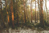
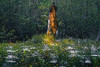
The above images may not be of the site on this page, but were taken nearby. They are loaded from Flickr so please click on them for image credits.
Click here to see more info for this site
Nearby sites
Click here to view sites on an interactive map of the areaKey: Red: member's photo, Blue: 3rd party photo, Yellow: other image, Green: no photo - please go there and take one, Grey: site destroyed
Download sites to:
KML (Google Earth)
GPX (GPS waypoints)
CSV (Garmin/Navman)
CSV (Excel)
To unlock full downloads you need to sign up as a Contributory Member. Otherwise downloads are limited to 50 sites.
Turn off the page maps and other distractions
Nearby sites listing. In the following links * = Image available
5.3km SW 231° Illmensee Seeufersiedlung Ancient Village or Settlement
5.3km SW 231° Sigmarinen Schloss Museum Museum
9.7km E 90° Schreckensee Ancient Village or Settlement
15.0km SE 130° Dickenwald Grabhügelgruppe Barrow Cemetery
16.3km NNE 29° Schelmberg Wald Keltische Viereckschanze Ancient Village or Settlement
16.3km SW 219° Salem Grabhügelgruppe Barrow Cemetery
17.1km SSW 211° Monolith Leutkirch Natural Stone / Erratic / Other Natural Feature
17.2km E 99° Baindt Viereckschanze Ancient Village or Settlement
17.2km E 98° Hartwald Grabhügelgruppe Barrow Cemetery
18.6km W 272° Gertholz Wald Keltische Viereckschanze Ancient Village or Settlement
20.2km SE 129° Haslachwald Grabhügelgruppe Barrow Cemetery
20.6km N 357° Bettelbühl Round Barrow(s)
20.7km NNW 339° Mengen-Ennetach Grabhügel Artificial Mound
21.0km NNW 339° Mengen-Ennetach Keltische Viereckschanze Ancient Village or Settlement
21.3km N 353° Lehenbühl Grabhügel Artificial Mound
21.3km N 352° Heunenburg Museum Museum
22.1km N 354° Baumburg Artificial Mound
22.2km ENE 57° Olzreute-Enzisholz Ancient Village or Settlement
22.9km N 355° Heunenburg* Hillfort
23.1km N 350° Hohmichele Grabhügel* Artificial Mound
23.3km SW 223° Seefelden Monolith Natural Stone / Erratic / Other Natural Feature
23.6km N 354° Giessübel-Talhau Grabhügelgruppe* Artificial Mound
23.7km NE 39° Siedlung Forschner Ancient Village or Settlement
23.8km NNE 32° Bad Buchau Museum* Museum
24.0km SW 221° Unteruhldingen Crannog* Crannog
View more nearby sites and additional images


 We would like to know more about this location. Please feel free to add a brief description and any relevant information in your own language.
 Wir möchten mehr über diese Stätte erfahren. Bitte zögern Sie nicht, eine kurze Beschreibung und relevante Informationen in Deutsch hinzuzufügen.
 Nous aimerions en savoir encore un peu sur les lieux. S'il vous plaît n'hesitez pas à ajouter une courte description et tous les renseignements pertinents dans votre propre langue.
 Quisieramos informarnos un poco más de las lugares. No dude en añadir una breve descripción y otros datos relevantes en su propio idioma.