


<< Text Pages >> Sasso della Predescia - Rock Art in Switzerland in Tessin
Submitted by AlexHunger on Saturday, 18 February 2006 Page Views: 8379
Rock ArtSite Name: Sasso della PredesciaCountry: Switzerland
NOTE: This site is 27.736 km away from the location you searched for.
Canton: Tessin Type: Rock Art
Nearest Town: Lugano Nearest Village: Gandria
Latitude: 46.003520N Longitude: 8.991370E
Condition:
| 5 | Perfect |
| 4 | Almost Perfect |
| 3 | Reasonable but with some damage |
| 2 | Ruined but still recognisable as an ancient site |
| 1 | Pretty much destroyed, possibly visible as crop marks |
| 0 | No data. |
| -1 | Completely destroyed |
| 5 | Superb |
| 4 | Good |
| 3 | Ordinary |
| 2 | Not Good |
| 1 | Awful |
| 0 | No data. |
| 5 | Can be driven to, probably with disabled access |
| 4 | Short walk on a footpath |
| 3 | Requiring a bit more of a walk |
| 2 | A long walk |
| 1 | In the middle of nowhere, a nightmare to find |
| 0 | No data. |
| 5 | co-ordinates taken by GPS or official recorded co-ordinates |
| 4 | co-ordinates scaled from a detailed map |
| 3 | co-ordinates scaled from a bad map |
| 2 | co-ordinates of the nearest village |
| 1 | co-ordinates of the nearest town |
| 0 | no data |
Internal Links:
External Links:
Cuphole stone in Tessin
Large cliff on lake Lugano with 82 cup hole stones and other markings along Percorso Didattico scenic path, along with at least 6 other cup hole stones.
You may be viewing yesterday's version of this page. To see the most up to date information please register for a free account.
Do not use the above information on other web sites or publications without permission of the contributor.
Nearby Images from Flickr
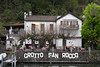
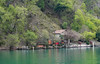
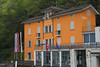
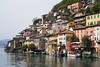
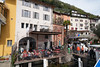
The above images may not be of the site on this page, but were taken nearby. They are loaded from Flickr so please click on them for image credits.
Click here to see more info for this site
Nearby sites
Click here to view sites on an interactive map of the areaKey: Red: member's photo, Blue: 3rd party photo, Yellow: other image, Green: no photo - please go there and take one, Grey: site destroyed
Download sites to:
KML (Google Earth)
GPX (GPS waypoints)
CSV (Garmin/Navman)
CSV (Excel)
To unlock full downloads you need to sign up as a Contributory Member. Otherwise downloads are limited to 50 sites.
Turn off the page maps and other distractions
Nearby sites listing. In the following links * = Image available
2.7km NNW 337° Pregassona Lepontische Stele Sculptured Stone
2.8km SSW 199° Pugerna Schalenstein* Rock Art
5.5km N 355° Dino Lepontische Stele Sculptured Stone
6.7km W 280° Bioggio Lepontische Stelen* Sculptured Stone
6.9km NW 318° San Zenone Schalenstein* Rock Art
7.2km NNW 334° Ponte Capriasca Lepontische Stele Sculptured Stone
9.5km W 280° Aranno Lepontische Stelen* Sculptured Stone
10.8km NNW 329° Mezzovico-Vira Lepontische Stele* Sculptured Stone
11.0km W 273° Novaggio Lepontische Inschrift* Sculptured Stone
11.0km W 274° Bedigliora (Banco) Lepontische Stele Sculptured Stone
11.7km W 272° Bedigliora Capèla dala Barèla* Rock Art
11.9km SSW 211° The Ceresio Valley Natural Stone / Erratic / Other Natural Feature
15.6km WNW 300° Masso di Piero* Carving
16.6km SSW 195° Stabio Lepontische Stelen Sculptured Stone
17.0km W 261° Pineta Alta carved stone* Carving
18.9km NNW 327° Ragno massi cuppellari* Rock Art
19.3km NW 323° Vira Gambarogno Lepontische Stele* Sculptured Stone
21.1km SSW 204° Velmaio* Rock Art
23.1km SSE 166° Roccione di Prestino Rock Art
23.8km NW 320° Mezzovico-Vira Lepontische Stelen Sculptured Stone
23.9km S 170° Cerchio di Como Stone Circle
24.8km NW 316° Losone Schalenstein Rock Art
24.8km NNW 329° Sass di Cent Cros Rock Art
25.0km NW 319° Locarno Schalenstein Rock Art
28.4km N 4° Claro sito preistorico Standing Stone (Menhir)
View more nearby sites and additional images


 We would like to know more about this location. Please feel free to add a brief description and any relevant information in your own language.
 Wir möchten mehr über diese Stätte erfahren. Bitte zögern Sie nicht, eine kurze Beschreibung und relevante Informationen in Deutsch hinzuzufügen.
 Nous aimerions en savoir encore un peu sur les lieux. S'il vous plaît n'hesitez pas à ajouter une courte description et tous les renseignements pertinents dans votre propre langue.
 Quisieramos informarnos un poco más de las lugares. No dude en añadir una breve descripción y otros datos relevantes en su propio idioma.