


<< Text Pages >> Summstein Eich - Modern Stone Circle etc in Switzerland in St.Gallen
Submitted by Harald_Platta on Tuesday, 19 December 2017 Page Views: 931
Modern SitesSite Name: Summstein EichCountry: Switzerland
NOTE: This site is 19.846 km away from the location you searched for.
Canton: St.Gallen Type: Modern Stone Circle etc
Nearest Town: Ebnat-Kappel
Latitude: 47.259210N Longitude: 9.113996E
Condition:
| 5 | Perfect |
| 4 | Almost Perfect |
| 3 | Reasonable but with some damage |
| 2 | Ruined but still recognisable as an ancient site |
| 1 | Pretty much destroyed, possibly visible as crop marks |
| 0 | No data. |
| -1 | Completely destroyed |
| 5 | Superb |
| 4 | Good |
| 3 | Ordinary |
| 2 | Not Good |
| 1 | Awful |
| 0 | No data. |
| 5 | Can be driven to, probably with disabled access |
| 4 | Short walk on a footpath |
| 3 | Requiring a bit more of a walk |
| 2 | A long walk |
| 1 | In the middle of nowhere, a nightmare to find |
| 0 | No data. |
| 5 | co-ordinates taken by GPS or official recorded co-ordinates |
| 4 | co-ordinates scaled from a detailed map |
| 3 | co-ordinates scaled from a bad map |
| 2 | co-ordinates of the nearest village |
| 1 | co-ordinates of the nearest town |
| 0 | no data |
Be the first person to rate this site - see the 'Contribute!' box in the right hand menu.
Internal Links:
External Links:
The Summstein ("Humming Stone") is a modern stone sculpture situated in Ebnat-Kappel (St. Gallen/Switzerland).
Further information and literature on Summsteine in general: MP page Großer Summstein.
Reference:
[01] Verkehrsverein ebnat-Kappel: Sinnepark Eich.
You may be viewing yesterday's version of this page. To see the most up to date information please register for a free account.
Do not use the above information on other web sites or publications without permission of the contributor.
Nearby Images from Flickr
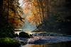
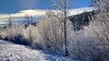
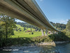
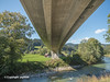
The above images may not be of the site on this page, but were taken nearby. They are loaded from Flickr so please click on them for image credits.
Click here to see more info for this site
Nearby sites
Click here to view sites on an interactive map of the areaKey: Red: member's photo, Blue: 3rd party photo, Yellow: other image, Green: no photo - please go there and take one, Grey: site destroyed
Download sites to:
KML (Google Earth)
GPX (GPS waypoints)
CSV (Garmin/Navman)
CSV (Excel)
To unlock full downloads you need to sign up as a Contributory Member. Otherwise downloads are limited to 50 sites.
Turn off the page maps and other distractions
Nearby sites listing. In the following links * = Image available
9.4km WSW 253° Ernetschwil Schalenstein Rock Art
15.9km WSW 246° Schrotermoos Steinreihe Stone Row / Alignment
16.2km WSW 244° Wygarten Steinreihe Stone Row / Alignment
19.8km W 265° Jona Schalenstein Rock Art
19.8km W 265° Moosriet Cromlech* Stone Circle
22.4km SSE 153° Seebenalp Hinkelstein * Standing Stone (Menhir)
23.6km W 259° Hurden Rosshorn Ancient Village or Settlement
25.5km W 260° Ufenau* Natural Stone / Erratic / Other Natural Feature
26.9km WNW 286° Robank Fürstengrabhügel* Artificial Mound
32.6km E 99° Opferplatz von Mauren Holy Well or Sacred Spring
33.0km SE 133° Oberprod Schalenstein Rock Art
33.1km ESE 111° Summstein Vaduz Modern Stone Circle etc
33.7km ESE 113° Liechtensteinisches Landesmuseum* Museum
33.7km E 94° Borscht Prehistoric Settlements* Ancient Village or Settlement
35.7km ESE 118° Triesen Prehistoric Settlements Ancient Village or Settlement
36.3km SE 126° Gutenberg Prehistoric Settlements* Ancient Village or Settlement
37.4km NE 40° Fussstein* Rock Art
38.1km W 275° Wetzwil Schalensteine* Rock Art
38.3km ENE 60° Rasplen Chindlistein* Rock Art
38.5km ENE 59° Holed Stone / Schalenstein Unter-Altenstein* Holed Stone
38.9km ENE 59° Holed Stone / Schalenstein Strich* Holed Stone
39.9km SW 235° Steinkreuz Haggenegg* Ancient Cross
40.7km E 79° Kultstein Kirche St. Arbogast* Holed Stone
42.2km SW 233° Tschütschiwald Chindlistein Natural Stone / Erratic / Other Natural Feature
44.0km W 266° Waldhof Tumulus* Artificial Mound
View more nearby sites and additional images


 We would like to know more about this location. Please feel free to add a brief description and any relevant information in your own language.
 Wir möchten mehr über diese Stätte erfahren. Bitte zögern Sie nicht, eine kurze Beschreibung und relevante Informationen in Deutsch hinzuzufügen.
 Nous aimerions en savoir encore un peu sur les lieux. S'il vous plaît n'hesitez pas à ajouter une courte description et tous les renseignements pertinents dans votre propre langue.
 Quisieramos informarnos un poco más de las lugares. No dude en añadir una breve descripción y otros datos relevantes en su propio idioma.