


<< Text Pages >> Ainas Nuraghe - Broch or Nuraghe in Italy in Sardinia (Sardegna)
Submitted by SolarMegalith on Saturday, 23 April 2022 Page Views: 274
Neolithic and Bronze AgeSite Name: Ainas NuragheCountry: Italy
NOTE: This site is 1.395 km away from the location you searched for.
Region: Sardinia (Sardegna) Type: Broch or Nuraghe
Nearest Town: Bultei
Latitude: 40.463707N Longitude: 9.074938E
Condition:
| 5 | Perfect |
| 4 | Almost Perfect |
| 3 | Reasonable but with some damage |
| 2 | Ruined but still recognisable as an ancient site |
| 1 | Pretty much destroyed, possibly visible as crop marks |
| 0 | No data. |
| -1 | Completely destroyed |
| 5 | Superb |
| 4 | Good |
| 3 | Ordinary |
| 2 | Not Good |
| 1 | Awful |
| 0 | No data. |
| 5 | Can be driven to, probably with disabled access |
| 4 | Short walk on a footpath |
| 3 | Requiring a bit more of a walk |
| 2 | A long walk |
| 1 | In the middle of nowhere, a nightmare to find |
| 0 | No data. |
| 5 | co-ordinates taken by GPS or official recorded co-ordinates |
| 4 | co-ordinates scaled from a detailed map |
| 3 | co-ordinates scaled from a bad map |
| 2 | co-ordinates of the nearest village |
| 1 | co-ordinates of the nearest town |
| 0 | no data |
Internal Links:
External Links:
Nuraghe in Sardinia (Sardegna)
Nuraghe Ainas is a single-towered structure located 0.7km North-East of Bultei.
You may be viewing yesterday's version of this page. To see the most up to date information please register for a free account.
Do not use the above information on other web sites or publications without permission of the contributor.
Nearby Images from Flickr

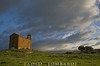
The above images may not be of the site on this page, but were taken nearby. They are loaded from Flickr so please click on them for image credits.
Click here to see more info for this site
Nearby sites
Click here to view sites on an interactive map of the areaKey: Red: member's photo, Blue: 3rd party photo, Yellow: other image, Green: no photo - please go there and take one, Grey: site destroyed
Download sites to:
KML (Google Earth)
GPX (GPS waypoints)
CSV (Garmin/Navman)
CSV (Excel)
To unlock full downloads you need to sign up as a Contributory Member. Otherwise downloads are limited to 50 sites.
Turn off the page maps and other distractions
Nearby sites listing. In the following links * = Image available
644m ENE 58° Gurzu Nuraghe Broch or Nuraghe
2.6km WNW 303° Tilariga Nuraghe* Broch or Nuraghe
3.1km ENE 74° Nurchidda Nuraghe Broch or Nuraghe
5.1km SSE 152° Merenda Ona Tomba di Giganti Chambered Tomb
5.7km E 86° Ena'e Sedina Nuraghe Broch or Nuraghe
5.7km SE 139° San Saturnino Nuraghe* Broch or Nuraghe
5.8km ENE 71° Bodoi Nuraghe Broch or Nuraghe
6.2km ENE 64° Ortuineddu Nuraghe Broch or Nuraghe
6.3km E 95° S'Aspru Nuraghe Broch or Nuraghe
6.8km ENE 64° Ortuine Nuraghe Broch or Nuraghe
7.0km ENE 60° Sae Maria Luisa Nuraghe Broch or Nuraghe
8.0km ESE 105° Sos Molimentos Domus de Janas* Rock Cut Tomb
8.7km SW 214° Tanca Noa Nuraghe (Bottidda) Broch or Nuraghe
10.2km N 6° Norchetta Nuraghe Broch or Nuraghe
10.2km E 83° Tomeone Nuraghe Broch or Nuraghe
11.1km E 85° Arile Nuraghe* Broch or Nuraghe
11.8km NE 47° Su Carru Nuraghe* Broch or Nuraghe
12.2km WSW 236° Erismanzanu Nuraghe* Broch or Nuraghe
12.7km WSW 250° Nuraghe Sa Reggia* Broch or Nuraghe
12.9km SSE 157° Aeddos Nuraghe* Broch or Nuraghe
12.9km ENE 61° Merula Nuraghe* Broch or Nuraghe
13.4km ENE 78° Laonidde Nuraghe* Broch or Nuraghe
14.6km SW 214° Mannuri Nuraghe Broch or Nuraghe
14.7km ENE 70° S'Iscobalzu Nuraghe* Broch or Nuraghe
14.8km E 83° Voes Nuraghe* Broch or Nuraghe
View more nearby sites and additional images


 We would like to know more about this location. Please feel free to add a brief description and any relevant information in your own language.
 Wir möchten mehr über diese Stätte erfahren. Bitte zögern Sie nicht, eine kurze Beschreibung und relevante Informationen in Deutsch hinzuzufügen.
 Nous aimerions en savoir encore un peu sur les lieux. S'il vous plaît n'hesitez pas à ajouter une courte description et tous les renseignements pertinents dans votre propre langue.
 Quisieramos informarnos un poco más de las lugares. No dude en añadir una breve descripción y otros datos relevantes en su propio idioma.