


<< Text Pages >> Kudumbigala Monastery Complex - Ancient Temple in Sri Lanka
Submitted by KaiHofmann on Friday, 12 September 2014 Page Views: 1514
Multi-periodSite Name: Kudumbigala Monastery ComplexCountry: Sri Lanka
NOTE: This site is 12.723 km away from the location you searched for.
Type: Ancient Temple
Nearest Town: Panama
Latitude: 6.672808N Longitude: 81.744943E
Condition:
| 5 | Perfect |
| 4 | Almost Perfect |
| 3 | Reasonable but with some damage |
| 2 | Ruined but still recognisable as an ancient site |
| 1 | Pretty much destroyed, possibly visible as crop marks |
| 0 | No data. |
| -1 | Completely destroyed |
| 5 | Superb |
| 4 | Good |
| 3 | Ordinary |
| 2 | Not Good |
| 1 | Awful |
| 0 | No data. |
| 5 | Can be driven to, probably with disabled access |
| 4 | Short walk on a footpath |
| 3 | Requiring a bit more of a walk |
| 2 | A long walk |
| 1 | In the middle of nowhere, a nightmare to find |
| 0 | No data. |
| 5 | co-ordinates taken by GPS or official recorded co-ordinates |
| 4 | co-ordinates scaled from a detailed map |
| 3 | co-ordinates scaled from a bad map |
| 2 | co-ordinates of the nearest village |
| 1 | co-ordinates of the nearest town |
| 0 | no data |
Internal Links:
External Links:
The wide spread Kudumbigala Monastery Complex is situated in an jungle area with large rock boulders. There are some caves with ancient inscriptions.
Remains of buildings have been found on some rock surfaces. The largest rock called Kudumbigala, it has on his summit remains of two ancient Stupas (dagobas).
You may be viewing yesterday's version of this page. To see the most up to date information please register for a free account.
Do not use the above information on other web sites or publications without permission of the contributor.
Nearby Images from Flickr
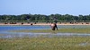
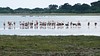
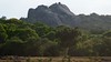
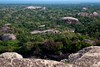
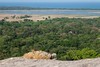
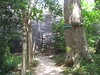
The above images may not be of the site on this page, but were taken nearby. They are loaded from Flickr so please click on them for image credits.
Click here to see more info for this site
Nearby sites
Click here to view sites on an interactive map of the areaKey: Red: member's photo, Blue: 3rd party photo, Yellow: other image, Green: no photo - please go there and take one, Grey: site destroyed
Download sites to:
KML (Google Earth)
GPX (GPS waypoints)
CSV (Garmin/Navman)
CSV (Excel)
To unlock full downloads you need to sign up as a Contributory Member. Otherwise downloads are limited to 50 sites.
Turn off the page maps and other distractions
Nearby sites listing. In the following links * = Image available
21.7km N 358° Magul Maha Viharaya Ancient Temple
22.9km N 2° Kotawehera Raja Maha Viharaya Ancient Temple
24.1km NNE 26° Muhudu Maha Viharaya Ancient Temple
33.7km NW 313° Wattumbegoda cave Rock Art
43.2km W 278° Dhambegoda Bodhisathwa Statue* Sculptured Stone
43.8km W 278° Maligawila standing Buddha* Sculptured Stone
45.5km SW 226° Sithulpauwa* Ancient Temple
51.2km W 280° Dematamal Viharaya* Ancient Temple
66.1km SW 229° Tissa Sandagiri Vihara Ancient Temple
66.5km SW 229° Tissamaharama Raja Maha Vihara Ancient Temple
66.8km SW 229° Building of the Silapassa Parivena Ancient Temple
67.4km SW 230° Yatala Dagoba* Ancient Temple
67.7km SW 231° Galkanumandiya Ruins* Ancient Temple
68.1km N 4° Deegavapi Dagoba Ancient Temple
68.3km SW 222° Kirinda Temple* Ancient Temple
72.2km W 272° Weherayaya Dagoba* Ancient Temple
73.6km W 271° Buduruvagala* Sculptured Stone
79.8km WNW 285° Ravana Ella Cave Cave or Rock Shelter
82.4km WNW 284° Dowa Rajamaha Viharaya Ancient Temple
92.0km N 351° Rajagala Kanda Ancient Temple
95.0km WSW 239° Karabagala Aranya Senasanaya Cave or Rock Shelter
98.9km SW 231° Gothapabbata Vihara* Ancient Temple
105.4km SW 233° Ussangoda* Natural Stone / Erratic / Other Natural Feature
107.2km WNW 286° Seetha Amman Temple* Modern Stone Circle etc
116.5km SW 236° Kahandawa Purana Viharaya* Ancient Temple
View more nearby sites and additional images


 We would like to know more about this location. Please feel free to add a brief description and any relevant information in your own language.
 Wir möchten mehr über diese Stätte erfahren. Bitte zögern Sie nicht, eine kurze Beschreibung und relevante Informationen in Deutsch hinzuzufügen.
 Nous aimerions en savoir encore un peu sur les lieux. S'il vous plaît n'hesitez pas à ajouter une courte description et tous les renseignements pertinents dans votre propre langue.
 Quisieramos informarnos un poco más de las lugares. No dude en añadir una breve descripción y otros datos relevantes en su propio idioma.