


<< Our Photo Pages >> Sa Mitza de Nieddinu Pozzo Sacro - Holy Well or Sacred Spring in Italy in Sardinia (Sardegna)
Submitted by SolarMegalith on Monday, 04 July 2016 Page Views: 1201
Springs and Holy WellsSite Name: Sa Mitza de Nieddinu Pozzo SacroCountry: Italy
NOTE: This site is 5.359 km away from the location you searched for.
Region: Sardinia (Sardegna) Type: Holy Well or Sacred Spring
Nearest Town: Guspini
Latitude: 39.603998N Longitude: 8.660424E
Condition:
| 5 | Perfect |
| 4 | Almost Perfect |
| 3 | Reasonable but with some damage |
| 2 | Ruined but still recognisable as an ancient site |
| 1 | Pretty much destroyed, possibly visible as crop marks |
| 0 | No data. |
| -1 | Completely destroyed |
| 5 | Superb |
| 4 | Good |
| 3 | Ordinary |
| 2 | Not Good |
| 1 | Awful |
| 0 | No data. |
| 5 | Can be driven to, probably with disabled access |
| 4 | Short walk on a footpath |
| 3 | Requiring a bit more of a walk |
| 2 | A long walk |
| 1 | In the middle of nowhere, a nightmare to find |
| 0 | No data. |
| 5 | co-ordinates taken by GPS or official recorded co-ordinates |
| 4 | co-ordinates scaled from a detailed map |
| 3 | co-ordinates scaled from a bad map |
| 2 | co-ordinates of the nearest village |
| 1 | co-ordinates of the nearest town |
| 0 | no data |
Internal Links:
External Links:
I have visited· I would like to visit
SolarMegalith visited on 20th Apr 2016 - their rating: Cond: 3 Amb: 4 Access: 4
")
The Nuragic well of Sa Mitza de Nieddinu is located north of Guspini. Its staircase and partly preserved chamber are heavily overgrown and interior of the well is filled with water. It is probably a Late Bronze Age monument.
You may be viewing yesterday's version of this page. To see the most up to date information please register for a free account.
")
")
Do not use the above information on other web sites or publications without permission of the contributor.
Nearby Images from Flickr
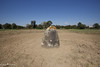
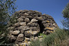

The above images may not be of the site on this page, but were taken nearby. They are loaded from Flickr so please click on them for image credits.
Click here to see more info for this site
Nearby sites
Click here to view sites on an interactive map of the areaKey: Red: member's photo, Blue: 3rd party photo, Yellow: other image, Green: no photo - please go there and take one, Grey: site destroyed
Download sites to:
KML (Google Earth)
GPX (GPS waypoints)
CSV (Garmin/Navman)
CSV (Excel)
To unlock full downloads you need to sign up as a Contributory Member. Otherwise downloads are limited to 50 sites.
Turn off the page maps and other distractions
Nearby sites listing. In the following links * = Image available
861m WNW 304° Melas Nuraghe* Broch or Nuraghe
2.7km W 267° Sa Urecci Nuraghe* Broch or Nuraghe
5.9km WSW 255° Istui Protonuraghe Broch or Nuraghe
10.1km NE 48° Cuccurada Nuraghe* Broch or Nuraghe
10.4km NNE 24° Domu Beccia Nuraghe* Broch or Nuraghe
10.6km ENE 78° Santu Domini Nuraghe Broch or Nuraghe
10.9km NNE 21° Bentu 'e Crobis Nuraghe* Broch or Nuraghe
11.4km SW 217° Cugui Nuraghe* Broch or Nuraghe
11.5km SSW 198° San Cosimo Nuraghe* Broch or Nuraghe
11.6km SSW 199° San Cosimo Tomba di Giganti* Chambered Tomb
11.9km ENE 57° Pala Merenza Nuraghe Broch or Nuraghe
12.0km ENE 74° Serretzi Nuraghe Broch or Nuraghe
12.9km NE 50° Su Gunventu Nuraghe* Broch or Nuraghe
13.1km NNE 22° S'Acqua Sa Baia Nuraghe Broch or Nuraghe
13.1km ENE 68° Sartaro Nuraghe* Broch or Nuraghe
13.2km ENE 70° Sedda sa Caudeba Tomba di Giganti A* Chambered Tomb
13.2km ENE 70° Sedda sa Caudeba Tomba di Giganti B* Chambered Tomb
13.7km E 84° Santa Anastasia* Holy Well or Sacred Spring
15.8km NNE 32° Inus Nuraghe* Broch or Nuraghe
17.0km ENE 78° Genna Maria Nuraghe* Broch or Nuraghe
18.6km ENE 75° Corti Marini Nuraghe Broch or Nuraghe
18.8km NNE 29° Truncu 'e is Pillonis Nuraghe* Broch or Nuraghe
19.2km NE 37° Santu Miali Nuraghe* Broch or Nuraghe
19.3km NNE 28° Scab'e Cresia* Cave or Rock Shelter
19.4km ENE 76° Trobas Nuraghe* Broch or Nuraghe
View more nearby sites and additional images


 We would like to know more about this location. Please feel free to add a brief description and any relevant information in your own language.
 Wir möchten mehr über diese Stätte erfahren. Bitte zögern Sie nicht, eine kurze Beschreibung und relevante Informationen in Deutsch hinzuzufügen.
 Nous aimerions en savoir encore un peu sur les lieux. S'il vous plaît n'hesitez pas à ajouter une courte description et tous les renseignements pertinents dans votre propre langue.
 Quisieramos informarnos un poco más de las lugares. No dude en añadir una breve descripción y otros datos relevantes en su propio idioma.