


<< Text Pages >> Völkersweiler Kreuz - Ancient Cross in Germany in Rhineland-Palatinate
Submitted by KaiHofmann on Thursday, 29 August 2019 Page Views: 372
Early Medieval (Dark Age)Site Name: Völkersweiler KreuzCountry: Germany
NOTE: This site is 2.562 km away from the location you searched for.
Land: Rhineland-Palatinate Type: Ancient Cross
Nearest Town: Hauenstein Nearest Village: Völkersweiler
Latitude: 49.169605N Longitude: 7.931711E
Condition:
| 5 | Perfect |
| 4 | Almost Perfect |
| 3 | Reasonable but with some damage |
| 2 | Ruined but still recognisable as an ancient site |
| 1 | Pretty much destroyed, possibly visible as crop marks |
| 0 | No data. |
| -1 | Completely destroyed |
| 5 | Superb |
| 4 | Good |
| 3 | Ordinary |
| 2 | Not Good |
| 1 | Awful |
| 0 | No data. |
| 5 | Can be driven to, probably with disabled access |
| 4 | Short walk on a footpath |
| 3 | Requiring a bit more of a walk |
| 2 | A long walk |
| 1 | In the middle of nowhere, a nightmare to find |
| 0 | No data. |
| 5 | co-ordinates taken by GPS or official recorded co-ordinates |
| 4 | co-ordinates scaled from a detailed map |
| 3 | co-ordinates scaled from a bad map |
| 2 | co-ordinates of the nearest village |
| 1 | co-ordinates of the nearest town |
| 0 | no data |
Internal Links:
External Links:
Ancient Cross in Rhineland-Palatinate
Early christian cross with furrows on its surface.
You may be viewing yesterday's version of this page. To see the most up to date information please register for a free account.
Do not use the above information on other web sites or publications without permission of the contributor.
Nearby Images from Flickr
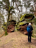
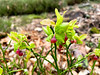
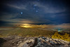
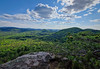
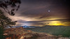
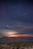
The above images may not be of the site on this page, but were taken nearby. They are loaded from Flickr so please click on them for image credits.
Click here to see more info for this site
Nearby sites
Click here to view sites on an interactive map of the areaKey: Red: member's photo, Blue: 3rd party photo, Yellow: other image, Green: no photo - please go there and take one, Grey: site destroyed
Download sites to:
KML (Google Earth)
GPX (GPS waypoints)
CSV (Garmin/Navman)
CSV (Excel)
To unlock full downloads you need to sign up as a Contributory Member. Otherwise downloads are limited to 50 sites.
Turn off the page maps and other distractions
Nearby sites listing. In the following links * = Image available
2.7km NNW 331° Runder Hut Rock Outcrop
4.7km NNW 337° Hünerstein Rindsberg Rock Outcrop
5.1km ESE 109° Ringwall Heidenschuh Hillfort
5.1km NW 325° Wetzrillen Wilgartswiesen Polissoir
6.1km NNW 332° Weidentalhoehle* Cave or Rock Shelter
6.6km NNW 340° Wilgartaburg Promontory Fort / Cliff Castle
8.7km S 181° Steinerner Tisch Rock Art
9.6km WSW 257° Burg Altdahn* Promontory Fort / Cliff Castle
10.2km NE 42° Opferschale Orensfels Natural Stone / Erratic / Other Natural Feature
13.6km SSW 196° Löffelskreuz Ancient Cross
14.0km WNW 282° Teufelstisch Pfalz* Natural Stone / Erratic / Other Natural Feature
15.7km SE 140° Schaidter Hinkelstein* Standing Stone (Menhir)
16.6km E 79° Summstein Landau Modern Stone Circle etc
18.3km NE 34° Wetzbrunnen Holy Well or Sacred Spring
18.3km SSW 197° Climbronn Holy Well or Sacred Spring
20.5km WNW 302° Foerster Saltarius und seine Gemahlin* Rock Art
20.6km WNW 302° Heidelsburg Höhensiedlung* Hillfort
20.8km SW 232° Maimont Opferschale* Natural Stone / Erratic / Other Natural Feature
20.8km SW 231° Maimont Keltenring* Hillfort
20.9km E 99° Herxheim Stone Age settlement Ancient Village or Settlement
21.7km W 273° Sant Pirmansstein* Standing Stone (Menhir)
22.9km E 99° Huegelgraeber Klingbachwald Barrow Cemetery
23.0km NNE 30° Hügelgrabfeld Königsberg* Barrow Cemetery
23.5km NNE 31° Heidenmauer Königsberg* Hillfort
23.7km NNE 32° Heidenloch Cave or Rock Shelter
View more nearby sites and additional images


 We would like to know more about this location. Please feel free to add a brief description and any relevant information in your own language.
 Wir möchten mehr über diese Stätte erfahren. Bitte zögern Sie nicht, eine kurze Beschreibung und relevante Informationen in Deutsch hinzuzufügen.
 Nous aimerions en savoir encore un peu sur les lieux. S'il vous plaît n'hesitez pas à ajouter une courte description et tous les renseignements pertinents dans votre propre langue.
 Quisieramos informarnos un poco más de las lugares. No dude en añadir una breve descripción y otros datos relevantes en su propio idioma.