


<< Text Pages >> Palais de Rohan Musee Archeologique - Museum in France in Alsace-Lorraine:Bas-Rhin (67)
Submitted by AlexHunger on Saturday, 16 April 2005 Page Views: 4074
MuseumsSite Name: Palais de Rohan Musee ArcheologiqueCountry: France
NOTE: This site is 0.531 km away from the location you searched for.
Département: Alsace-Lorraine:Bas-Rhin (67) Type: Museum
Nearest Town: Strasbourg Nearest Village: Strasbourg
Latitude: 48.581210N Longitude: 7.752130E
Condition:
| 5 | Perfect |
| 4 | Almost Perfect |
| 3 | Reasonable but with some damage |
| 2 | Ruined but still recognisable as an ancient site |
| 1 | Pretty much destroyed, possibly visible as crop marks |
| 0 | No data. |
| -1 | Completely destroyed |
| 5 | Superb |
| 4 | Good |
| 3 | Ordinary |
| 2 | Not Good |
| 1 | Awful |
| 0 | No data. |
| 5 | Can be driven to, probably with disabled access |
| 4 | Short walk on a footpath |
| 3 | Requiring a bit more of a walk |
| 2 | A long walk |
| 1 | In the middle of nowhere, a nightmare to find |
| 0 | No data. |
| 5 | co-ordinates taken by GPS or official recorded co-ordinates |
| 4 | co-ordinates scaled from a detailed map |
| 3 | co-ordinates scaled from a bad map |
| 2 | co-ordinates of the nearest village |
| 1 | co-ordinates of the nearest town |
| 0 | no data |
Internal Links:
External Links:
Museum in Bas Rhin
Great museum with items from Paleolithic to 800 CE
IMPORTANT NOTE: Positional co-ordinates taken from a gps fix
Address: 2 Place Du Château, basement, 67000
You may be viewing yesterday's version of this page. To see the most up to date information please register for a free account.
Do not use the above information on other web sites or publications without permission of the contributor.
Nearby Images from Flickr
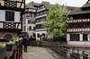
The above images may not be of the site on this page, but were taken nearby. They are loaded from Flickr so please click on them for image credits.
Click here to see more info for this site
Nearby sites
Click here to view sites on an interactive map of the areaKey: Red: member's photo, Blue: 3rd party photo, Yellow: other image, Green: no photo - please go there and take one, Grey: site destroyed
Download sites to:
KML (Google Earth)
GPX (GPS waypoints)
CSV (Garmin/Navman)
CSV (Excel)
To unlock full downloads you need to sign up as a Contributory Member. Otherwise downloads are limited to 50 sites.
Turn off the page maps and other distractions
Nearby sites listing. In the following links * = Image available
6.0km SSE 164° Dolmen du Stockfeld Chambered Tomb
18.3km WSW 253° Langenstein de Dorlisheim* Standing Stone (Menhir)
18.4km SE 125° Brücklesbünd Menhir* Standing Stone (Menhir)
19.3km ESE 119° Der Dicke Stein Bohlsbach Standing Stone (Menhir)
22.4km SE 133° Bibelistein* Standing Stone (Menhir)
25.9km NE 44° Greffern Menhir II Standing Stone (Menhir)
25.9km NE 44° Greffern Menhir I Standing Stone (Menhir)
29.4km W 279° Heidenschloss* Ancient Village or Settlement
30.1km WSW 238° Mont St. Odile* Hillfort
30.2km SE 134° Heidenplatz und Steinsofa Schwaibach* Rock Art
30.4km WSW 238° Fountain Sainte-Odile* Holy Well or Sacred Spring
31.0km SW 236° Rocher Robert Forrer* Ancient Mine, Quarry or other Industry
31.0km WSW 237° Mont St.Odile Tombes Mérovingiennes* Burial Chamber or Dolmen
31.1km WSW 236° Grotte Des Druides* Cave or Rock Shelter
31.1km NNE 15° Forêt de Haguenau Necropolis Barrow Cemetery
32.5km S 176° Keltisches Fürstengrab von Kappel* Round Barrow(s)
33.7km W 266° Ringelsberg Fortifications Gallo-romaines Hillfort
34.1km WNW 285° Sattelfelsen* Standing Stone (Menhir)
34.1km WNW 290° Rocher du Hibou Natural Stone / Erratic / Other Natural Feature
34.3km WNW 294° Brotsch Mur Paien Ancient Village or Settlement
34.3km WNW 294° Hexentisch Cave or Rock Shelter
34.5km NE 47° Heiligenbuck Artificial Mound
34.8km WNW 288° Rocher de la Spill* Rock Outcrop
35.0km WNW 285° Le Table des Géants* Natural Stone / Erratic / Other Natural Feature
35.4km WNW 291° Krappenfels Murs Paien* Misc. Earthwork
View more nearby sites and additional images


 We would like to know more about this location. Please feel free to add a brief description and any relevant information in your own language.
 Wir möchten mehr über diese Stätte erfahren. Bitte zögern Sie nicht, eine kurze Beschreibung und relevante Informationen in Deutsch hinzuzufügen.
 Nous aimerions en savoir encore un peu sur les lieux. S'il vous plaît n'hesitez pas à ajouter une courte description et tous les renseignements pertinents dans votre propre langue.
 Quisieramos informarnos un poco más de las lugares. No dude en añadir una breve descripción y otros datos relevantes en su propio idioma.