 with our Megalithic Portal iPhone app")


<< Text Pages >> Großsteingrab Elte - Chambered Tomb in Germany in North Rhine-Westphalia
Submitted by Harald_Platta on Wednesday, 05 August 2015 Page Views: 1054
Neolithic and Bronze AgeSite Name: Großsteingrab ElteCountry: Germany
NOTE: This site is 7.064 km away from the location you searched for.
Land: North Rhine-Westphalia Type: Chambered Tomb
Nearest Town: Rheine
Latitude: 52.250000N Longitude: 7.516667E
Condition:
| 5 | Perfect |
| 4 | Almost Perfect |
| 3 | Reasonable but with some damage |
| 2 | Ruined but still recognisable as an ancient site |
| 1 | Pretty much destroyed, possibly visible as crop marks |
| 0 | No data. |
| -1 | Completely destroyed |
| 5 | Superb |
| 4 | Good |
| 3 | Ordinary |
| 2 | Not Good |
| 1 | Awful |
| 0 | No data. |
| 5 | Can be driven to, probably with disabled access |
| 4 | Short walk on a footpath |
| 3 | Requiring a bit more of a walk |
| 2 | A long walk |
| 1 | In the middle of nowhere, a nightmare to find |
| 0 | No data. |
| 5 | co-ordinates taken by GPS or official recorded co-ordinates |
| 4 | co-ordinates scaled from a detailed map |
| 3 | co-ordinates scaled from a bad map |
| 2 | co-ordinates of the nearest village |
| 1 | co-ordinates of the nearest town |
| 0 | no data |
Internal Links:
External Links:
The chambered tomb was located in Elte, which is a city district of Rheine (North Rhine-Westphalia, Germany).
Nothing is known about the appearence of the tomb. Because another chambered tomb is still well preserved in Rheine (Rheine Megalithgrab), it can be speculated, that it had been built in a similar manner.
Text Reference:
[01] Greiwe, F.: Das Amt Rheine: Raum, Geschichte, Brauchtum (1974).
You may be viewing yesterday's version of this page. To see the most up to date information please register for a free account.
Do not use the above information on other web sites or publications without permission of the contributor.
Nearby Images from Flickr
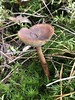
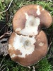
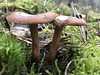
The above images may not be of the site on this page, but were taken nearby. They are loaded from Flickr so please click on them for image credits.
Click here to see more info for this site
Nearby sites
Click here to view sites on an interactive map of the areaKey: Red: member's photo, Blue: 3rd party photo, Yellow: other image, Green: no photo - please go there and take one, Grey: site destroyed
Download sites to:
KML (Google Earth)
GPX (GPS waypoints)
CSV (Garmin/Navman)
CSV (Excel)
To unlock full downloads you need to sign up as a Contributory Member. Otherwise downloads are limited to 50 sites.
Turn off the page maps and other distractions
Nearby sites listing. In the following links * = Image available
5.9km NW 325° Gräberfeld Altenrheine Barrow Cemetery
6.3km WSW 243° Am Hilgenfeld Barrow Cemetery
7.6km WNW 295° Hünenborg Thieberg* Modern Stone Circle etc
7.8km NW 316° Rheine Megalithgrab* Passage Grave
12.1km E 96° Dörenther Steinkreuze* Ancient Cross
12.8km E 93° Hockendes Weib* Rock Outcrop
13.2km SE 141° Saerbeck Iron Age Settlement* Ancient Village or Settlement
15.3km SSE 154° Sachsenhof Greven-Pentrup* Museum
15.8km E 97° Wallburg Schweinskopf (Tecklenburger Land)* Hillfort
16.4km SE 139° Huettrup Huegelgrab 1 Round Barrow(s)
17.7km NE 55° Espel (1) Chambered Tomb
17.8km NE 56° Espel (2) Passage Grave
18.3km SE 126° Overbeck Chambered Tomb
18.9km E 99° Heidentempel Tecklenburg* Natural Stone / Erratic / Other Natural Feature
18.9km ESE 106° Hünengrab Wechte (2) Passage Grave
18.9km ENE 77° Grabhügelfeld Tannenkamp* Barrow Cemetery
18.9km ESE 105° Steinhuegelgrab Wechte* Round Barrow(s)
19.2km NW 316° Mehringer Steine 3* Chambered Tomb
19.2km NW 316° Mehringer Steine 2* Chambered Tomb
19.4km NW 316° Mehringer Steine 1* Chambered Tomb
19.4km ESE 104° Hünengrab Wechte (1)* Burial Chamber or Dolmen
20.1km E 100° Hexenküche* Natural Stone / Erratic / Other Natural Feature
20.3km SE 124° Grabhügelfeld Ladbergen* Barrow Cemetery
20.7km NNW 336° Bramsche-Wesel Steingrab 3 Chambered Tomb
21.6km NNW 337° Bramsche-Wesel Steingrab 2 Chambered Tomb
View more nearby sites and additional images


 We would like to know more about this location. Please feel free to add a brief description and any relevant information in your own language.
 Wir möchten mehr über diese Stätte erfahren. Bitte zögern Sie nicht, eine kurze Beschreibung und relevante Informationen in Deutsch hinzuzufügen.
 Nous aimerions en savoir encore un peu sur les lieux. S'il vous plaît n'hesitez pas à ajouter une courte description et tous les renseignements pertinents dans votre propre langue.
 Quisieramos informarnos un poco más de las lugares. No dude en añadir una breve descripción y otros datos relevantes en su propio idioma.