


<< Text Pages >> Summstein Ettingen - Modern Stone Circle etc in Switzerland in Baselland
Submitted by Harald_Platta on Saturday, 02 December 2017 Page Views: 924
Modern SitesSite Name: Summstein EttingenCountry: Switzerland
NOTE: This site is 9.711 km away from the location you searched for.
Canton: Baselland Type: Modern Stone Circle etc
Nearest Town: Ettingen
Latitude: 47.482250N Longitude: 7.549800E
Condition:
| 5 | Perfect |
| 4 | Almost Perfect |
| 3 | Reasonable but with some damage |
| 2 | Ruined but still recognisable as an ancient site |
| 1 | Pretty much destroyed, possibly visible as crop marks |
| 0 | No data. |
| -1 | Completely destroyed |
| 5 | Superb |
| 4 | Good |
| 3 | Ordinary |
| 2 | Not Good |
| 1 | Awful |
| 0 | No data. |
| 5 | Can be driven to, probably with disabled access |
| 4 | Short walk on a footpath |
| 3 | Requiring a bit more of a walk |
| 2 | A long walk |
| 1 | In the middle of nowhere, a nightmare to find |
| 0 | No data. |
| 5 | co-ordinates taken by GPS or official recorded co-ordinates |
| 4 | co-ordinates scaled from a detailed map |
| 3 | co-ordinates scaled from a bad map |
| 2 | co-ordinates of the nearest village |
| 1 | co-ordinates of the nearest town |
| 0 | no data |
Be the first person to rate this site - see the 'Contribute!' box in the right hand menu.
Internal Links:
External Links:
The Summstein ("Humming Stone") is a modern stone sculpture situated in Ettingen (Switzerland).
Further information and literature on Summsteine in general: MP page Großer Summstein.
Reference:
[01] Waymarking.com: Humming Stone on Playground Baselstrasse - Ettingen, BL, Switzerland.
You may be viewing yesterday's version of this page. To see the most up to date information please register for a free account.
Do not use the above information on other web sites or publications without permission of the contributor.
Nearby Images from Flickr

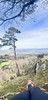
The above images may not be of the site on this page, but were taken nearby. They are loaded from Flickr so please click on them for image credits.
Click here to see more info for this site
Nearby sites
Click here to view sites on an interactive map of the areaKey: Red: member's photo, Blue: 3rd party photo, Yellow: other image, Green: no photo - please go there and take one, Grey: site destroyed
Download sites to:
KML (Google Earth)
GPX (GPS waypoints)
CSV (Garmin/Navman)
CSV (Excel)
To unlock full downloads you need to sign up as a Contributory Member. Otherwise downloads are limited to 50 sites.
Turn off the page maps and other distractions
Nearby sites listing. In the following links * = Image available
2.1km SE 137° Aesch Dolmen* Chambered Tomb
7.6km SSW 210° Laufen Dolmen* Chambered Tomb
10.9km SSE 164° Meltingen Schalenstein* Rock Art
11.9km NE 48° Hornfels* Hillfort
14.0km WSW 259° Saint-Joseph Abri* Cave or Rock Shelter
14.1km ENE 66° Augusta Raurica* Ancient Village or Settlement
16.4km NNE 30° Burghof Museum Museum
18.4km NNE 33° Homburger Wald Grabhügelgruppe Barrow Cemetery
20.0km SW 221° Pierre de Saint Germain* Rock Art
20.5km W 275° Kastelberg Oppidium* Promontory Fort / Cliff Castle
21.9km N 6° Katzenberg Grabhügelgruppe* Barrow Cemetery
23.6km W 263° Grotte du Mannlefelsen (Oberlarg)* Cave or Rock Shelter
24.3km SSE 149° Oensingen Schalenstein* Rock Art
25.7km SSE 161° Oberbipp Dolmen* Burial Chamber or Dolmen
26.6km SSE 164° Menhir Wiedlisbach* Modern Stone Circle etc
26.9km S 169° Attiswil Freistein* Standing Stone (Menhir)
27.1km ENE 63° Heidenstein (Schwörstadt)* Burial Chamber or Dolmen
28.1km S 180° Schildchrott - Solothurner Megalithweg* Natural Stone / Erratic / Other Natural Feature
28.1km S 182° Rüttenen Schalenstein Rock Art
28.2km S 180° Namenloser Findling - Solothurner Megalithweg* Natural Stone / Erratic / Other Natural Feature
28.2km S 180° Chli Matterhorn - Solothurner Megalithweg* Natural Stone / Erratic / Other Natural Feature
28.3km S 180° Steinsetzungen - Solothurner Megalithweg* Natural Stone / Erratic / Other Natural Feature
28.4km ENE 59° Hunnenstein (Dossenbach)* Standing Stone (Menhir)
28.4km S 180° Rütschelistein - Solothurner Megalithweg* Natural Stone / Erratic / Other Natural Feature
28.6km E 86° Galgenstein (Wegenstetten) Chambered Tomb
View more nearby sites and additional images


 We would like to know more about this location. Please feel free to add a brief description and any relevant information in your own language.
 Wir möchten mehr über diese Stätte erfahren. Bitte zögern Sie nicht, eine kurze Beschreibung und relevante Informationen in Deutsch hinzuzufügen.
 Nous aimerions en savoir encore un peu sur les lieux. S'il vous plaît n'hesitez pas à ajouter une courte description et tous les renseignements pertinents dans votre propre langue.
 Quisieramos informarnos un poco más de las lugares. No dude en añadir una breve descripción y otros datos relevantes en su propio idioma.