

<< Our Photo Pages >> Dreitonnenkuppe Grabhügel - Round Barrow(s) in Germany in Rhineland-Palatinate
Submitted by KaiHofmann on Sunday, 23 February 2020 Page Views: 421
Neolithic and Bronze AgeSite Name: Dreitonnenkuppe GrabhügelCountry: Germany
NOTE: This site is 1.632 km away from the location you searched for.
Land: Rhineland-Palatinate Type: Round Barrow(s)
Nearest Town: Koblenz Nearest Village: Ochtendung
Latitude: 50.326231N Longitude: 7.405498E
Condition:
| 5 | Perfect |
| 4 | Almost Perfect |
| 3 | Reasonable but with some damage |
| 2 | Ruined but still recognisable as an ancient site |
| 1 | Pretty much destroyed, possibly visible as crop marks |
| 0 | No data. |
| -1 | Completely destroyed |
| 5 | Superb |
| 4 | Good |
| 3 | Ordinary |
| 2 | Not Good |
| 1 | Awful |
| 0 | No data. |
| 5 | Can be driven to, probably with disabled access |
| 4 | Short walk on a footpath |
| 3 | Requiring a bit more of a walk |
| 2 | A long walk |
| 1 | In the middle of nowhere, a nightmare to find |
| 0 | No data. |
| 5 | co-ordinates taken by GPS or official recorded co-ordinates |
| 4 | co-ordinates scaled from a detailed map |
| 3 | co-ordinates scaled from a bad map |
| 2 | co-ordinates of the nearest village |
| 1 | co-ordinates of the nearest town |
| 0 | no data |
Internal Links:
External Links:
")
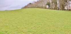
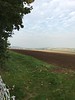
Today one flat burial mound is still visible on the field. It was part of a group of three large prince´s burial mounds. The one which is still visible as a flat mound was one of the largest burial mounds in Rhineland-Palatinate. Some meters away a stone stands besides the road. It was possible the tombstone of one of the mounds and could be a standing stone.
You may be viewing yesterday's version of this page. To see the most up to date information please register for a free account.
")
")
")
Do not use the above information on other web sites or publications without permission of the contributor.
Nearby Images from Flickr

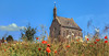
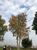
The above images may not be of the site on this page, but were taken nearby. They are loaded from Flickr so please click on them for image credits.
Click here to see more info for this site
Nearby sites
Click here to view sites on an interactive map of the areaKey: Red: member's photo, Blue: 3rd party photo, Yellow: other image, Green: no photo - please go there and take one, Grey: site destroyed
Download sites to:
KML (Google Earth)
GPX (GPS waypoints)
CSV (Garmin/Navman)
CSV (Excel)
To unlock full downloads you need to sign up as a Contributory Member. Otherwise downloads are limited to 50 sites.
Turn off the page maps and other distractions
Nearby sites listing. In the following links * = Image available
49m NNW 348° Dreitonnenkuppe Stein* Standing Stone (Menhir)
2.3km NNW 346° Grabmal Ochtendung* Round Barrow(s)
2.8km ENE 62° Goloring* Henge
3.3km ENE 57° Gollenbusch Graeberfeld Barrow Cemetery
3.5km ENE 67° Hügelgräberfeld Chorsang Barrow Cemetery
8.6km NNW 335° Kretz Römerbergwerk Ancient Mine, Quarry or other Industry
9.6km SSE 157° Keltenburg Alken Hillfort
11.4km SE 130° Grabhügelfeld Waldesch* Barrow Cemetery
11.5km SE 126° Bruder Tönnes Hügel* Round Barrow(s)
11.7km NNW 326° Tumulus von Nickenich* Round Barrow(s)
12.7km E 94° Wallanlage Dommelberg* Hillfort
15.2km S 189° Druidenstein Moselkern* Hillfort
18.5km SSW 207° Martberg* Ancient Temple
19.6km NNE 30° Grabhügelfeld Heimbach-Weis* Barrow Cemetery
19.7km NNW 341° Reutersley* Hillfort
20.3km SSE 162° Gondershausen paleolithic horse engravings* Rock Art
21.0km ENE 70° Grabhügelfeld Simmern Barrow Cemetery
22.7km WNW 297° Schleifstein Kempenich* Polissoir
26.0km SSE 164° Grabhügelgruppe Beltheim Barrow Cemetery
26.7km SSE 152° Flammensäule Pfalzfeld* Sculptured Stone
28.8km E 100° Alte Burg Singhofen* Hillfort
30.1km S 177° Bell Huegelgraeber Barrow Cemetery
30.2km SE 130° Befestigung auf dem Hünenberg Hillfort
31.4km SW 220° Calmont Temple* Ancient Temple
33.4km S 175° Grabhügelfeld Alterkülz Barrow Cemetery
View more nearby sites and additional images


 We would like to know more about this location. Please feel free to add a brief description and any relevant information in your own language.
 Wir möchten mehr über diese Stätte erfahren. Bitte zögern Sie nicht, eine kurze Beschreibung und relevante Informationen in Deutsch hinzuzufügen.
 Nous aimerions en savoir encore un peu sur les lieux. S'il vous plaît n'hesitez pas à ajouter une courte description et tous les renseignements pertinents dans votre propre langue.
 Quisieramos informarnos un poco más de las lugares. No dude en añadir una breve descripción y otros datos relevantes en su propio idioma.