 with our Megalithic Portal iPhone app")


<< Our Photo Pages >> Der Gutenbrunnen - Holy Well or Sacred Spring in Germany in Rhineland-Palatinate
Submitted by KaiHofmann on Tuesday, 29 March 2016 Page Views: 816
Springs and Holy WellsSite Name: Der GutenbrunnenCountry: Germany
NOTE: This site is 0.872 km away from the location you searched for.
Land: Rhineland-Palatinate Type: Holy Well or Sacred Spring
Nearest Town: St.Wendel Nearest Village: Güdesweiler
Latitude: 49.527763N Longitude: 7.101697E
Condition:
| 5 | Perfect |
| 4 | Almost Perfect |
| 3 | Reasonable but with some damage |
| 2 | Ruined but still recognisable as an ancient site |
| 1 | Pretty much destroyed, possibly visible as crop marks |
| 0 | No data. |
| -1 | Completely destroyed |
| 5 | Superb |
| 4 | Good |
| 3 | Ordinary |
| 2 | Not Good |
| 1 | Awful |
| 0 | No data. |
| 5 | Can be driven to, probably with disabled access |
| 4 | Short walk on a footpath |
| 3 | Requiring a bit more of a walk |
| 2 | A long walk |
| 1 | In the middle of nowhere, a nightmare to find |
| 0 | No data. |
| 5 | co-ordinates taken by GPS or official recorded co-ordinates |
| 4 | co-ordinates scaled from a detailed map |
| 3 | co-ordinates scaled from a bad map |
| 2 | co-ordinates of the nearest village |
| 1 | co-ordinates of the nearest town |
| 0 | no data |
Internal Links:
External Links:
I have visited· I would like to visit
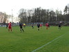
ELindey visited on 20th Jun 2019 - their rating: Cond: 4 Amb: 3 Access: 4 A modern housing has been built up around the spring. It sits by the remains of a 18th century chapel, but dates back much older.
")
Holy well close to an chapell of the 17th century.
You may be viewing yesterday's version of this page. To see the most up to date information please register for a free account.
Do not use the above information on other web sites or publications without permission of the contributor.
Nearby Images from Flickr
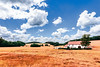
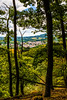
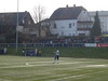
The above images may not be of the site on this page, but were taken nearby. They are loaded from Flickr so please click on them for image credits.
Click here to see more info for this site
Nearby sites
Click here to view sites on an interactive map of the areaKey: Red: member's photo, Blue: 3rd party photo, Yellow: other image, Green: no photo - please go there and take one, Grey: site destroyed
Download sites to:
KML (Google Earth)
GPX (GPS waypoints)
CSV (Garmin/Navman)
CSV (Excel)
To unlock full downloads you need to sign up as a Contributory Member. Otherwise downloads are limited to 50 sites.
Turn off the page maps and other distractions
Nearby sites listing. In the following links * = Image available
646m W 261° Guedesweiler Wildfrauenhoehle* Cave or Rock Shelter
3.1km WSW 250° Mommerich Huenenwall* Hillfort
3.6km NNE 12° Hinkelstein Walhausen* Standing Stone (Menhir)
4.2km S 189° Augenborn* Holy Well or Sacred Spring
4.7km WSW 256° Tholey Fuchshuebel* Round Barrow(s)
4.8km SE 134° Wendalinushöhle* Cave or Rock Shelter
4.9km SW 220° Wareswald* Ancient Village or Settlement
6.4km SE 136° Strasse der Skulpturen* Modern Stone Circle etc
6.9km SW 228° Storchenstein* Standing Stone (Menhir)
7.9km NW 325° Huegelgraeberfeld Priesberg Barrow Cemetery
8.1km NE 39° Messerbrunnen* Holy Well or Sacred Spring
8.3km NW 306° Grindborn* Holy Well or Sacred Spring
9.8km SSE 160° Spiemont Hillfort
10.3km NNE 29° Hasselt Graeberfeld* Barrow Cemetery
12.1km SW 227° Sotzweiler Steinkreuz* Ancient Cross
12.5km NNW 327° Otzenhausen Quelle* Holy Well or Sacred Spring
12.5km NE 42° Altburg Weiersbach* Hillfort
12.6km NNW 327° Hunnenring* Hillfort
13.1km E 85° Schwarzerden Mithrasrelief* Ancient Temple
13.7km WNW 298° Schlittchen* Ancient Mine, Quarry or other Industry
13.9km WNW 294° Oberlöstern Menhir* Standing Stone (Menhir)
14.5km WNW 287° Grabhuegelgruppe Preussenkopf Barrow Cemetery
14.7km WNW 293° Oberloestern Monumentalgrabhuegel* Round Barrow(s)
16.3km S 169° Summstein Schiffweiler Modern Stone Circle etc
17.9km WSW 250° Birg Keltenburg, Limbach Hillfort
View more nearby sites and additional images


 We would like to know more about this location. Please feel free to add a brief description and any relevant information in your own language.
 Wir möchten mehr über diese Stätte erfahren. Bitte zögern Sie nicht, eine kurze Beschreibung und relevante Informationen in Deutsch hinzuzufügen.
 Nous aimerions en savoir encore un peu sur les lieux. S'il vous plaît n'hesitez pas à ajouter une courte description et tous les renseignements pertinents dans votre propre langue.
 Quisieramos informarnos un poco más de las lugares. No dude en añadir una breve descripción y otros datos relevantes en su propio idioma.