


<< Our Photo Pages >> Courgenay Pierre-Percée - Chambered Tomb in Switzerland in Jura
Submitted by AlexHunger on Saturday, 18 February 2006 Page Views: 4356
Neolithic and Bronze AgeSite Name: Courgenay Pierre-PercéeCountry: Switzerland
NOTE: This site is 8.695 km away from the location you searched for.
Canton: Jura Type: Chambered Tomb
Nearest Town: Luzern Nearest Village: Courgenay
Latitude: 47.406200N Longitude: 7.119000E
Condition:
| 5 | Perfect |
| 4 | Almost Perfect |
| 3 | Reasonable but with some damage |
| 2 | Ruined but still recognisable as an ancient site |
| 1 | Pretty much destroyed, possibly visible as crop marks |
| 0 | No data. |
| -1 | Completely destroyed |
| 5 | Superb |
| 4 | Good |
| 3 | Ordinary |
| 2 | Not Good |
| 1 | Awful |
| 0 | No data. |
| 5 | Can be driven to, probably with disabled access |
| 4 | Short walk on a footpath |
| 3 | Requiring a bit more of a walk |
| 2 | A long walk |
| 1 | In the middle of nowhere, a nightmare to find |
| 0 | No data. |
| 5 | co-ordinates taken by GPS or official recorded co-ordinates |
| 4 | co-ordinates scaled from a detailed map |
| 3 | co-ordinates scaled from a bad map |
| 2 | co-ordinates of the nearest village |
| 1 | co-ordinates of the nearest town |
| 0 | no data |
Internal Links:
External Links:
I have visited· I would like to visit
aolson visited on 17th Aug 2017 - their rating: Cond: 2 Amb: 2 Access: 5
")
There is also a smaller stone with hole close to the big one, about 1 m in height and 50 cm wide.
On Rue de la Pierre-Percée.
You may be viewing yesterday's version of this page. To see the most up to date information please register for a free account.
")
")
")
Do not use the above information on other web sites or publications without permission of the contributor.
Nearby Images from Flickr
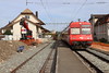
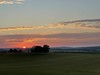

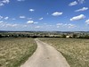


The above images may not be of the site on this page, but were taken nearby. They are loaded from Flickr so please click on them for image credits.
Click here to see more info for this site
Nearby sites
Click here to view sites on an interactive map of the areaKey: Red: member's photo, Blue: 3rd party photo, Yellow: other image, Green: no photo - please go there and take one, Grey: site destroyed
Download sites to:
KML (Google Earth)
GPX (GPS waypoints)
CSV (Garmin/Navman)
CSV (Excel)
To unlock full downloads you need to sign up as a Contributory Member. Otherwise downloads are limited to 50 sites.
Turn off the page maps and other distractions
Nearby sites listing. In the following links * = Image available
10.6km ENE 58° Grotte du Mannlefelsen (Oberlarg)* Cave or Rock Shelter
11.8km SE 131° Bassecourt Menhir Standing Stone (Menhir)
15.9km NE 49° Kastelberg Oppidium* Promontory Fort / Cliff Castle
17.5km W 277° Cromlech des Fourneaux* Stone Circle
19.5km ENE 73° Saint-Joseph Abri* Cave or Rock Shelter
20.5km ESE 109° Pierre de Saint Germain* Rock Art
24.7km W 281° Théâtre gallo-romain de Mandeure* Ancient Village or Settlement
26.2km WNW 295° Megalithe Chantant Montbeliard (Summstein) Modern Stone Circle etc
28.7km E 86° Laufen Dolmen* Chambered Tomb
30.6km NW 309° Brevilliers Dolmen* Burial Chamber or Dolmen
31.1km SSE 163° Museum Schwab* Museum
31.1km SSE 163° Brüggmöösli Schalenstein* Rock Art
31.1km SSE 163° Luterhölzli Schalenstein Rock Art
31.9km SSE 158° Längholz Schalenstein Rock Art
31.9km SE 141° Eichholz Schalenstein* Rock Art
32.1km SE 130° Selzach Schalenstein* Rock Art
32.3km SSE 159° Längholz Dachsenstein Rock Art
32.3km SSE 159° Längholz Heidenstein Natural Stone / Erratic / Other Natural Feature
32.8km S 171° Druidenstein Rock Art
33.1km S 172° Findling Holenstein* Natural Stone / Erratic / Other Natural Feature
33.5km ENE 75° Summstein Ettingen Modern Stone Circle etc
34.5km ENE 78° Aesch Dolmen* Chambered Tomb
35.2km SSE 158° Roman temple district Petinesca* Ancient Temple
35.5km E 93° Meltingen Schalenstein* Rock Art
36.1km SSE 150° Dotzigeberg Schalenstein Rock Art
View more nearby sites and additional images


 We would like to know more about this location. Please feel free to add a brief description and any relevant information in your own language.
 Wir möchten mehr über diese Stätte erfahren. Bitte zögern Sie nicht, eine kurze Beschreibung und relevante Informationen in Deutsch hinzuzufügen.
 Nous aimerions en savoir encore un peu sur les lieux. S'il vous plaît n'hesitez pas à ajouter une courte description et tous les renseignements pertinents dans votre propre langue.
 Quisieramos informarnos un poco más de las lugares. No dude en añadir una breve descripción y otros datos relevantes en su propio idioma.