


<< Text Pages >> Oppidum du Mont Saint-Martin - Hillfort in France in Provence:Alpes-Maritimes (06)
Submitted by AlexHunger on Tuesday, 17 May 2005 Page Views: 2267
Iron Age and Later PrehistorySite Name: Oppidum du Mont Saint-MartinCountry: France
NOTE: This site is 2.924 km away from the location you searched for.
Département: Provence:Alpes-Maritimes (06) Type: Hillfort
Nearest Town: Nice Nearest Village: Miramar
Latitude: 43.504850N Longitude: 6.904810E
Condition:
| 5 | Perfect |
| 4 | Almost Perfect |
| 3 | Reasonable but with some damage |
| 2 | Ruined but still recognisable as an ancient site |
| 1 | Pretty much destroyed, possibly visible as crop marks |
| 0 | No data. |
| -1 | Completely destroyed |
| 5 | Superb |
| 4 | Good |
| 3 | Ordinary |
| 2 | Not Good |
| 1 | Awful |
| 0 | No data. |
| 5 | Can be driven to, probably with disabled access |
| 4 | Short walk on a footpath |
| 3 | Requiring a bit more of a walk |
| 2 | A long walk |
| 1 | In the middle of nowhere, a nightmare to find |
| 0 | No data. |
| 5 | co-ordinates taken by GPS or official recorded co-ordinates |
| 4 | co-ordinates scaled from a detailed map |
| 3 | co-ordinates scaled from a bad map |
| 2 | co-ordinates of the nearest village |
| 1 | co-ordinates of the nearest town |
| 0 | no data |
Internal Links:
External Links:
Hill Fort in Alpes-Maritimes
3.3 Km North West of town in Hills.
Location Source: T4T35.fr
You may be viewing yesterday's version of this page. To see the most up to date information please register for a free account.
Do not use the above information on other web sites or publications without permission of the contributor.
Nearby Images from Flickr
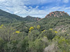
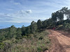
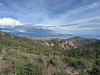
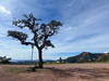
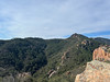
The above images may not be of the site on this page, but were taken nearby. They are loaded from Flickr so please click on them for image credits.
Click here to see more info for this site
Nearby sites
Click here to view sites on an interactive map of the areaKey: Red: member's photo, Blue: 3rd party photo, Yellow: other image, Green: no photo - please go there and take one, Grey: site destroyed
Download sites to:
KML (Google Earth)
GPX (GPS waypoints)
CSV (Garmin/Navman)
CSV (Excel)
To unlock full downloads you need to sign up as a Contributory Member. Otherwise downloads are limited to 50 sites.
Turn off the page maps and other distractions
Nearby sites listing. In the following links * = Image available
8.6km SW 228° Menhir des Trois Gollets* Standing Stone (Menhir)
9.2km SW 229° Menhir de Valescure * Standing Stone (Menhir)
9.7km SW 215° Aire Peyronne Menhir* Standing Stone (Menhir)
10.4km WSW 241° Dolmen de Valescure Burial Chamber or Dolmen
10.4km SW 230° Dolmen de Montrouge Burial Chamber or Dolmen
11.2km SW 229° Valbonette Tumulus Artificial Mound
11.3km SW 230° Dolmen de La Valbonette Burial Chamber or Dolmen
12.8km WSW 252° Grotte Sepulcrale de L'Olivier Cave or Rock Shelter
13.0km NE 34° Aven des Breguieres Cave or Rock Shelter
13.8km WSW 247° Grotte Sepulcrale de Gaspard de Besse Cave or Rock Shelter
14.0km SW 231° Saint-Raphaël Musée Archéologique Museum
14.4km N 6° Grotte de Peymeinade Cave or Rock Shelter
15.5km NNW 339° Font du Roure Grotte Sepulcrale Cave or Rock Shelter
15.7km NE 53° Font de Cine Court Tomb
16.1km NNW 331° Les Bergeries Dolmen Burial Chamber or Dolmen
16.1km WNW 299° Verrerie Vielle Menhirs Standing Stone (Menhir)
16.4km NNW 330° Dolmen de Lou Serre Dinguille* Burial Chamber or Dolmen
16.6km NNW 345° Grotte des Luchons Cave or Rock Shelter
16.6km NNW 337° Tombe en bloc du Brusquet Court Tomb
16.8km NNE 14° Tumulus de Saint-Christophe Artificial Mound
16.8km WNW 299° Crouzes Menhirs Standing Stone (Menhir)
16.8km NNW 347° Tumulus de Clauds Artificial Mound
17.0km NNW 346° Tumulus du Cartinet No.2 Artificial Mound
17.0km NE 44° Solstice Sundial* Modern Stone Circle etc
17.0km N 5° The Museum of Provençal Art and History Museum
View more nearby sites and additional images


 We would like to know more about this location. Please feel free to add a brief description and any relevant information in your own language.
 Wir möchten mehr über diese Stätte erfahren. Bitte zögern Sie nicht, eine kurze Beschreibung und relevante Informationen in Deutsch hinzuzufügen.
 Nous aimerions en savoir encore un peu sur les lieux. S'il vous plaît n'hesitez pas à ajouter une courte description et tous les renseignements pertinents dans votre propre langue.
 Quisieramos informarnos un poco más de las lugares. No dude en añadir una breve descripción y otros datos relevantes en su propio idioma.