


<< Our Photo Pages >> Museum Burg Linn - Museum in Germany in North Rhine-Westphalia
Submitted by Harald_Platta on Thursday, 24 March 2016 Page Views: 1334
MuseumsSite Name: Museum Burg LinnCountry: Germany
NOTE: This site is 4.831 km away from the location you searched for.
Land: North Rhine-Westphalia Type: Museum
Nearest Town: Krefeld
Latitude: 51.334696N Longitude: 6.636167E
Condition:
| 5 | Perfect |
| 4 | Almost Perfect |
| 3 | Reasonable but with some damage |
| 2 | Ruined but still recognisable as an ancient site |
| 1 | Pretty much destroyed, possibly visible as crop marks |
| 0 | No data. |
| -1 | Completely destroyed |
| 5 | Superb |
| 4 | Good |
| 3 | Ordinary |
| 2 | Not Good |
| 1 | Awful |
| 0 | No data. |
| 5 | Can be driven to, probably with disabled access |
| 4 | Short walk on a footpath |
| 3 | Requiring a bit more of a walk |
| 2 | A long walk |
| 1 | In the middle of nowhere, a nightmare to find |
| 0 | No data. |
| 5 | co-ordinates taken by GPS or official recorded co-ordinates |
| 4 | co-ordinates scaled from a detailed map |
| 3 | co-ordinates scaled from a bad map |
| 2 | co-ordinates of the nearest village |
| 1 | co-ordinates of the nearest town |
| 0 | no data |
Internal Links:
External Links:
")
The exhibition has several rooms for pre- and early history, including tools from the Neolithic, finds from the Iron Age barrow cemetery Gellep or from the ancient temple Elfrath.
Homepage: Museum Burg Linn
You may be viewing yesterday's version of this page. To see the most up to date information please register for a free account.
Do not use the above information on other web sites or publications without permission of the contributor.
Nearby Images from Flickr
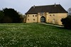
The above images may not be of the site on this page, but were taken nearby. They are loaded from Flickr so please click on them for image credits.
Click here to see more info for this site
Nearby sites
Click here to view sites on an interactive map of the areaKey: Red: member's photo, Blue: 3rd party photo, Yellow: other image, Green: no photo - please go there and take one, Grey: site destroyed
Download sites to:
KML (Google Earth)
GPX (GPS waypoints)
CSV (Garmin/Navman)
CSV (Excel)
To unlock full downloads you need to sign up as a Contributory Member. Otherwise downloads are limited to 50 sites.
Turn off the page maps and other distractions
Nearby sites listing. In the following links * = Image available
3.0km E 100° Grabhügelfeld Krefeld-Gellep* Barrow Cemetery
3.2km SSE 168° Heiligtum Ossum* Ancient Temple
3.4km E 95° Heiligtum Gellep* Ancient Temple
4.0km NNW 335° Heiligtum Elfrath* Ancient Temple
8.4km ESE 118° Kaiserswerth Menhir* Standing Stone (Menhir)
8.4km NW 309° Wallburg Hülser Berg* Hillfort
12.0km NE 54° In den Rehwiesen* Barrow Cemetery
13.5km NE 49° Wedau* Barrow Cemetery
14.3km NE 37° Kultur- und Stadthistorisches Museum Duisburg* Museum
15.4km NE 52° Heiliger Brunnen im Duisburger Wald* Holy Well or Sacred Spring
15.4km NE 38° Unkenstein* Marker Stone
15.6km SE 143° Stadtmuseum Landeshauptstadt Düsseldorf* Museum
15.7km ESE 119° Frauensteine Düsseldorf* Natural Stone / Erratic / Other Natural Feature
16.2km SSE 164° Clemens Sels Museum* Museum
16.5km NE 44° Marienborn (Duisburg)* Holy Well or Sacred Spring
16.5km NE 43° Wallburg Kaiserberg* Hillfort
16.6km SE 146° Summstein Florastraße Modern Stone Circle etc
16.7km N 353° Summstein Jungborn Modern Stone Circle etc
16.8km ENE 59° Hünengrab Uhlenhorst* Modern Stone Circle etc
16.8km NE 48° In der Monning* Barrow Cemetery
17.2km ESE 119° Grabhügelfeld Tönnesaap* Barrow Cemetery
17.7km SSE 161° Fossa Sanguinis* Ancient Temple
17.8km SSE 160° Novaesium* Ancient Village or Settlement
19.6km ENE 57° Summstein im Stadthallengarten* Modern Stone Circle etc
19.9km SSE 153° Castellum and Settlement Reckberg* Ancient Village or Settlement
View more nearby sites and additional images


 We would like to know more about this location. Please feel free to add a brief description and any relevant information in your own language.
 Wir möchten mehr über diese Stätte erfahren. Bitte zögern Sie nicht, eine kurze Beschreibung und relevante Informationen in Deutsch hinzuzufügen.
 Nous aimerions en savoir encore un peu sur les lieux. S'il vous plaît n'hesitez pas à ajouter une courte description et tous les renseignements pertinents dans votre propre langue.
 Quisieramos informarnos un poco más de las lugares. No dude en añadir una breve descripción y otros datos relevantes en su propio idioma.