

<< Text Pages >> Buedesheim Rotley - Natural Stone / Erratic / Other Natural Feature in Germany in Rhineland-Palatinate
Submitted by KaiHofmann on Thursday, 24 March 2011 Page Views: 2902
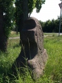
Natural PlacesSite Name: Buedesheim Rotley Alternative Name: Rote LeyCountry: Germany
NOTE: This site is 1.863 km away from the location you searched for.
Land: Rhineland-Palatinate Type: Natural Stone / Erratic / Other Natural Feature
Nearest Town: Gerolstein Nearest Village: Buedesheim
Latitude: 50.220798N Longitude: 6.582283E
Condition:
| 5 | Perfect |
| 4 | Almost Perfect |
| 3 | Reasonable but with some damage |
| 2 | Ruined but still recognisable as an ancient site |
| 1 | Pretty much destroyed, possibly visible as crop marks |
| 0 | No data. |
| -1 | Completely destroyed |
| 5 | Superb |
| 4 | Good |
| 3 | Ordinary |
| 2 | Not Good |
| 1 | Awful |
| 0 | No data. |
| 5 | Can be driven to, probably with disabled access |
| 4 | Short walk on a footpath |
| 3 | Requiring a bit more of a walk |
| 2 | A long walk |
| 1 | In the middle of nowhere, a nightmare to find |
| 0 | No data. |
| 5 | co-ordinates taken by GPS or official recorded co-ordinates |
| 4 | co-ordinates scaled from a detailed map |
| 3 | co-ordinates scaled from a bad map |
| 2 | co-ordinates of the nearest village |
| 1 | co-ordinates of the nearest town |
| 0 | no data |
Internal Links:
External Links:
Neolithic site close to the Rotley rock.
You may be viewing yesterday's version of this page. To see the most up to date information please register for a free account.
Do not use the above information on other web sites or publications without permission of the contributor.
Nearby Images from Flickr

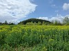
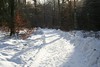
The above images may not be of the site on this page, but were taken nearby. They are loaded from Flickr so please click on them for image credits.
Click here to see more info for this site
Nearby sites
Click here to view sites on an interactive map of the areaKey: Red: member's photo, Blue: 3rd party photo, Yellow: other image, Green: no photo - please go there and take one, Grey: site destroyed
Download sites to:
KML (Google Earth)
GPX (GPS waypoints)
CSV (Garmin/Navman)
CSV (Excel)
To unlock full downloads you need to sign up as a Contributory Member. Otherwise downloads are limited to 50 sites.
Turn off the page maps and other distractions
Nearby sites listing. In the following links * = Image available
4.5km WSW 249° Langstein bei Wallersheim* Standing Stone (Menhir)
4.7km E 82° Auberg Felsformation Natural Stone / Erratic / Other Natural Feature
5.2km WSW 256° Fleringen Menhir* Standing Stone (Menhir)
5.3km E 83° Magdalena Höhle Cave or Rock Shelter
5.6km ENE 78° Buchenloch Hoehle* Cave or Rock Shelter
6.7km E 81° Judenkirchhof Pelm* Ancient Temple
6.9km E 83° Hedenborn Holy Well or Sacred Spring
7.1km ESE 107° Dietzenley Hillfort
8.9km SW 230° Altburg Niederhersdorf* Hillfort
11.4km W 262° Weissenstein* Standing Stone (Menhir)
12.8km ENE 71° Hünenstein Betteldorf* Standing Stone (Menhir)
13.4km E 80° Der Spitze Stein von Hinterweiler* Standing Stone (Menhir)
15.5km SE 129° Burgberg Schutz* Hillfort
15.9km E 82° Huegelgraeberfeld Dockweiler Wald* Barrow Cemetery
16.3km WSW 255° Watzerath* Modern Stone Circle etc
16.6km WNW 285° Forstmeister-Jansen-Stein* Standing Stone (Menhir)
20.4km N 7° Düwelsteen Ripsdorfer Wald* Rock Outcrop
20.4km N 7° Düwelskall* Cave or Rock Shelter
23.3km N 7° Grabhügel Hängebuche* Round Barrow(s)
24.1km E 80° Teufelsstein von Ueß Natural Stone / Erratic / Other Natural Feature
24.5km ESE 102° Ringwall Steineberg Hillfort
24.6km ESE 102° Steineberg Opferstein* Natural Stone / Erratic / Other Natural Feature
24.7km ESE 102° Steineberg Grabhuegelfeld Barrow Cemetery
26.6km WSW 244° Menhir Binscheid* Standing Stone (Menhir)
26.7km NW 324° Weißer Stein* Natural Stone / Erratic / Other Natural Feature
View more nearby sites and additional images


 We would like to know more about this location. Please feel free to add a brief description and any relevant information in your own language.
 Wir möchten mehr über diese Stätte erfahren. Bitte zögern Sie nicht, eine kurze Beschreibung und relevante Informationen in Deutsch hinzuzufügen.
 Nous aimerions en savoir encore un peu sur les lieux. S'il vous plaît n'hesitez pas à ajouter une courte description et tous les renseignements pertinents dans votre propre langue.
 Quisieramos informarnos un poco más de las lugares. No dude en añadir una breve descripción y otros datos relevantes en su propio idioma.