


<< Text Pages >> Sepulture de St-Marc - Burial Chamber or Dolmen in France in Provence:Bouches-du-Rhône (13)
Submitted by TheCaptain on Wednesday, 08 September 2010 Page Views: 2573
Neolithic and Bronze AgeSite Name: Sepulture de St-MarcCountry: France
NOTE: This site is 0.281 km away from the location you searched for.
Département: Provence:Bouches-du-Rhône (13) Type: Burial Chamber or Dolmen
Nearest Town: Aix-en-Provence Nearest Village: St Marc-Jaumegarde
Latitude: 43.547000N Longitude: 5.522000E
Condition:
| 5 | Perfect |
| 4 | Almost Perfect |
| 3 | Reasonable but with some damage |
| 2 | Ruined but still recognisable as an ancient site |
| 1 | Pretty much destroyed, possibly visible as crop marks |
| 0 | No data. |
| -1 | Completely destroyed |
| 5 | Superb |
| 4 | Good |
| 3 | Ordinary |
| 2 | Not Good |
| 1 | Awful |
| 0 | No data. |
| 5 | Can be driven to, probably with disabled access |
| 4 | Short walk on a footpath |
| 3 | Requiring a bit more of a walk |
| 2 | A long walk |
| 1 | In the middle of nowhere, a nightmare to find |
| 0 | No data. |
| 5 | co-ordinates taken by GPS or official recorded co-ordinates |
| 4 | co-ordinates scaled from a detailed map |
| 3 | co-ordinates scaled from a bad map |
| 2 | co-ordinates of the nearest village |
| 1 | co-ordinates of the nearest town |
| 0 | no data |
Be the first person to rate this site - see the 'Contribute!' box in the right hand menu.
Internal Links:
External Links:
Collective Tombe in Provence:Bouches-du-Rhône (13)
Sepulture de St-Marc is a Collective Tombe in the community of St Marc-Jaumegarde, Departement of Bouches-du-Rhône, Region of Provence - Alpes - Cote d'Azur
You may be viewing yesterday's version of this page. To see the most up to date information please register for a free account.
Do not use the above information on other web sites or publications without permission of the contributor.
Nearby Images from Flickr
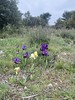
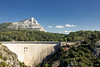
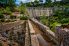
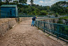
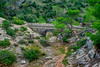
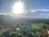
The above images may not be of the site on this page, but were taken nearby. They are loaded from Flickr so please click on them for image credits.
Click here to see more info for this site
Nearby sites
Click here to view sites on an interactive map of the areaKey: Red: member's photo, Blue: 3rd party photo, Yellow: other image, Green: no photo - please go there and take one, Grey: site destroyed
Download sites to:
KML (Google Earth)
GPX (GPS waypoints)
CSV (Garmin/Navman)
CSV (Excel)
To unlock full downloads you need to sign up as a Contributory Member. Otherwise downloads are limited to 50 sites.
Turn off the page maps and other distractions
Nearby sites listing. In the following links * = Image available
5.4km SE 135° Dolmen de Maurely Burial Chamber or Dolmen
5.4km SE 125° Baume Vaoutade Cave or Rock Shelter
5.7km ESE 119° Oppidum d'Untinos* Ancient Village or Settlement
6.0km WSW 245° La Blaque Burial Chamber or Dolmen
6.2km WSW 249° Mousse Fountain Holy Well or Sacred Spring
6.4km E 82° Le Délubre Cave or Rock Shelter
6.5km E 82° Grotte de la Citadelle 1 Cave or Rock Shelter
6.6km E 82° Grotte de la Citadelle 2 Cave or Rock Shelter
6.7km W 275° Entremont Oppidium* Hillfort
7.4km SSE 150° Grotte Sicard Cave or Rock Shelter
7.5km SSE 150° Grotte de la Marane Cave or Rock Shelter
7.5km SSE 151° Grotte des Abeilles Cave or Rock Shelter
7.6km SSE 150° Vallon de Valtrede Cave or Rock Shelter
9.8km N 3° Dolmen de La Plaine 1 Burial Chamber or Dolmen
14.9km S 183° Oppidium de Mimet Ancient Village or Settlement
16.3km S 191° Grotte du Facteur Cave or Rock Shelter
16.4km E 101° Blaquierre Tumulus Artificial Mound
16.5km S 178° Grotte des Fées (Mimet) Cave or Rock Shelter
16.6km NE 54° Dolmen des Cudieres 2 Burial Chamber or Dolmen
16.6km NE 54° Dolmen des Cudieres 1 Burial Chamber or Dolmen
17.0km S 189° Grotte de l'Ermite Cave or Rock Shelter
17.2km SE 130° Baume d'Onze Heures Cave or Rock Shelter
17.8km E 91° Oppidum du Pain-de-Munition Ancient Village or Settlement
17.8km SSE 161° Le Tonneau Cave or Rock Shelter
17.8km SSE 161° Grotte de Tonneau Cave or Rock Shelter
View more nearby sites and additional images


 We would like to know more about this location. Please feel free to add a brief description and any relevant information in your own language.
 Wir möchten mehr über diese Stätte erfahren. Bitte zögern Sie nicht, eine kurze Beschreibung und relevante Informationen in Deutsch hinzuzufügen.
 Nous aimerions en savoir encore un peu sur les lieux. S'il vous plaît n'hesitez pas à ajouter une courte description et tous les renseignements pertinents dans votre propre langue.
 Quisieramos informarnos un poco más de las lugares. No dude en añadir una breve descripción y otros datos relevantes en su propio idioma.