
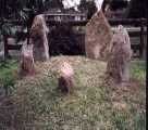

<< Our Photo Pages >> Grafheuvels op de Zuilensteinse Kop (45579) - Round Barrow(s) in Netherlands in Utrecht
Submitted by Podovsky on Tuesday, 12 January 2021 Page Views: 2004
Neolithic and Bronze AgeSite Name: Grafheuvels op de Zuilensteinse Kop (45579)Country: Netherlands
NOTE: This site is 6.039 km away from the location you searched for.
Province: Utrecht Type: Round Barrow(s)
Nearest Town: Leersum
Latitude: 52.017137N Longitude: 5.447134E
Condition:
| 5 | Perfect |
| 4 | Almost Perfect |
| 3 | Reasonable but with some damage |
| 2 | Ruined but still recognisable as an ancient site |
| 1 | Pretty much destroyed, possibly visible as crop marks |
| 0 | No data. |
| -1 | Completely destroyed |
| 5 | Superb |
| 4 | Good |
| 3 | Ordinary |
| 2 | Not Good |
| 1 | Awful |
| 0 | No data. |
| 5 | Can be driven to, probably with disabled access |
| 4 | Short walk on a footpath |
| 3 | Requiring a bit more of a walk |
| 2 | A long walk |
| 1 | In the middle of nowhere, a nightmare to find |
| 0 | No data. |
| 5 | co-ordinates taken by GPS or official recorded co-ordinates |
| 4 | co-ordinates scaled from a detailed map |
| 3 | co-ordinates scaled from a bad map |
| 2 | co-ordinates of the nearest village |
| 1 | co-ordinates of the nearest town |
| 0 | no data |
Internal Links:
External Links:
I have visited· I would like to visit
Podovsky visited on 19th Jan 2020 - their rating: Cond: 3 Amb: 4 Access: 3
 (PID:206815)")
Wikipedia (dutch): Grafheuvels op de Zuilensteinse Kop
Rijksmonument (national monument) number: 45579
You may be viewing yesterday's version of this page. To see the most up to date information please register for a free account.
Do not use the above information on other web sites or publications without permission of the contributor.
Nearby Images from Flickr
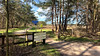
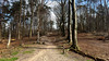
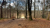
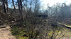
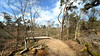
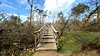
The above images may not be of the site on this page, but were taken nearby. They are loaded from Flickr so please click on them for image credits.
Click here to see more info for this site
Nearby sites
Click here to view sites on an interactive map of the areaKey: Red: member's photo, Blue: 3rd party photo, Yellow: other image, Green: no photo - please go there and take one, Grey: site destroyed
Download sites to:
KML (Google Earth)
GPX (GPS waypoints)
CSV (Garmin/Navman)
CSV (Excel)
To unlock full downloads you need to sign up as a Contributory Member. Otherwise downloads are limited to 50 sites.
Turn off the page maps and other distractions
Nearby sites listing. In the following links * = Image available
423m SE 141° Grafheuvels Zuilensteinse Berg* Round Barrow(s)
1.1km W 259° Leersumse Kei* Natural Stone / Erratic / Other Natural Feature
1.7km ESE 113° Grafheuvel Amerongen (45455) Round Barrow(s)
2.0km W 270° Grafheuvels Leersum (45582) Round Barrow(s)
2.2km WNW 297° Grafheuvels Breedeveen Round Barrow(s)
3.3km ESE 105° Grafheuvel Hooiweg Round Barrow(s)
3.5km ESE 118° Grafheuvel Amerongen (45456) Round Barrow(s)
3.9km SE 126° Grafheuvels Galgenberg Round Barrow(s)
4.0km WNW 290° Grafheuvels Doornse Gat* Round Barrow(s)
4.0km ESE 123° Grafheuvel Galgenberg IV Round Barrow(s)
5.9km NW 311° Grafheuvels Maarn* Round Barrow(s)
6.1km ESE 110° Residence menhir* Standing Stone (Menhir)
7.5km WNW 295° Grafheuvel Doorn (45568) Round Barrow(s)
8.6km NW 307° Zwerfsteneneiland Modern Stone Circle etc
9.9km WNW 302° Grafheuvels Driebergen Rijsenburg (45504)* Round Barrow(s)
10.0km SE 129° Zwerfsteen van Rhenen* Natural Stone / Erratic / Other Natural Feature
10.3km NW 326° Grafheuvels Leusden Zuid (45629)* Round Barrow(s)
13.0km NNW 332° Grafheuvels Oud Leusden Round Barrow(s)
14.5km S 182° Streekmuseum Tiel* Museum
15.1km NNW 339° Galgenberg Amersfoort (45449)* Round Barrow(s)
15.1km NNW 339° Grafheuvel Amersfoort (45448) Round Barrow(s)
15.6km NNW 345° Amersfoortse Kei* Natural Stone / Erratic / Other Natural Feature
16.0km ENE 75° Bloedsteen* Natural Stone / Erratic / Other Natural Feature
16.6km NNW 332° Grafheuvel Monnikenbosch (45993)* Round Barrow(s)
16.7km E 98° Grafheuvels Bennekom (530825) Round Barrow(s)
View more nearby sites and additional images


 We would like to know more about this location. Please feel free to add a brief description and any relevant information in your own language.
 Wir möchten mehr über diese Stätte erfahren. Bitte zögern Sie nicht, eine kurze Beschreibung und relevante Informationen in Deutsch hinzuzufügen.
 Nous aimerions en savoir encore un peu sur les lieux. S'il vous plaît n'hesitez pas à ajouter une courte description et tous les renseignements pertinents dans votre propre langue.
 Quisieramos informarnos un poco más de las lugares. No dude en añadir una breve descripción y otros datos relevantes en su propio idioma.