

<< Our Photo Pages >> La Pierre Trouée - Standing Stone (Menhir) in France in Alsace-Lorraine:Meuse (55)
Submitted by AlexHunger on Tuesday, 07 June 2005 Page Views: 5060
Neolithic and Bronze AgeSite Name: La Pierre Trouée Alternative Name: Mécrin MenhirCountry: France
NOTE: This site is 5.615 km away from the location you searched for.
Département: Alsace-Lorraine:Meuse (55) Type: Standing Stone (Menhir)
Nearest Town: Bar-le-Duc Nearest Village: Mécrin
Latitude: 48.823300N Longitude: 5.521100E
Condition:
| 5 | Perfect |
| 4 | Almost Perfect |
| 3 | Reasonable but with some damage |
| 2 | Ruined but still recognisable as an ancient site |
| 1 | Pretty much destroyed, possibly visible as crop marks |
| 0 | No data. |
| -1 | Completely destroyed |
| 5 | Superb |
| 4 | Good |
| 3 | Ordinary |
| 2 | Not Good |
| 1 | Awful |
| 0 | No data. |
| 5 | Can be driven to, probably with disabled access |
| 4 | Short walk on a footpath |
| 3 | Requiring a bit more of a walk |
| 2 | A long walk |
| 1 | In the middle of nowhere, a nightmare to find |
| 0 | No data. |
| 5 | co-ordinates taken by GPS or official recorded co-ordinates |
| 4 | co-ordinates scaled from a detailed map |
| 3 | co-ordinates scaled from a bad map |
| 2 | co-ordinates of the nearest village |
| 1 | co-ordinates of the nearest town |
| 0 | no data |
Internal Links:
External Links:
")
You may be viewing yesterday's version of this page. To see the most up to date information please register for a free account.
")
Do not use the above information on other web sites or publications without permission of the contributor.
Nearby Images from Flickr
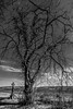
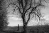


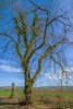
The above images may not be of the site on this page, but were taken nearby. They are loaded from Flickr so please click on them for image credits.
Click here to see more info for this site
Nearby sites
Click here to view sites on an interactive map of the areaKey: Red: member's photo, Blue: 3rd party photo, Yellow: other image, Green: no photo - please go there and take one, Grey: site destroyed
Download sites to:
KML (Google Earth)
GPX (GPS waypoints)
CSV (Garmin/Navman)
CSV (Excel)
To unlock full downloads you need to sign up as a Contributory Member. Otherwise downloads are limited to 50 sites.
Turn off the page maps and other distractions
Nearby sites listing. In the following links * = Image available
2.3km SSE 152° Le Menhir des 3 évêchés* Standing Stone (Menhir)
6.0km NNE 13° Le Camp des Romains Ancient Village or Settlement
7.8km N 11° La Cote-de-Bar Cave or Rock Shelter
7.9km N 4° La Grosse Borne (Chauvoncourt)* Standing Stone (Menhir)
11.7km NE 39° La Dame Schone Menhir* Standing Stone (Menhir)
13.0km NE 50° Woinville Menhir* Standing Stone (Menhir)
18.0km W 273° Rumont burial chamber Burial Chamber or Dolmen
21.9km SSW 202° Oppidum des Leuci* Ancient Village or Settlement
27.3km WSW 237° Menhir de la Chèvre Standing Stone (Menhir)
28.0km WSW 244° Champ l'Alouette Menhir Standing Stone (Menhir)
28.3km SW 236° Menhir de Champ l'Ecuyer Standing Stone (Menhir)
29.5km WSW 238° Allée Couverte du Ruissard Passage Grave
30.6km WSW 240° Menhir le Corrois Standing Stone (Menhir)
36.7km ESE 123° Grottes dites Trou de Sainte-Reine Cave or Rock Shelter
37.4km ESE 122° Grotte le Trou-des-Celtes Cave or Rock Shelter
37.7km ENE 72° La Pierre-au-Jô Menhir* Standing Stone (Menhir)
40.1km ESE 116° Grotte du Géant Cave or Rock Shelter
40.4km ENE 58° Le Trou-des-Fées Cave or Rock Shelter
40.5km ESE 118° Dolmen du Bois l'Evêque Burial Chamber or Dolmen
40.6km E 101° La Garenne (Liverdun) Burial Chamber or Dolmen
41.9km ESE 121° Bois de l'Evêque Dolmen Burial Chamber or Dolmen
42.5km SW 225° La Haute Borne de Fontaines-sur-Marne* Standing Stone (Menhir)
42.7km ESE 120° Bois l'Abbé 2 Burial Chamber or Dolmen
42.7km ENE 61° Le Rudemont Cave or Rock Shelter
43.3km ESE 121° Bois l'Abbé 1 Burial Chamber or Dolmen
View more nearby sites and additional images


 We would like to know more about this location. Please feel free to add a brief description and any relevant information in your own language.
 Wir möchten mehr über diese Stätte erfahren. Bitte zögern Sie nicht, eine kurze Beschreibung und relevante Informationen in Deutsch hinzuzufügen.
 Nous aimerions en savoir encore un peu sur les lieux. S'il vous plaît n'hesitez pas à ajouter une courte description et tous les renseignements pertinents dans votre propre langue.
 Quisieramos informarnos un poco más de las lugares. No dude en añadir una breve descripción y otros datos relevantes en su propio idioma.