 with our Megalithic Portal iPhone app")


<< Text Pages >> Mousse Fountain - Holy Well or Sacred Spring in France in Provence:Bouches-du-Rhône (13)
Submitted by Anne T on Monday, 28 January 2019 Page Views: 790
Springs and Holy WellsSite Name: Mousse Fountain Alternative Name: La Fontaine Deau Chaude; Fontaine sur le Cours MirabeauCountry: France
NOTE: This site is 0.568 km away from the location you searched for.
Département: Provence:Bouches-du-Rhône (13) Type: Holy Well or Sacred Spring
Nearest Town: Aix-en-Provence
Latitude: 43.526901N Longitude: 5.449895E
Condition:
| 5 | Perfect |
| 4 | Almost Perfect |
| 3 | Reasonable but with some damage |
| 2 | Ruined but still recognisable as an ancient site |
| 1 | Pretty much destroyed, possibly visible as crop marks |
| 0 | No data. |
| -1 | Completely destroyed |
| 5 | Superb |
| 4 | Good |
| 3 | Ordinary |
| 2 | Not Good |
| 1 | Awful |
| 0 | No data. |
| 5 | Can be driven to, probably with disabled access |
| 4 | Short walk on a footpath |
| 3 | Requiring a bit more of a walk |
| 2 | A long walk |
| 1 | In the middle of nowhere, a nightmare to find |
| 0 | No data. |
| 5 | co-ordinates taken by GPS or official recorded co-ordinates |
| 4 | co-ordinates scaled from a detailed map |
| 3 | co-ordinates scaled from a bad map |
| 2 | co-ordinates of the nearest village |
| 1 | co-ordinates of the nearest town |
| 0 | no data |
Be the first person to rate this site - see the 'Contribute!' box in the right hand menu.
Internal Links:
External Links:
Holy Well or Sacred Spring in Provence:Bouches-du-Rhône (13)
Information for this hot thermal fountain which has been visited since Roman times (and possibly before) comes from The Journal of Antiquities - see their entry for The Mousse Fountain, Aix-En-Provence, France, which tells us that the water has been said to cure nervous disorders, stomach disorders, rheumatism and some qynaecological conditions.
The Journal adds the temperature of the water can reach 94 degrees F, and sometimes a thick foam gathers on top of the water, which gives it its' local name of "mousse" fountain.
The Journal says: "There are three other famous fountains close by: Fontaine de la Rotonde (19th century) in the Place de General de Gaul at the west end of the avenue is probably the largest, while Fontaine of the Nine Cannons (17th century) stands halfway between the two, while at the eastern end is the 19th century Fontaine du Roy Rene, but there are other fountains in the town."
Note: Have you visited this site? Do you have photographs or information to add?
You may be viewing yesterday's version of this page. To see the most up to date information please register for a free account.
Do not use the above information on other web sites or publications without permission of the contributor.
Nearby Images from Flickr

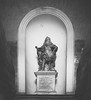

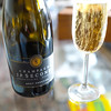


The above images may not be of the site on this page, but were taken nearby. They are loaded from Flickr so please click on them for image credits.
Click here to see more info for this site
Nearby sites
Click here to view sites on an interactive map of the areaKey: Red: member's photo, Blue: 3rd party photo, Yellow: other image, Green: no photo - please go there and take one, Grey: site destroyed
Download sites to:
KML (Google Earth)
GPX (GPS waypoints)
CSV (Garmin/Navman)
CSV (Excel)
To unlock full downloads you need to sign up as a Contributory Member. Otherwise downloads are limited to 50 sites.
Turn off the page maps and other distractions
Nearby sites listing. In the following links * = Image available
462m SE 134° La Blaque Burial Chamber or Dolmen
2.9km NNW 343° Entremont Oppidium* Hillfort
6.2km ENE 69° Sepulture de St-Marc Burial Chamber or Dolmen
9.7km E 99° Dolmen de Maurely Burial Chamber or Dolmen
10.3km E 95° Baume Vaoutade Cave or Rock Shelter
10.4km ESE 114° Grotte Sicard Cave or Rock Shelter
10.5km ESE 114° Grotte des Abeilles Cave or Rock Shelter
10.5km ESE 114° Grotte de la Marane Cave or Rock Shelter
10.5km ESE 114° Vallon de Valtrede Cave or Rock Shelter
10.8km E 93° Oppidum d'Untinos* Ancient Village or Settlement
12.6km ENE 76° Le Délubre Cave or Rock Shelter
12.7km ENE 76° Grotte de la Citadelle 1 Cave or Rock Shelter
12.7km ENE 76° Grotte de la Citadelle 2 Cave or Rock Shelter
13.6km NNE 28° Dolmen de La Plaine 1 Burial Chamber or Dolmen
13.6km SSE 158° Oppidium de Mimet Ancient Village or Settlement
14.0km S 169° Grotte du Facteur Cave or Rock Shelter
14.5km W 272° Roquepertuse* Ancient Temple
14.9km SSE 167° Grotte de l'Ermite Cave or Rock Shelter
15.7km SSE 156° Grotte des Fées (Mimet) Cave or Rock Shelter
16.8km WSW 254° Oppidum ligure du Castellas* Ancient Village or Settlement
18.2km NNW 346° St-Valentin Cave or Rock Shelter
18.2km NNW 346° Le Moulestre Cave or Rock Shelter
18.6km SE 142° Le Tonneau Cave or Rock Shelter
18.7km SE 142° Grotte de Tonneau Cave or Rock Shelter
19.7km S 176° Baume Montée Cave or Rock Shelter
View more nearby sites and additional images


 We would like to know more about this location. Please feel free to add a brief description and any relevant information in your own language.
 Wir möchten mehr über diese Stätte erfahren. Bitte zögern Sie nicht, eine kurze Beschreibung und relevante Informationen in Deutsch hinzuzufügen.
 Nous aimerions en savoir encore un peu sur les lieux. S'il vous plaît n'hesitez pas à ajouter une courte description et tous les renseignements pertinents dans votre propre langue.
 Quisieramos informarnos un poco más de las lugares. No dude en añadir una breve descripción y otros datos relevantes en su propio idioma.