


<< Text Pages >> Petit Barsan - Passage Grave in France in Provence:Vaucluse (84)
Submitted by TheCaptain on Wednesday, 08 September 2010 Page Views: 1638
Neolithic and Bronze AgeSite Name: Petit BarsanCountry: France
NOTE: This site is 2.661 km away from the location you searched for.
Département: Provence:Vaucluse (84) Type: Passage Grave
Nearest Town: Carpentras Nearest Village: Vaison-la-Romaine
Latitude: 44.241000N Longitude: 5.074000E
Condition:
| 5 | Perfect |
| 4 | Almost Perfect |
| 3 | Reasonable but with some damage |
| 2 | Ruined but still recognisable as an ancient site |
| 1 | Pretty much destroyed, possibly visible as crop marks |
| 0 | No data. |
| -1 | Completely destroyed |
| 5 | Superb |
| 4 | Good |
| 3 | Ordinary |
| 2 | Not Good |
| 1 | Awful |
| 0 | No data. |
| 5 | Can be driven to, probably with disabled access |
| 4 | Short walk on a footpath |
| 3 | Requiring a bit more of a walk |
| 2 | A long walk |
| 1 | In the middle of nowhere, a nightmare to find |
| 0 | No data. |
| 5 | co-ordinates taken by GPS or official recorded co-ordinates |
| 4 | co-ordinates scaled from a detailed map |
| 3 | co-ordinates scaled from a bad map |
| 2 | co-ordinates of the nearest village |
| 1 | co-ordinates of the nearest town |
| 0 | no data |
Be the first person to rate this site - see the 'Contribute!' box in the right hand menu.
Internal Links:
External Links:
Hypogee in Provence:Vaucluse (84)
Petit Barsan is a Hypogee in the community of Vaison-la-Romaine, Departement of Vaucluse, Region of Provence - Alpes - Cote d'Azur
You may be viewing yesterday's version of this page. To see the most up to date information please register for a free account.
Do not use the above information on other web sites or publications without permission of the contributor.
Nearby Images from Flickr
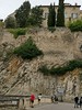
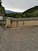
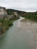
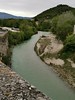
The above images may not be of the site on this page, but were taken nearby. They are loaded from Flickr so please click on them for image credits.
Click here to see more info for this site
Nearby sites
Click here to view sites on an interactive map of the areaKey: Red: member's photo, Blue: 3rd party photo, Yellow: other image, Green: no photo - please go there and take one, Grey: site destroyed
Download sites to:
KML (Google Earth)
GPX (GPS waypoints)
CSV (Garmin/Navman)
CSV (Excel)
To unlock full downloads you need to sign up as a Contributory Member. Otherwise downloads are limited to 50 sites.
Turn off the page maps and other distractions
Nearby sites listing. In the following links * = Image available
1.6km WSW 256° Vaison* Modern Stone Circle etc
4.8km W 273° Les Crottes Passage Grave
5.7km NNW 326° Granges-Vieilles Passage Grave
5.8km ESE 118° La Masque Cave or Rock Shelter
8.4km S 183° Aven des Fourches 1 Cave or Rock Shelter
9.6km SE 131° Sainte-Marguerite Cave or Rock Shelter
11.4km W 263° Les Echaffins Passage Grave
13.0km SE 145° La Madeleine 1 Cave or Rock Shelter
19.4km SSW 205° La Lave Passage Grave
20.6km NW 326° Le Capitaine Passage Grave
20.7km NNW 326° Coutelier Cave or Rock Shelter
23.4km NW 324° Grote de Rochecourbiere Cave or Rock Shelter
24.2km WSW 241° Roman Theatre of Orange* Ancient Palace
25.2km SSE 164° Unang Cave or Rock Shelter
25.3km WSW 254° La Sabliere Cave or Rock Shelter
27.9km SSE 168° Souveilles Cave or Rock Shelter
28.0km SSE 168° Grotte du Stade Cave or Rock Shelter
28.0km SSE 168° Les Dents Cave or Rock Shelter
29.4km S 175° Jas de Juvert Cave or Rock Shelter
31.4km ESE 122° Les Boileau Cave or Rock Shelter
36.1km WSW 248° Oppidum du Camp de César (Laudun-l'Ardoise)* Ancient Village or Settlement
36.1km W 268° Pierre des Druides (St Alexandre)* Standing Stone (Menhir)
36.2km S 173° Fontaine de Vaucluse* Holy Well or Sacred Spring
37.1km WSW 257° Musée Archeologique (Bagnols)* Museum
38.8km S 175° Les Esclargades Cave or Rock Shelter
View more nearby sites and additional images


 We would like to know more about this location. Please feel free to add a brief description and any relevant information in your own language.
 Wir möchten mehr über diese Stätte erfahren. Bitte zögern Sie nicht, eine kurze Beschreibung und relevante Informationen in Deutsch hinzuzufügen.
 Nous aimerions en savoir encore un peu sur les lieux. S'il vous plaît n'hesitez pas à ajouter une courte description et tous les renseignements pertinents dans votre propre langue.
 Quisieramos informarnos un poco más de las lugares. No dude en añadir una breve descripción y otros datos relevantes en su propio idioma.